Navimag Ferry Patagonia: Four Days Through the Chilean Fjords on a Working Ship
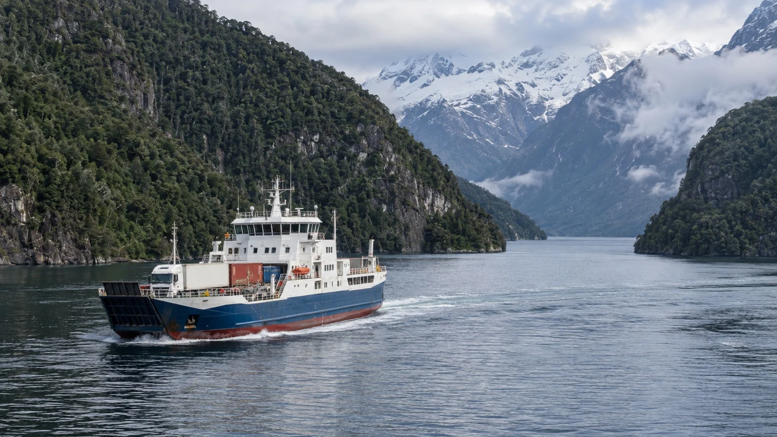
The Navimag ferry Patagonia crossing is not a cruise, and the moment you accept that, it becomes one of the best value sea journeys anywhere. It is a working roll-on roll-off freight ship between Puerto Montt and Puerto Natales that happens to sell berths to passengers.
The trucks are the point of the voyage; you are the extra revenue. Get that the right way round and four days in the Chilean fjords will be the part of the trip you talk about for years.
Quick take
Book this crossing for a working-ferry journey, not as a substitute for a fjord cruise. The two experiences look similar on a map and feel nothing alike on the water.
What you are buying is the scenery, the slow geography, and the smugness of arriving in Torres del Paine country by sea. What you are not buying is a balcony, a maitre d’, or any guarantee that the glacier will be visible when you pass it.
A private cabin is worth considering over a shared bunk room if the price works for you. Three nights of other people’s alarms and movement can wear down even a relaxed traveler.
Do not book this with a tight connection at the far end. Sailings shift for weather and freight, so a tidy arrival schedule should be treated as a plan rather than a guarantee.
The quick facts
- What it actually is: a cargo ferry with passenger accommodation, not a cruise ship with a hold. Chile’s national tourism board, Chile Travel, describes the sea approach to Puerto Natales plainly as reaching the town “by sea from Puerto Montt on a ferry on the Canal Route”.
- The route: Puerto Montt in the Los Lagos region to Puerto Natales in Magallanes, threading the sheltered channels behind the Patagonian archipelago for most of its length. It runs in both directions, and the southbound and northbound legs are not mirror images in timing or light.
- How long: several days at sea, commonly sold as a four day crossing, with a published schedule that can still move because of weather and operations. Treat the duration on Navimag‘s own booking pages as the only current figure, and add a buffer day.
- Where you land: the Puerto Natales terminal run by Empresa Portuaria Austral, an L-shaped pier about 108 feet long reached by a roughly 330-foot stone causeway. It has specialized in roll-on roll-off ships since the 1980s and opened a roughly 3,230-square-foot passenger building in 2003.
- Cabins and bunks: accommodation runs from private cabins with a window down to shared bunk berths in a communal room. Grade names and what each includes change over time, so read the current deck plan on Navimag’s site before you pay.
- Food and drink: meals are included and they are canteen food served at set times, not dining you would cross a street for. Bring your own snacks, and assume the bar and the coffee are basic.
- The one rough stretch: the Golfo de Penas, where the route leaves the channels and meets the open South Pacific. Everything else is sheltered water, and this is the part people remember.
The Navimag ferry Patagonia route, terminal to terminal
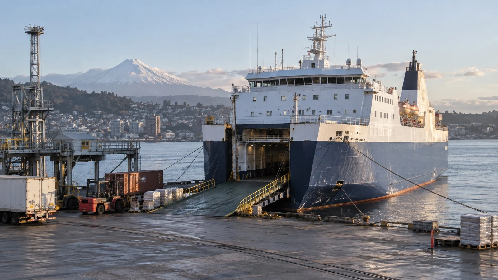
At the northern end you are in Puerto Montt, which is a genuine working port rather than a tourist quay. The port authority, Empresa Portuaria Puerto Montt, runs both a commercial dock and a dedicated ferry terminal, and administers 13 connectivity ramps serving destinations such as Chacao, Castro and Quellon.
Check-in for a freight ferry does not happen where a cruise passenger expects it to. Confirm the loading point on your ticket, get there early, and expect to share the wait with truck drivers.
At the southern end, Puerto Natales is a small terminal with a big job. The pier has four berths of different lengths, the largest taking ships up to roughly 443 feet, and the whole facility is built around ramps rather than gangways.
From Puerto Natales, the reason most people took the boat is roughly 50 to 93 miles up the road. CONAF gives the approach to Torres del Paine as about 93 miles on Route 9 North, or roughly 50 miles via the Y-290 and Lago Porteno.
Do not plan to sail in and walk the W the same day. Buses to the park run on their own schedule, and a ferry arriving late in the afternoon costs you a full day.
The Golfo de Penas, and how much to worry
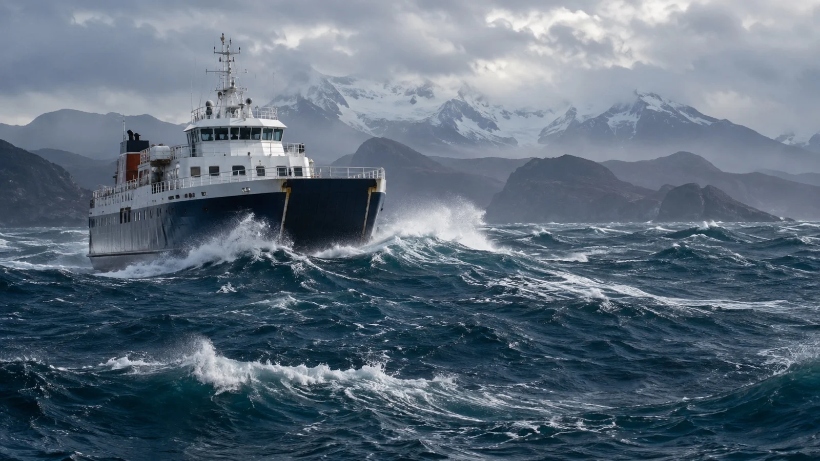
For most of the voyage you are inside a system of channels with land on both sides, which is why the ship is stable and the views are constant. The Golfo de Penas is where that protection stops.
The gulf is open to the South Pacific and the ship crosses it because there is no inshore route around it. Depending on conditions it usually occupies part of a night and the morning after.
If you are prone to seasickness, this is the one section to prepare for properly. Start medication before you reach it rather than after, and ask the crew for the expected timing, because they will know it to within an hour or two.
Plenty of crossings are uneventful and some are genuinely unpleasant. Nobody can tell you in advance which one you have bought.
Channels, glaciers, and what the weather decides
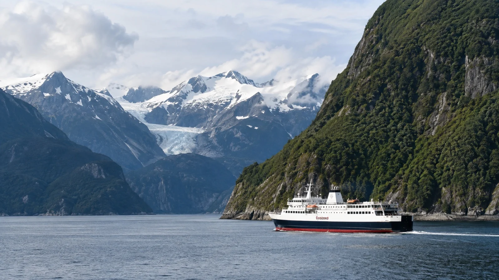
The scenery here is not a series of highlights with dull bits between them. It is a continuous corridor of forested rock, narrows and side fjords, some of it tight enough to pick out individual trees.
Much of the southern half runs alongside country protected by two enormous parks. CONAF puts Bernardo O’Higgins National Park at roughly 13,614 square miles, including about 3,863 square miles of ice, and states flatly that it can only be reached by sea.
Next door, Kawesqar National Park covers a further roughly 10,975 square miles with no public infrastructure and, again, no land access. You are sailing past two of the largest protected areas in South America and almost nobody on board is getting off.
Glacier viewing on this route is real and it is conditional. Detours toward ice depend on weather, visibility and the freight schedule, so treat any glacier stop as a bonus rather than a purchased item.
If a guaranteed glacier is what you actually want, a proper expedition ship is the better buy, and the guide to the Amalia Glacier passage covers what that looks like from a cruise deck. The ferry gives you the geography and withholds the certainty.
Life on board, and the lectures
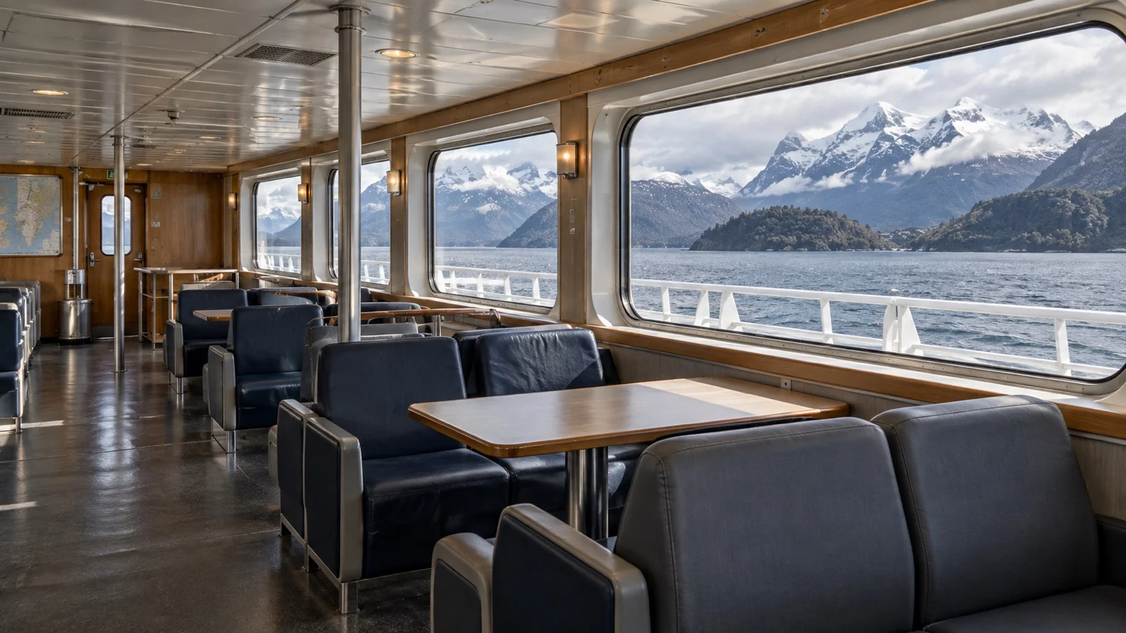
The onboard day is short on structure and long on staring out of windows. There is usually a lounge with big glass, a small bar, and a talks program covering the geography, the glaciers and the Kawesqar people whose territory you are crossing.
The lectures are decent and they are not a lecture series in the expedition cruise sense. Content and language depend on who is aboard, so confirm with Navimag if English delivery matters to you.
Connectivity is the thing that surprises people most. Mobile signal disappears for long stretches, satellite internet is limited or absent, and this is a genuine feature rather than a fault.
What to pack and what to skip
- Seasickness tablets, taken early: the kind you already know works on you, in the quantity you would need for two full days. The ship’s shop is not the place to be experimenting.
- A proper waterproof, not a fashion one: the deck is where the trip happens and the rain is horizontal at times. Waterproof pants sound absurd until the first squall.
- Binoculars: the single best piece of kit on this route, for dolphins, condors and the far side of a channel. A cheap compact pair is enough.
- Earplugs and an eye mask: essential in a shared bunk room, useful even in a cabin, because this is a cargo ship with cargo ship noises. Ramps and engines do not observe quiet hours.
- Snacks you actually like: meals are included, but menus and serving times may not match your habits. Chocolate, nuts, and instant coffee travel well.
- Skip: a big suitcase, formal anything, and the expectation of a gym or a pool. Nothing about this ship rewards packing for a cruise.
Fun fact: the largest national park in Chile is the one you sail through the middle of and cannot visit, because CONAF lists Bernardo O’Higgins at roughly 13,614 square miles with sea as the only means of access. That is a protected area larger than Belgium with no road into it at all.
How to decide
Book this if the journey is the destination and you are relaxed about comfort. Skip it if you have four days of vacation and want to see three things.
The financial case is straightforward. It costs a fraction of a fjord cruise, covers your bed and meals throughout, and moves you a long way down the country while you sleep.
The time case is less generous. Four days at sea plus a buffer day is a serious chunk of a Patagonia itinerary, and a flight does the same transfer in a morning.
Direction matters more than people expect. Southbound builds toward Torres del Paine and feels like an arrival; northbound suits anyone ending in the Lake District.
A realistic word on accessibility
A working freight ferry is one of the hardest maritime environments for anyone with limited mobility. Treat accessibility as a deciding factor, not a detail to solve after booking.
Access is by ramp rather than a level gangway, and the angle changes with tide and load. Aboard, expect stairs between decks, high door sills, and corridors sized for crew rather than wheelchairs.
Elevator access, accessible cabins and accessible bathrooms cannot be assumed on a ship of this type. Ask Navimag directly, in writing, and get the answer confirmed against the specific vessel you are booked on rather than the fleet in general.
The wider comparison is worth having before you commit, and the roundup of Chile’s cruise ports covers the alternatives that handle mobility needs properly. If you need step-free travel, a scheduled flight and a hotel in Puerto Natales is the honest answer.
When to go, and the weather
Navimag markets the fjord run as an austral summer service, broadly tracking southern hemisphere spring to early fall. Outside that window sailings thin out and the weather stops being a background detail.
Temperatures here are cool rather than cold, and they barely move through the year. The Biblioteca del Congreso Nacional gives an average around 43 Fahrenheit for the trans-Andean part of Magallanes, and the maritime channels are damper and windier than that figure suggests.
Rainfall is the real variable, and it is extreme. Around 138 inches a year falls on the western archipelago you sail through, while CONAF describes the Torres del Paine steppe just inland as receiving roughly 16 inches.
If your plan continues into the park in winter, read the park rules first. CONAF requires an authorized guide on the Base Torres trail between late April and the end of August, closes the full Paine Massif circuit over the winter months, and advises studded tires for driving in the park.
A practical ticket and connection plan
Navimag currently sells the Esperanza crossing as four days and three nights, with transport, accommodation, and meals included. Use the dates and reporting instructions on your own ticket because Puerto Montt and Puerto Natales check-in offices, boarding points, and operational timing are not interchangeable.
Arrive in the departure city a full day early and keep the day after arrival free before a flight, bus, or Torres del Paine booking. This is a scheduled working ferry, but weather, cargo operations, and the Golfo de Penas can still move the practical arrival time.
Chile’s entry and agricultural controls apply before the ferry, and no national-park admission is created by sailing beside protected land. The scenery is the excursion; glacier proximity, wildlife, and route details remain conditional rather than purchased landings.
Esperanza is advertised with passenger facilities that include cabins, an infirmary, and exterior decks, but accessible details must be confirmed for the exact sailing. Ask about the terminal ramp, elevator, cabin doorway, bathroom, and emergency assistance in writing because a shipboard elevator does not solve a steep tidal boarding ramp.
Quick answers
Is the Navimag ferry a cruise?
No, and the difference is not marketing.
It is a roll-on roll-off cargo ship carrying freight, vehicles and passengers, with canteen meals and no cruise ship entertainment.
How rough is the Golfo de Penas?
It is the only open ocean section of the route, and it can be genuinely uncomfortable.
Take medication before you get there and ask the crew when the crossing is expected to begin.
Can I get to Torres del Paine straight off the ferry?
Not sensibly on the same day.
CONAF puts the park roughly 50 to 93 miles from Puerto Natales depending on the route, and the bus schedule will not wait for a late arrival.
Do I have to share a cabin?
No, private cabins exist alongside shared bunk berths.
Grades and pricing change, so check the current deck plan on Navimag’s site rather than an old blog post.
Will I see glaciers?
Often, but never guaranteed.
Ice viewing depends on weather, visibility and the ship’s schedule, and no part of it is contractual.
The last word
Navimag is one of the few sea journeys left that has not been redesigned around the passenger experience. It is a supply line, and you are allowed to ride it.
That is precisely why it works. The channels look the way they look because almost nothing has been built there, and the ship behaves the way it does because it has cargo to deliver.
If you want the same landscape with a hot tub and a lecture theater, the comparison to make is with scenic cruising through the Chilean fjords on a proper expedition ship, and the trade-off is money against authenticity. The equivalent argument plays out at the other end of the world in the guide to taking the Alaska ferry instead of a cruise, with the same conclusion.
Either way you end up in Patagonia, with Punta Arenas as the logical next move south. Book the cabin, pack the tablets, and lower your expectations about dinner.
How this guide was researched: Unless a first-hand visit is explicitly identified above, this guide is based on independent research using official port, tourism, transit, government, and attraction sources where available. Terminal specifications were checked against Empresa Portuaria Austral and Empresa Portuaria Puerto Montt, park access and rules against CONAF, the sea route to Puerto Natales against Chile Travel, and regional climate figures against the Biblioteca del Congreso Nacional de Chile.
Logistics and time-sensitive details were reviewed on September 12, 2026. See our Editorial Policy.
More on this topic: browse every guide on expedition and alternative cruises.