Cruise Ports With Real Hiking Within Reach
Most cruise line hiking excursions are a bus ride, a photo stop and forty minutes on a gravel path. Real trails exist in plenty of ports, and a few start close enough that you can be on one within half an hour of the gangway.
My quick take
Hiking is the port day activity where the gap between what you want and what the clock allows is widest. The trail does not care that your ship leaves at five.
So I plan hikes backward from the all aboard time and then cut the ambition by one level. A summit I can reach in ninety minutes is worth doing, and a summit that takes three hours each way is a hike for a land vacation.
The quick facts
- Easiest good one: Mauao at Tauranga, where the trailhead is a short walk from the berth.
- Best value for effort: Signal Hill in St. John’s and the city walls at Kotor, both straight out of town.
- Needs a permit: The Chilkoot Trail out of Skagway, in season.
- Needs a guide: Boiling Lake in Dominica, which is not a port day hike anyway.
- Carry: A quart of water per person, real shoes, a shell, and a phone with an offline map.
What counts as a hike you can actually do in port
Three numbers decide it. How far the trailhead is from the pier, how much you climb, and how honest you are about your own pace on the way down.
My working rule is that the trailhead should be within forty minutes of the ship, and the hike itself should take no more than half of your remaining time ashore. That leaves the other half for the return, the traffic, and the fact that you will be slower than you think on tired legs.
Elevation is the number people underestimate. A thousand feet (300 m) of gain over a mile is a stair machine, not a walk, and it will cost you far more time and water than the distance suggests.
Tauranga puts a volcano five minutes from the gangway
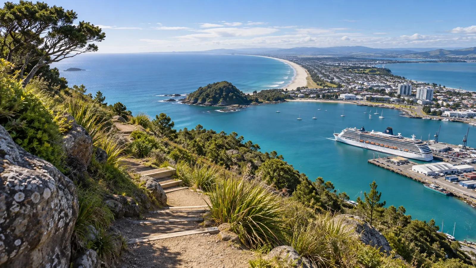
This is the best hiking port I know of for pure convenience. Ships berth on the Mount Maunganui side of the harbor, the township is about five minutes away on foot, and the extinct cone of Mauao rises straight out of the end of the beach.
The summit track takes roughly forty minutes up and it is genuinely steep, with a payoff over the harbor and the surf beach that justifies the effort. The base track loops the whole cone on much flatter ground with some uneven footing, which is the better call if anyone in your group would rather not climb.
Slips and maintenance close sections of these tracks from time to time, so check the current status the week you sail rather than assuming. The Tauranga port guide covers what else is within walking distance if the summit is shut.
Kotor is 1,350 steps and no water fountains
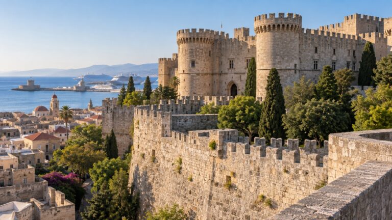
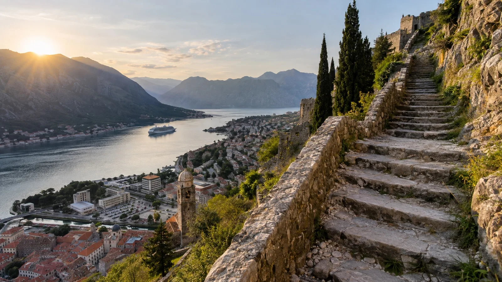
The walls above Kotor are a staircase, not a trail, and that is exactly why they work on a port day. The quay is a flat five minute walk from the Sea Gate, so you are climbing within ten minutes of leaving the ship.
It is roughly 1,350 steps up to the fortress of San Giovanni, about 985 feet (300 m) above the water. There is a ticket in the busier months, and there is no water on the route, so buy a bottle in town on the way through.
Go at opening or do not go at all in July. Kotor bakes in a bowl of limestone, the steps have almost no shade, and the crowd gets thick by mid morning, which is why the Kotor port guide pushes the shoulder months for this one.
St. John’s has a coastal trail that starts downtown
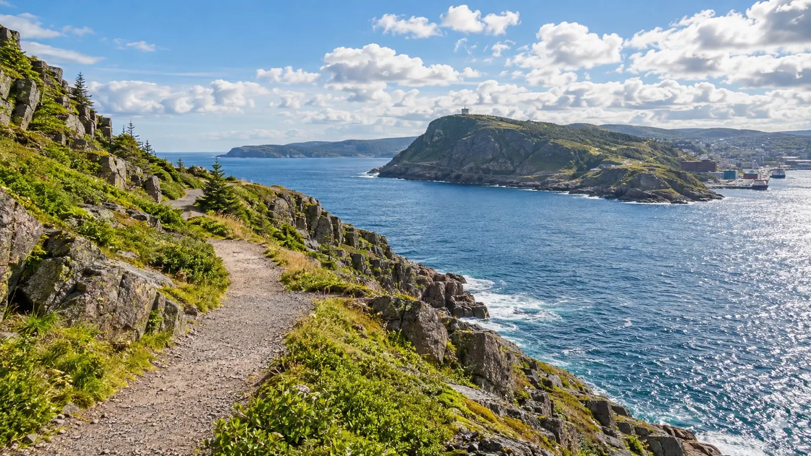
Newfoundland is an underrated hiking stop because the good trail is right there. The headland above the harbor narrows carries a network of paths, and the North Head Trail runs along the cliff edge between the city and the tower on top.
It is a short hike with real exposure, meaning narrow sections, stairs, and a long way down on one side. That makes it a poor choice in wind or wet rock, and it is worth turning around rather than pushing through weather on a cliff you do not know.
Fog is the local variable, and it can sit on the headland all morning then burn off by noon. I would check the view from the pier before committing, and the St. John’s port guide covers the walk up from downtown.
Acadia from Bar Harbor is close, and the tender is the problem
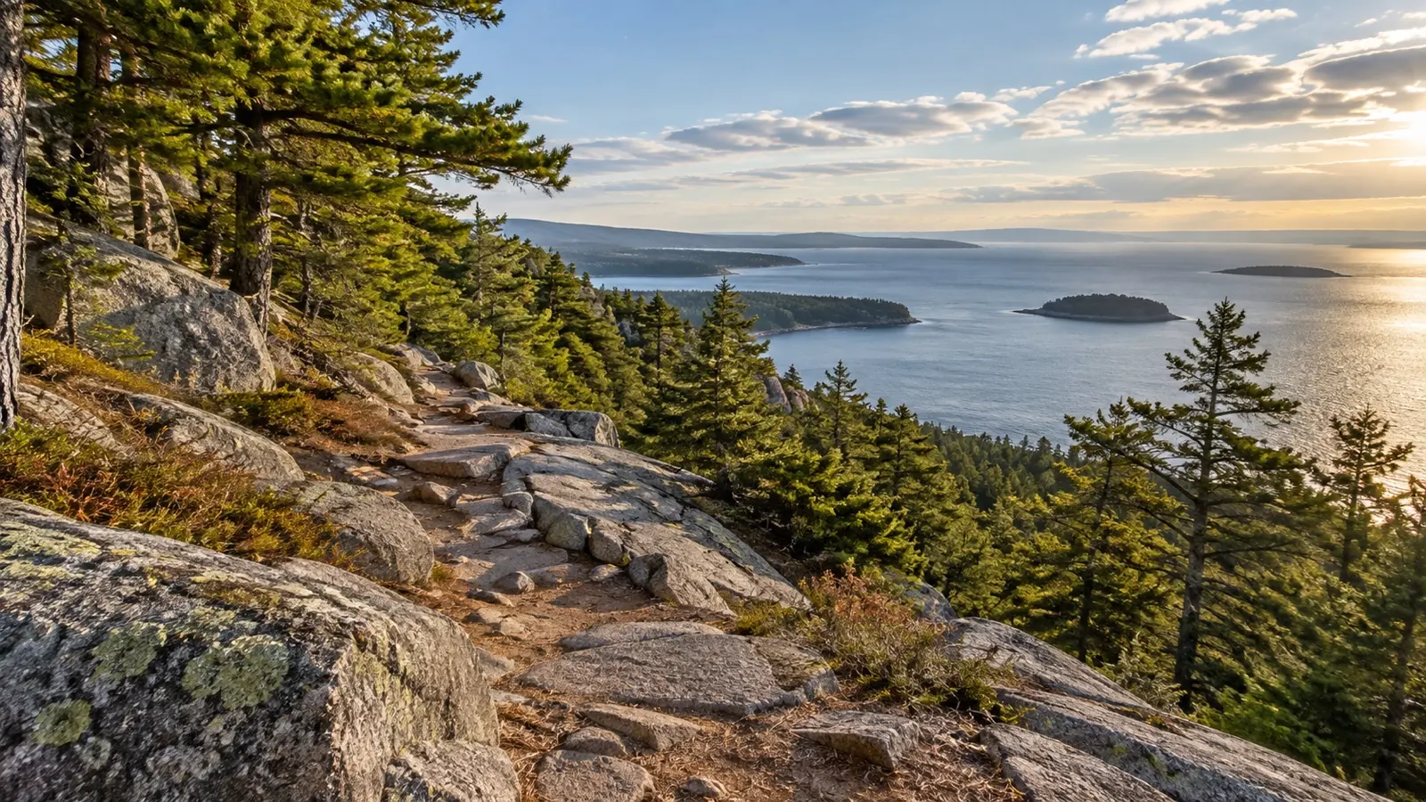
Acadia has more than 150 miles (240 km) of trails and some of them are twenty minutes from where the tender lands. The park itself is blunt about what to bring, telling hikers to carry at least a quart of water and wear sturdy hiking shoes, more on a warm day.
The flat coastal paths are the safe port day pick. The famous ladder trails with iron rungs bolted into the rock are a different proposition, the lines for them get bad in summer, and some cliff routes close seasonally for nesting birds.
Bar Harbor has no cruise berth, so every one of these hikes ends with a tender line. I would be back at the waterfront a full ninety minutes before the last tender here, because tendering eats more of your day than the schedule admits, and the Bar Harbor port guide explains why fog gets a vote.
Whittier gives you 800 feet of climbing and a glacier at the top
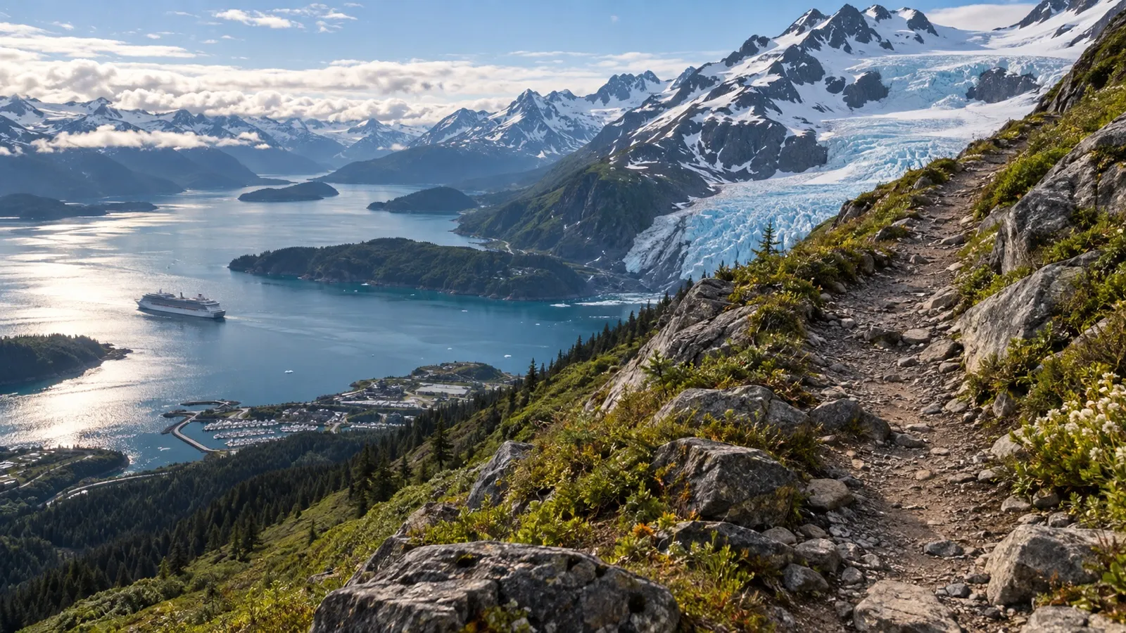
Whittier is a tiny town at the head of Passage Canal, and downtown is a five to ten minute walk from the dock. Just past the railroad tracks there is a gravel forest access road, and off that road is one of the best short hikes in Alaska.
The trail over Portage Pass runs about two miles (3.2 km) one way with roughly 800 feet (245 m) of gain, and it is rated as a steep uphill hike rather than a stroll. The official advice is hiking boots, water, and clothes for changing weather, which is not boilerplate in this particular town.
I have stood on the Whittier waterfront in rain that arrived sideways, and it colors how I think about this one. A waterproof shell with a hood and shoes with real traction are the difference between a great morning and a miserable one, and the Whittier port guide says the same thing about the weather.
In Juneau the tram is not cheating
Juneau has trails leaving from downtown that climb hard from sea level, and on a seven hour port call most people should not attempt them from the bottom. The tramway from the docks lifts you about 1,800 feet (550 m) in six minutes and drops you onto the trail network up top.
That is a legitimate way to get a mountain hike out of a short call. You walk the good part, you skip the switchbacks through the trees, and you are never more than a ride away from the pier.
The glacier trails north of town are the other option, about twelve or thirteen miles (20 km) out. The shoreline walk toward the ice from the visitor center is flat and easy, which makes it the right choice for a mixed group, and the Juneau port guide lays out how to get there.
Table Mountain deserves more respect than it usually gets
Cape Town ships berth inside the working port about a mile from the waterfront, and the mountain is right there above the city. That proximity fools people into treating a serious mountain like a city park.
The direct gorge route up the front is a relentless staircase in full sun with no bail out point, and the weather on top can change while you are on it. The park publishes safe hiking guidance for exactly this reason, and it is worth reading before you decide to walk up rather than ride.
The cableway is the sensible port day answer, with the caveat that it closes in high wind and you need a backup plan. My honest opinion is that hiking up here is a great idea on a land trip with a local group and a poor idea alone on a port day, and the Cape Town port guide covers the wider safety picture.
Madeira levadas, and the booking you now have to make
Funchal is a walk off port and the island is laced with levada paths, the irrigation channels that contour along the hillsides. They are mostly flat, which makes them sound easier than they are.
Plenty of levadas run along a narrow ledge with a long drop on the open side and no railing, and several pass through unlit tunnels where you need a flashlight. Vertigo is a real disqualifier here, and a wet levada in cloud is not the day you were picturing.
The bigger change is administrative. Madeira now charges for access to its official marked trails and expects you to book online before you set out, so treat that as a step to complete before you sail rather than something to sort out at the trailhead, and check the Funchal port guide for how far out the good ones are.
The ones that need a permit or a guide
Two famous hikes come up constantly in cruise forums and both have a gate in front of them. Knowing that before you build a day around one saves a lot of disappointment.
- The Chilkoot from Skagway: Permits and reservations are required through the summer season, and you have to attend an in person orientation to be issued one.
- Boiling Lake in Dominica: A certified guide is required, and it is an eight mile (13 km) round trip that realistically runs six to eight hours plus transfers.
Neither is a port day hike, and I would not pretend otherwise. From Skagway you can walk a short section of the historic trail near the trailhead without the full commitment, which is the version that fits.
Dominica has better options for a single day. The waterfall walks near Roseau take minutes rather than hours from a parking lot, and the Roseau port guide is honest about which rainforest hikes fit a call and which do not.
Water, shoes and the things people skip
Cruise passengers hike in the wrong shoes more than any other group I have watched go up a trail. Deck sneakers on wet rock, sandals on a gravel descent, and one bottle of water shared between two people at noon.
- Water: A quart per person minimum, and double that in the tropics or above about 80 degrees (27 C).
- Shoes: Closed toe with real tread. Trail runners are fine, flip flops are how people break ankles.
- Shell: A packable waterproof layer with a hood, even when the morning looks perfect.
- Navigation: An offline map downloaded before you lose signal, plus a screenshot of the trail junctions.
- Ship card and cash: Both, in a zip bag, because a soaked ship card at the gangway is a slow problem.
Trekking poles are the one item worth borrowing if you have knees with opinions. The descent is where port day hikers get hurt, and poles turn a nervous forty minutes into a normal one.
Missing the ship on a trail is a real risk, not a story
On a trail you lose the two things that usually save you. There is no taxi to flag down and often no cell signal, so a twisted ankle two miles up a mountain does not resolve itself in fifteen minutes.
That is why I set a turnaround time before I start walking and treat it as non negotiable, regardless of how close the summit looks. If the clock says turn around, you turn around, and my thinking on how early to head back to the ship gets stricter, not looser, when a trail is involved.
Tell someone your route, even if it is just a note to your cabin mate. And read the port agent playbook once before your cruise, so that if the worst happens you know who to call from a trailhead instead of guessing.
If someone in your group cannot manage the climb, split up rather than dragging them along. There are always flat options, and planning a port day for someone who cannot walk far is its own skill.
Quick answers
Can you hike on a cruise port day?
Yes, as long as the trailhead is close and the hike takes no more than half your time ashore. Ports like Tauranga, Kotor and St. John’s put a real trail within a short walk of the ship.
Should I book a hiking excursion or go on my own?
Go on your own where the trail starts near the pier and is well marked. Book through the ship where the trail is far out, requires a guide, or where getting back depends on someone else’s vehicle.
What shoes should I bring for hiking in port?
Closed toe shoes with real tread, either trail runners or light hiking shoes. Anything you would wear by the pool is the wrong answer on wet rock or loose gravel.
Which cruise port has the best hiking?
For convenience it is Tauranga, where the summit track is minutes from the berth. For scenery per mile of effort I would take Whittier, if the weather cooperates.
Do any cruise port hikes need a permit?
The Chilkoot Trail out of Skagway requires a permit and reservation through the main season, and Madeira now requires an advance booking for its marked trails. Several national parks also require a certified guide for their harder routes.
Final word
The good news is that the best port day hikes are usually the close ones. A steep hour above a harbor beats a four hour bus round trip to a trail you get thirty minutes on.
Pick two ports on your itinerary where the trail starts near the pier, pack proper shoes and enough water, and set a turnaround time before you leave the ship. Then walk up something and enjoy having earned the view.
How this guide was researched: Trailhead locations, distances from each cruise berth, elevation gain, permit and guide requirements and official safety advice were checked in November 2026. Trail closures, permit systems, ticket prices and port call hours change from season to season, so confirm the current status for your own sailing before you plan a day around a hike. See our Editorial Policy.
More on this topic: browse every guide on shore excursions and DIY port days.