Måløy Cruise Port: Vågsøy Island, Norway
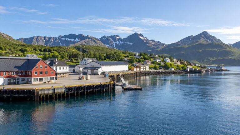
Måløy is a compact working port on Norway’s exposed western coast, where fishing, ferries, murals, and Atlantic weather share the waterfront. It is not a grand fjord city, and that quieter scale is exactly why the stop can be so enjoyable.
The best scenery lies outside town, so the day turns on one choice: stay local for history and street art, or arrange transport to Kannesteinen, Refviksanden, Vågsberget, or Kråkenes. Trying to collect every name usually means seeing the island through a windshield.
Måløy quick facts
- Where you arrive: Måløy harbor on Vågsøy, in Kinn municipality and Vestland county.
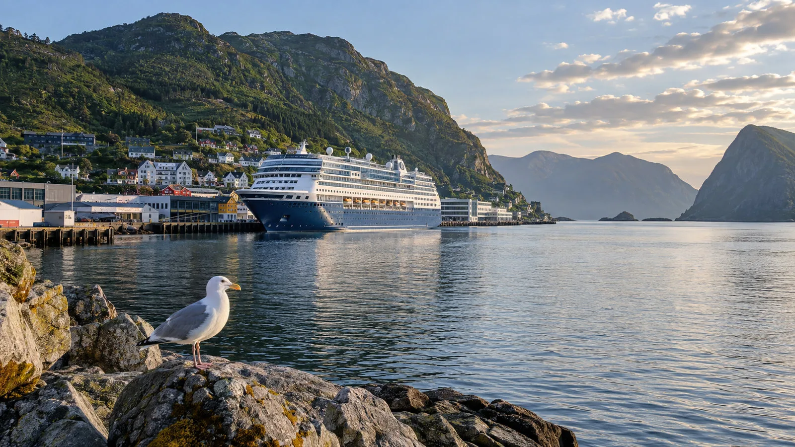
- Ship access: Many calls use an alongside quay, but the assigned berth and gangway arrangements depend on the vessel.
- Town access: The center and waterfront are close to the harbor and practical to explore on foot.
- Main choices: Kannesteinen and Refviksanden for coastal scenery, or the Måløy Raid Centre and murals for a town based day.
- Currency: Norwegian krone, with cards widely used and a physical card still useful as backup.
- Weather: Highly changeable because Vågsøy faces the exposed Stadhavet sea.
- Best planning rule: Prearrange transport for island sights and leave a generous return buffer.
A working harbor, not a staged cruise village
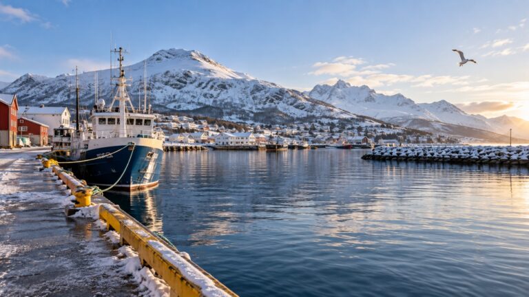
Måløy grew around the sea and remains one of Norway’s important fishing communities. Boats, processing activity, freight, and coastal services are part of the view rather than something hidden behind a visitor district.
The town sits on the southeastern side of Vågsøy and connects to the mainland across Måløy Bridge. Fjord Norway describes the island as a place shaped by open sea, lighthouses, fisheries, and dramatic coastal weather.
This is a good port for travelers who enjoy ordinary local life alongside scenery. It is less rewarding for anyone expecting a large terminal, polished shopping zone, or a famous monument beside the gangway.
Getting from the ship into town
Many cruise and coastal ships berth within easy walking distance of the center. The exact quay can vary, so use the ship’s arrival information instead of assuming every vessel stops at the same point.
The waterfront and main streets are compact enough for a relaxed walk. Cafes, shops, the war history center, and much of the street art can fit into a town only plan without a taxi.
There may be visitor information near the harbor on busier calls, but do not depend on finding transport after arrival. Måløy is small, and taxi supply can be quickly absorbed by one cruise ship.
If you have limited mobility, ask which quay is assigned and whether the gangway includes steep sections. A short map distance does not describe the slope or ship access on the day.
Kannesteinen: the signature coastal landmark
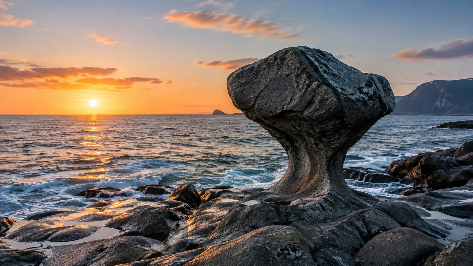
Kannesteinen is a sculpted eclogite rock on the shoreline near Oppedal, about 6 miles from Måløy. Waves and weather shaped it into a form often compared with a goblet, mushroom, or one-legged chair.
The regional history site Kringom explains that the rock stands at Kvalheimsvika on a coast exposed to strong westerly weather. It is protected under Norwegian law and remains part of a vulnerable natural setting.
The rock is about 10 feet high, and a fall could cause serious injury. Stay off the formation, respect barriers, and let the tide decide how close you can safely approach.
Low tide may expose more shoreline, while high water can surround the rock. Check conditions before leaving town, but do not build the entire port day around achieving one exact photograph.
The drive is short, yet the stop still takes time because the parking area, walk, weather, and other visitors affect the pace. Pair it with one nearby coastal sight rather than a long island checklist.
Refviksanden: a bright beach on a wild coast
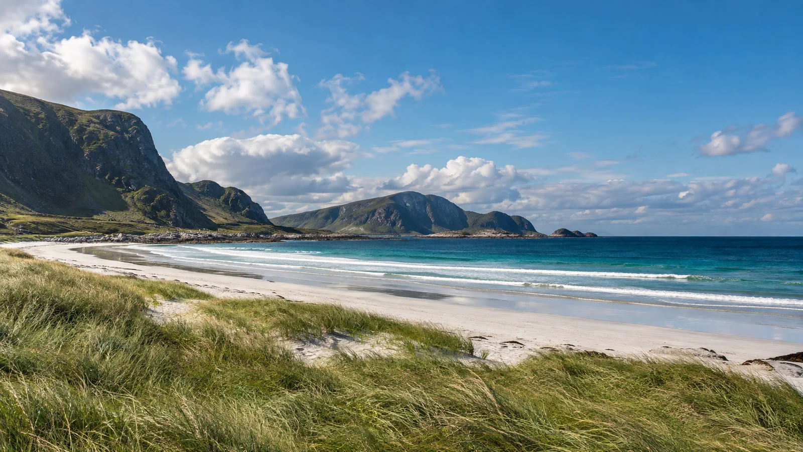
Refviksanden is a pale shell-sand beach at Refvik that stretches approximately 0.9 miles. Its color can look almost tropical, while the temperature and wind quickly remind you that this is the Norwegian Sea.
The beach works as a scenic walk, a photography stop, or a place to slow down after Kannesteinen. Swimming is a personal decision based on conditions and ability, not something to attempt because the sand looks inviting.
Bring a windproof and waterproof layer even on a promising morning. The open coast can move from calm to uncomfortable far faster than a sheltered town forecast suggests.
Sand also creates an accessibility challenge for wheelchairs and travelers with balance concerns. Ask an excursion provider how close the vehicle can stop and whether a firm viewing point is available.
Vågsberget and the old trading coast
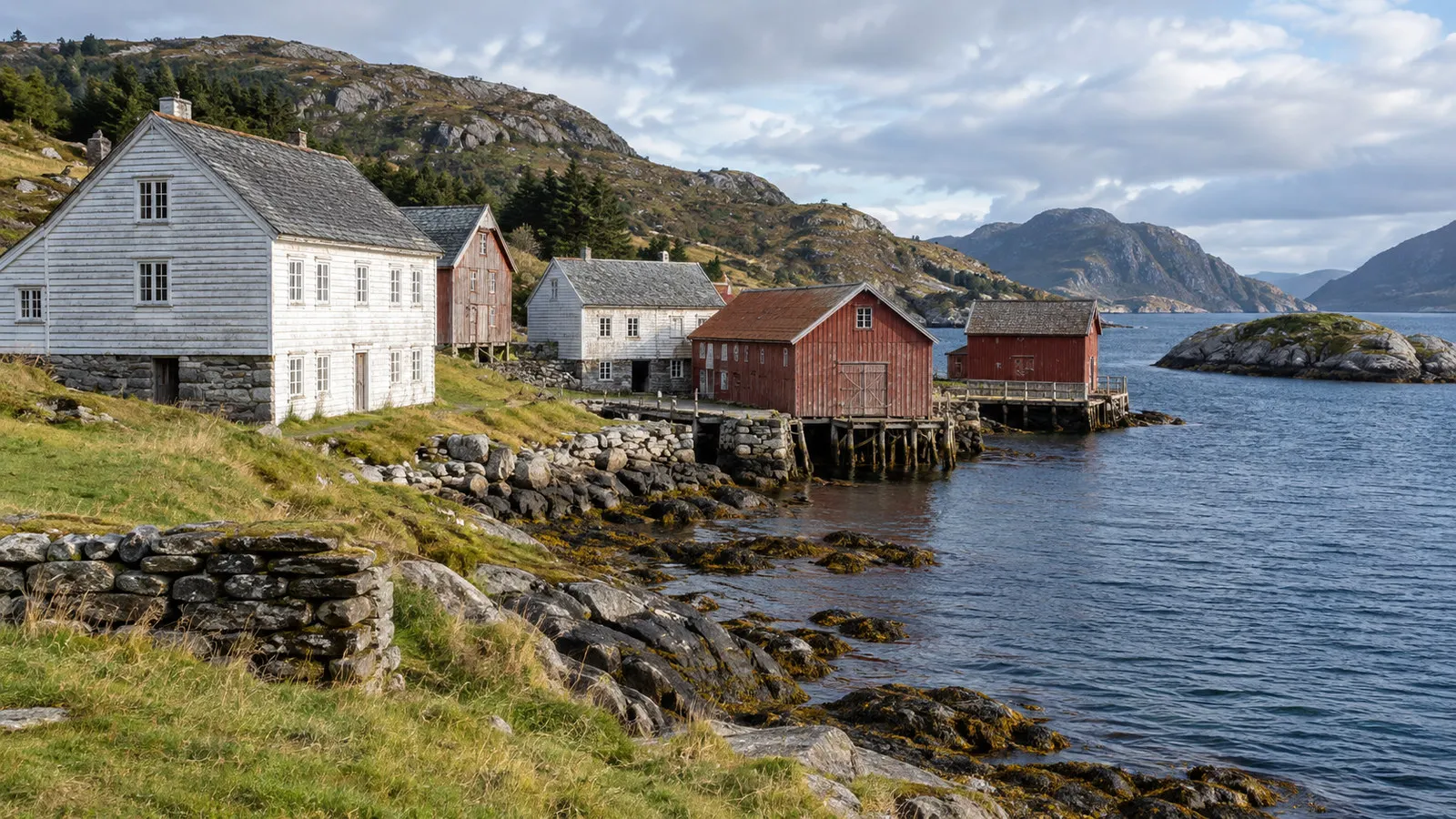
Vågsberget preserves the story of a coastal trading place and guesthouse that served people moving along the sea route. It adds human history to a circuit that might otherwise feel like a sequence of landscape stops.
Opening arrangements can be seasonal, so verify the current schedule before treating an interior visit as guaranteed. Even when buildings are closed, the setting helps explain why sheltered trading points mattered on this exposed coast.
Kannesteinen, Vågsberget, and Refviksanden can form a sensible small group excursion when timing works. Kråkenes Lighthouse is farther and more exposed, so adding it requires a longer and more carefully paced plan.
Kråkenes Lighthouse and the Atlantic edge
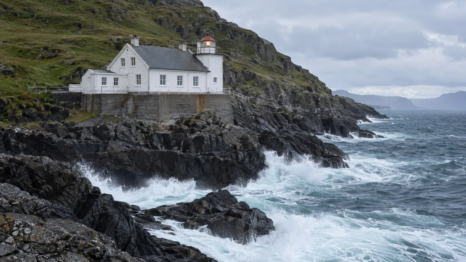
Kråkenes Lighthouse stands on the western side of Vågsøy facing some of Norway’s roughest coastal water. The setting can be magnificent, but weather and road time make it a deliberate excursion rather than a casual extension.
Do not assume every tour includes access inside the lighthouse. Confirm the exact stop, walking surface, facilities, and cancellation policy with the operator.
On a short call, Kannesteinen and Refviksanden usually create a cleaner plan. Choose Kråkenes when the exposed lighthouse landscape is your main interest and the schedule provides enough margin.
Måløy Raid Centre and wartime history
Operation Archery brought British and Norwegian forces to Måløy on December 27, 1941. The raid targeted German military and industrial positions, and the town’s museum presents the event through photographs, film, and local stories.
This is the strongest indoor option when wind or rain makes an island drive less appealing. Check opening hours against the ship’s call because smaller museums can use seasonal or limited schedules.
The subject is serious, and it helps place the harbor in a wider wartime landscape. Allow time to read rather than rushing through only to say you visited.
Street art and a good town walk
Måløy’s murals celebrate coastal culture, fishing, history, and local identity. Fjord Norway says there are about 20 works, with most within walking distance of the center.
A self guided mural walk pairs naturally with the Raid Centre, harbor, and a cafe stop. It is also the most flexible plan when the ship arrives late or coastal weather changes the excursion program.
Look beyond the largest walls because smaller works can appear along side streets and working buildings. Stay alert around harbor traffic and do not enter operational areas for a better camera angle.
Ship excursion, taxi, or rental car?
A ship excursion offers the simplest timing protection for the sights outside town. It also solves the local transport problem when several hundred passengers are trying to reach the same rock and beach.
A prebooked taxi or private guide gives more control over the pace and can focus on one or two stops. Agree on the route, price, waiting time, and return deadline before departure.
A rental car can work for experienced drivers who are comfortable with narrow roads, changing weather, and Norwegian traffic rules. Confirm collection hours, fuel policy, parking, and whether the vehicle will actually be available near the quay.
Public transport is useful for local residents but is not designed around every cruise call or scenic stop. Check the official schedule for the date, and do not build a tight day around a connection that runs only occasionally.
Accessibility and mobility
The compact town center offers the easiest terrain, though curb cuts, slopes, weather, and the assigned gangway still matter. Ask the cruise line for exact berth and assistance information before sailing.
Kannesteinen involves an outdoor approach near wet rock and uneven coastal ground. Refviksanden adds soft sand, while Kråkenes can include exposed paths and difficult weather.
A panoramic vehicle tour may be more comfortable than walking to every landmark. Ask whether the important views are visible from a firm surface and how far the guide expects guests to walk.
The Raid Centre and murals can form a satisfying alternative close to the ship. Confirm museum access directly because historic or adapted buildings may still have steps or narrow spaces.
Weather and coastal safety
Måløy sits beside Stadhavet, which Fjord Norway describes as one of the most exposed areas on the Norwegian coast. Wind, rain, and rapidly changing visibility are part of the destination rather than rare surprises.
Dress in layers with a proper waterproof outer shell and shoes that grip on wet ground. A small umbrella is less useful than a hood when the wind begins to work.
Stay away from wave washed rocks and do not climb Kannesteinen. At beaches and lighthouses, follow local barriers and turn back when conditions become uncomfortable.
Norway’s emergency numbers are 110 for fire, 112 for police, and 113 for urgent medical help. On an organized excursion, the guide and ship team are usually the fastest first contacts.
Food, money, and practical stops
Måløy’s cafes and restaurants reflect a town built around the sea, and local seafood is an obvious choice when time allows. Opening hours can be quiet outside peak periods, so keep a second option in mind.
Cards are widely accepted in Norway, but carry a physical card and know its PIN. Cash is rarely essential, yet a small amount of Norwegian krone can be useful if a terminal or connection fails.
Use the town supermarket or pharmacy for ordinary supplies instead of expecting a cruise terminal shop. Return purchases to the ship early enough to clear any security process without stress.
Timing your return to the ship
Leave a larger buffer for Kannesteinen, Refviksanden, or Kråkenes than the driving time alone suggests. Narrow roads, photo stops, weather, and limited taxis can all slow the return.
Ship excursions follow the vessel’s operating plan, while independent travelers carry their own timing risk. Save the ship’s contact instructions and confirm all aboard time before leaving the harbor.
Do not count on another vessel or easy road transfer to the next port if you miss sailing. The coastal geography that makes Måløy interesting also makes recovery complicated.
How Måløy fits a Norway itinerary
Måløy works well on coastal itineraries that value smaller communities between major fjord destinations. It provides a working harbor and exposed island scenery rather than another polished city stop.
Norway’s coastal services also call here as part of longer north and southbound routes. Our Norway Coastal Express ports guide explains how those calls differ from a conventional full day cruise visit.
If your itinerary includes protected fjords, our Norway fjord rules guide adds context for the country’s changing environmental requirements. Måløy itself is a coastal port rather than a deep World Heritage fjord call.
Quick answers
Can I walk into Måløy from the ship?
Many berths are close to the compact town center. Check the assigned quay and gangway arrangement for your particular vessel.
What is the best short excursion?
Kannesteinen paired with Refviksanden creates a strong coastal introduction when transport is arranged. On a shorter or wetter call, choose the Raid Centre and murals in town.
Can I visit Kannesteinen independently?
Yes, with a rental car or prearranged taxi, but confirm return transport and tide conditions. Do not climb the protected rock.
Is Måløy accessible?
The town is the most manageable option, while coastal sights involve sand, wet rock, or uneven paths. Request exact gangway and excursion details from the cruise line.
What should I wear?
Wear layers, a waterproof shell, and shoes with good grip. Carry the outer layer even when the morning begins bright.
Is Måløy worth the stop?
Yes, for travelers who enjoy working ports, local history, and open coast scenery. It is not the best match for anyone seeking large museums or major city shopping.
The last word
Måløy succeeds by being specific: a small fishing town beside a restless sea. Choose a town day or one focused island circuit, and the port feels generous rather than limited.
Kannesteinen may supply the famous photograph, but the harbor, murals, beach, and weather explain the place. Give them enough time to do their work.
How this guide was researched: Unless a first-hand visit is explicitly identified above, this guide uses official and regional information from Visit Norway, Fjord Norway, Kringom, and the Måløy Raid Centre. Berths, transport, opening hours, and weather-dependent access were reviewed on September 12, 2026; confirm final details with your cruise line and local operator under our Editorial Policy.
More on this topic: browse every guide on expedition and alternative cruises.