Bordeaux River Cruise Ports: The Only Tide-Timed River Cruise in Europe
Bordeaux’s river-cruise loop is unusually controlled by tides across the Garonne, Dordogne, and Gironde. Tide and bridge windows can reorder days, berths, and excursion times, so flexible travel plans matter even when every destination remains on the itinerary.
My quick take
A Bordeaux river itinerary can be unusually walkable from a central landing, but its timetable needs flexibility. Exact walking distance and transfer needs depend on the landing, tide, and itinerary.
Many published Bordeaux river itineraries operate round-trip from Bordeaux, with calls on the Garonne, Dordogne, and Gironde. Routes and durations vary, so check the current itinerary rather than assuming every sailing follows the same loop.
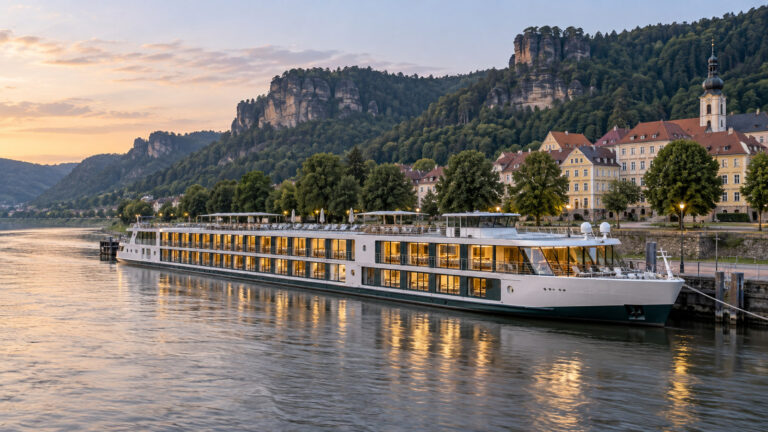
It helps to treat the ship as a base for exploring the wine region rather than as transport between distant cities. The appeal is in the riverfront towns, historic sites, and vineyard excursions.
Do not book an independent flight or train too close to the published arrival time in Bordeaux. Tides and bridge operations can affect the working schedule, so leave a sensible buffer.
The quick facts
- Where you land: in Bordeaux, the Chartrons quays, listed by the port as the Albert Londres, La Fayette and Thomas Jefferson landings. Elsewhere on the loop you get Blaye, Bourg, Pauillac, Cussac-Fort-Medoc, Libourne, Cadillac and, at the mouth, Royan.
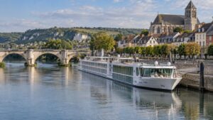
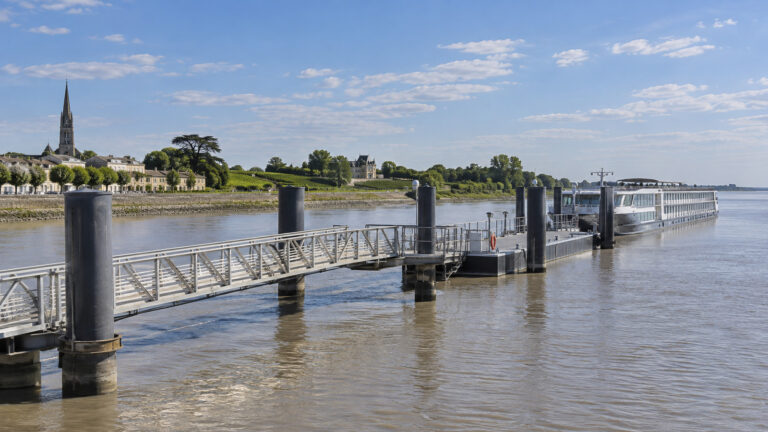
- How you get ashore: Standard river-cruise calls use a gangway to a quay or floating pontoon, sometimes through rafted ships. The precise berth, ramp angle, and cross-ship route depend on tide, vessel traffic, and the local assignment, while excursion boats operate separately.
- Into town: Bordeaux, Blaye, Bourg, Pauillac, and Libourne can put you near the center, but the walk varies by berth and tide. Cussac-Fort-Medoc, wine estates, and Saint-Emilion require road transport rather than a simple walk from the gangway.
- Currency and language: Euros and French.
- Getting around cost: Walking may cover much of a central call, but costs vary when you use Bordeaux’s TBM trams, buses, or a taxi. Check current fares and accepted payment methods before travel.
- Time zone: Central European Time, UTC+1, with daylight saving from late March to late October.
- Ship size: Published berth limits vary by landing, vessel dimensions, draft, and local operating conditions. The operator and port must match the ship to the assigned berth rather than applying one length ceiling to every stop on the loop.
- How often the call is missed: No reliable public percentage is available. Tides, river conditions, berth availability, and other operational limits can change or prevent a call.
Why the tide runs your itinerary
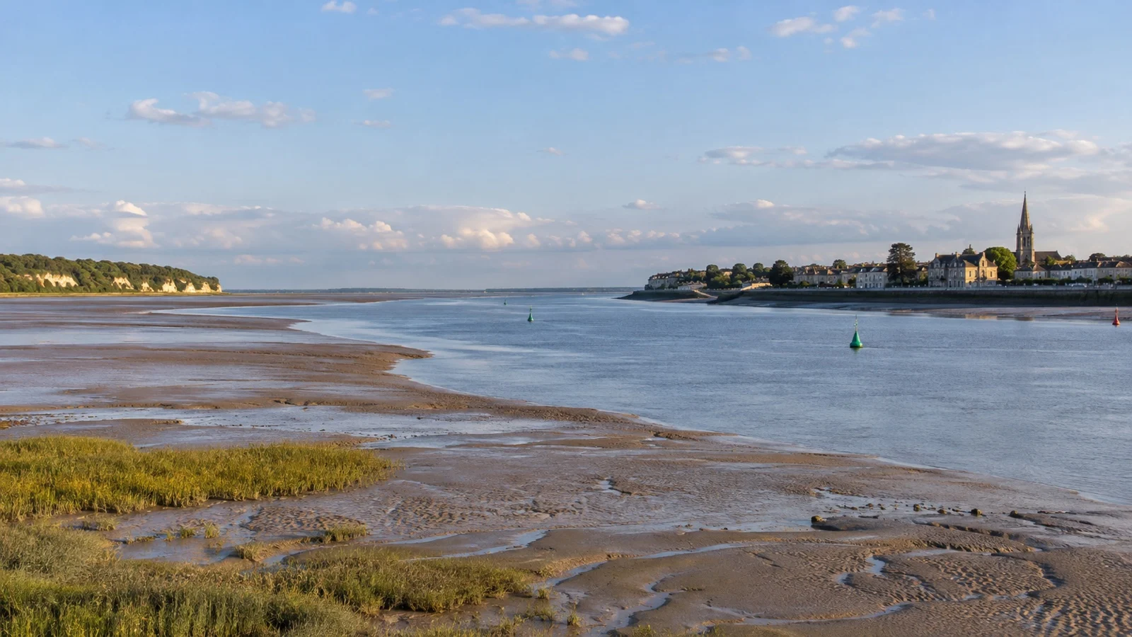
The Garonne and Dordogne meet at the Bec d’Ambes and form the Gironde estuary, which opens to the Atlantic. Tidal conditions reach Bordeaux and influence river operations.
The practical effect is that operators plan movements around the tide, river conditions, berth access, and bridge windows. That can change sailing and excursion times from the original brochure schedule.
The Chaban-Delmas lifting bridge is another operational factor for vessels passing central Bordeaux. Use the ship’s daily program for confirmed sailing times because published web information can change.
The action to take is dull and effective. Read the next day’s times on the daily program rather than assuming they match the itinerary you booked.
What the title means, and what it does not
Bordeaux is not literally the only tidal river-cruise region in Europe. It is unusual because tides strongly control a multi-day loop across the Garonne, Dordogne, and Gironde, while the Chaban-Delmas bridge opening schedule adds another moving constraint in central Bordeaux.
The result is a cruise whose days, berths, and excursion order may change even when the advertised destinations remain. Treat the schedule as flexible and leave an appropriate buffer before any independently booked flight or long-distance train.
Standard calls use quays or floating pontoons, but low tide can steepen a ramp and rafting can add thresholds between ships. Saint-Emilion brings steep cobbles, while wine estates may add gravel, steps, cellar stairs, and coach transfers, so ask for the exact accessible version of each excursion.
France is in the Schengen Area, but document requirements still depend on nationality and the full itinerary. Follow the ship’s stated all-aboard time and allow extra travel margin when returning from Saint-Emilion or a wine estate.
The berths, one at a time
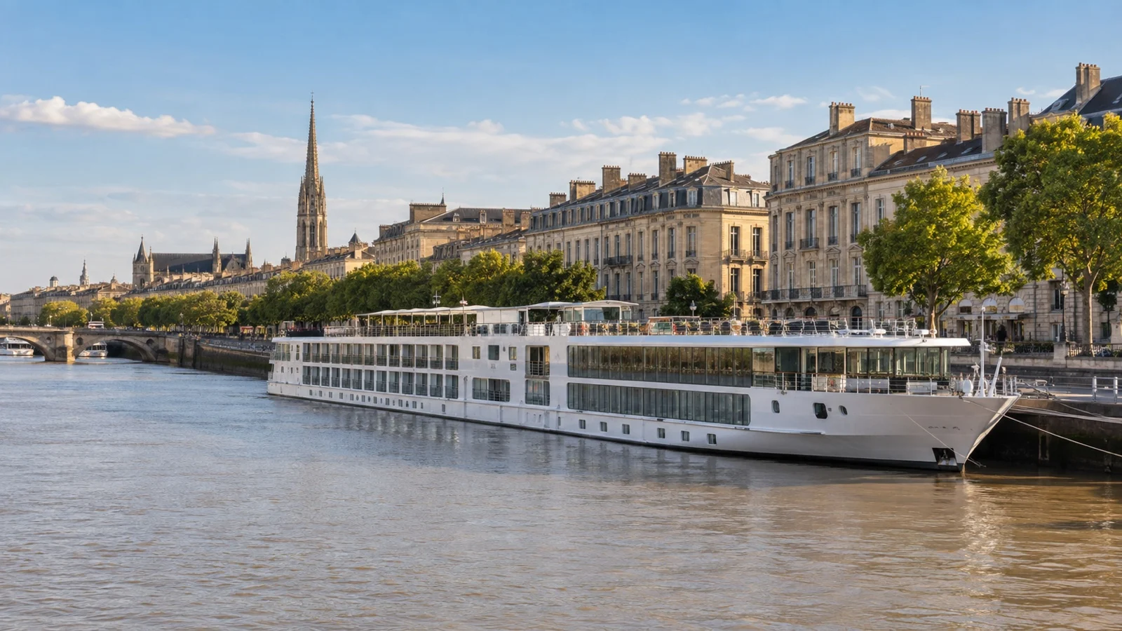
A central Bordeaux landing can make the city easy to explore on foot. The route along the river toward Place de la Bourse is comparatively level, but the distance depends on the assigned landing.
That riverfront route leads into the UNESCO-listed Bordeaux, Port of the Moon, inscribed in 2007 across 1,731 hectares. UNESCO records 347 listed buildings and notes that Bordeaux has more protected buildings than any French city except Paris.
Blaye’s landing can provide convenient access to the citadel, though the route uphill includes uneven surfaces. Confirm the assigned landing and gangway conditions with the ship.
Bourg also needs a closer look because the upper town sits above the river. Even when the landing is near the center, the final approach can be steep.
Libourne and Cadillac can serve as excursion gateways as well as calls in their own right. Published itineraries commonly use Libourne for Saint-Emilion and Cadillac for destinations in the Sauternes or Graves area.
Pauillac is an estuary town with access to the Medoc wine region. Some itineraries also call near Fort Medoc at Cussac, where excursion transport may be more useful than independent walking.
UNESCO sites connected to the region
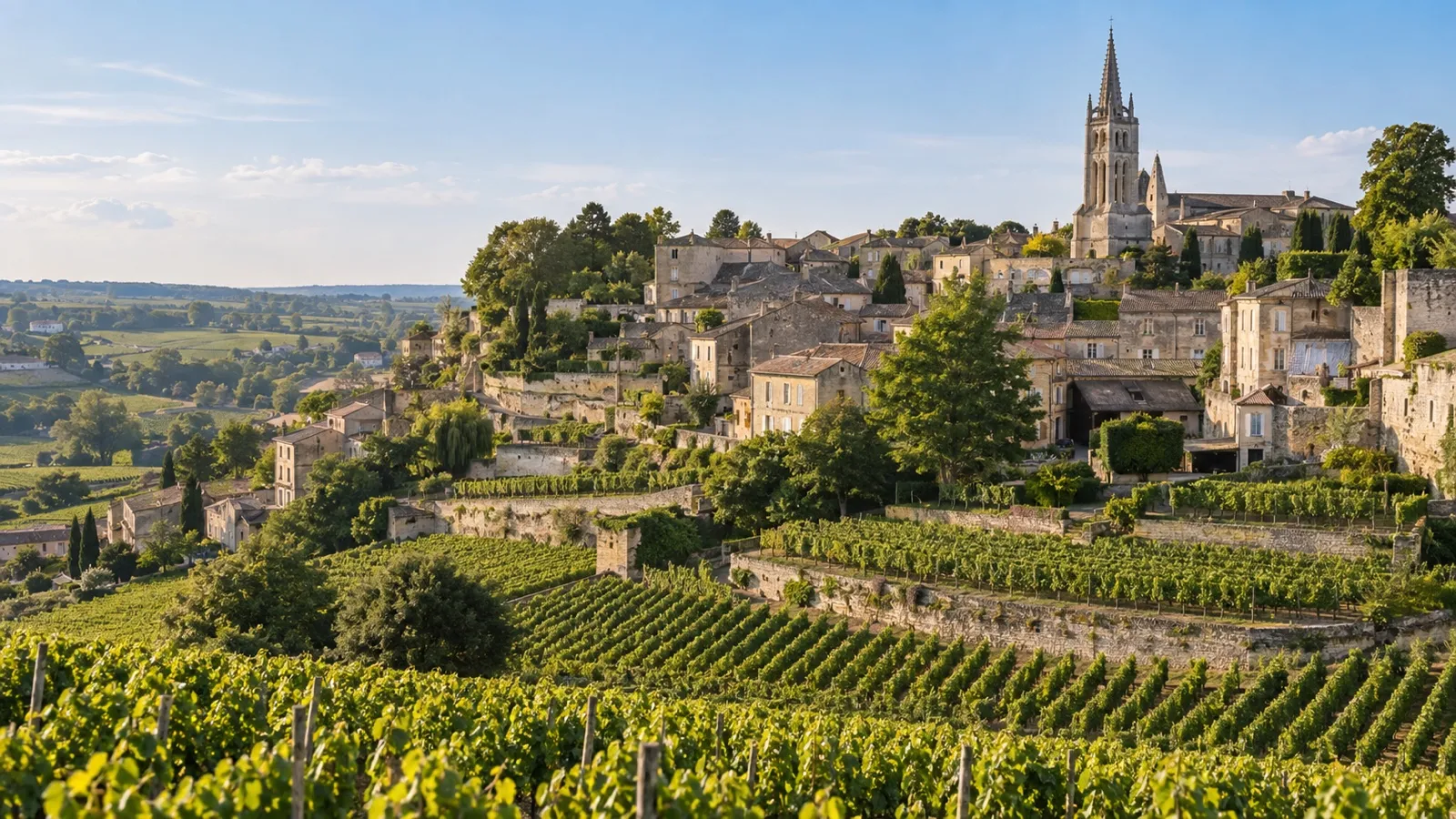
The Bordeaux region connects several distinct World Heritage inscriptions, although the exact sites reached depend on the itinerary and excursions. UNESCO’s listings provide the clearest basis for understanding why these places matter.
The Jurisdiction of Saint-Emilion was inscribed in 1999 as an exceptional cultural landscape devoted to wine growing. It is commonly reached by road from a river landing such as Libourne.
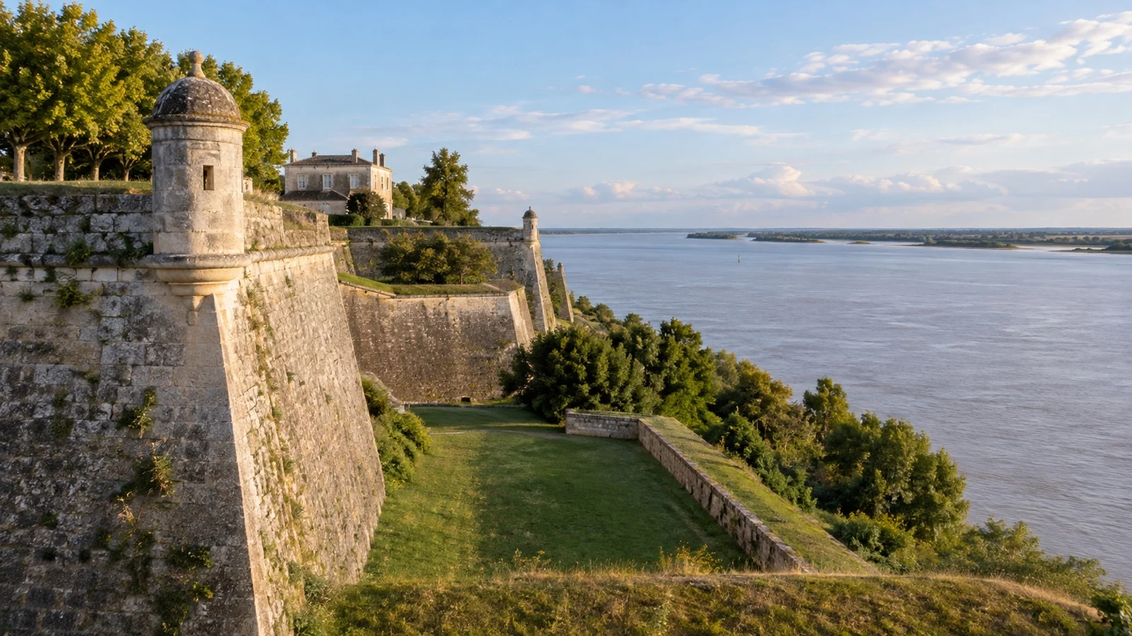
Blaye is part of the Fortifications of Vauban, twelve sites inscribed together in 2008. The Reseau des sites majeurs de Vauban groups Blaye with Fort Pate and Fort Medoc across the water at Cussac and calls the trio the verrou de l’estuaire, the lock on the estuary.
The stops I would actually spend time on
The order varies by itinerary, so use this as a practical shortlist rather than a fixed sequence.
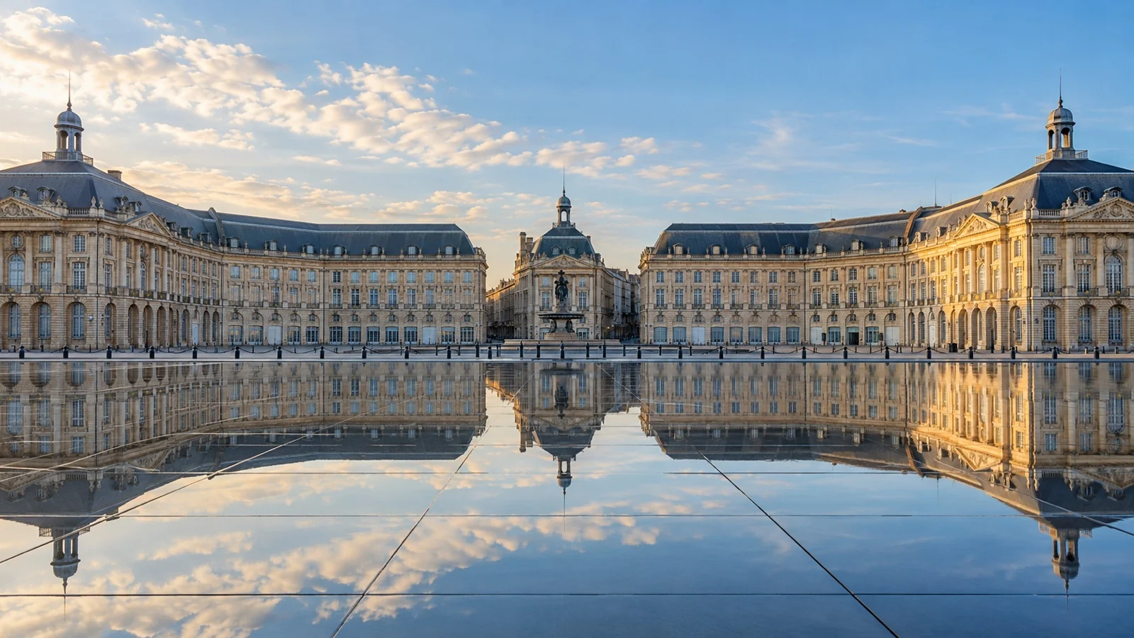
- Place de la Bourse and the Miroir d’eau: the 18th century riverfront ensemble and its reflecting pool are central Bordeaux landmarks. Distance varies by landing, and early morning or evening can be more comfortable than the busiest part of the day.
- The Chartrons quarter: the former wine merchants’ district lies along the northern central waterfront. Depending on the landing, its shops, cafes, and quay may be close enough to explore on foot.
- La Cite du Vin: the wine museum north of central Bordeaux covers wine cultures from around the world. It may be walkable from a Chartrons landing, but distance and transit needs depend on the exact berth.
- The Blaye citadel: Vauban’s estuary fortress, straight up from the pontoon, with long views over the estuary islands. Allow for uneven cobbles and grass ramparts rather than a smooth museum path.
- Saint-Emilion: the hill town and vineyard landscape are reached by road rather than directly from a river berth. The Grand Saint-Emilionnais tourist office controls access to the monolithic church, so check the current tour schedule and book ahead.
- The Medoc from Pauillac: major classified estates are reached by road from the estuary. Advance reservations are common, so a ship excursion or prearranged tour is often the simplest option.
- Chateau de Cadillac: this ducal chateau, managed by the Centre des monuments nationaux, later served as a women’s prison from 1822 to 1952. Check the official site for current admission, opening hours, and accessibility.
- Bourg’s upper town: this historic settlement rises above the river and rewards the climb with broad views. Expect slopes and uneven surfaces.
Fun fact: the loop is bracketed at its seaward end by Cordouan Lighthouse, a roughly 220-foot limestone tower standing on a plateau in the open estuary mouth, which UNESCO inscribed in 2021. It has been lit more or less continuously since the 17th century, largely to guide ships up to Bordeaux.
How I would plan the day
Check the sailing time first, every night, before you plan anything else. On this river that number is the plan, and everything else arranges itself around it.
In Bordeaux I would walk the quay south to Place de la Bourse in the morning, then double back for the Cite du Vin or the Chartrons market. It is one flat riverside axis and you can do all of it on foot.
Libourne and Pauillac are the two calls where I would take the ship’s tour without arguing. Both need transport, and the classified chateaux need a booking you cannot make on the morning.
A realistic word on accessibility
Standard river-cruise calls use a gangway to a quay or floating pontoon, but tide changes the ramp angle and rafting may add a cross-ship route. Bordeaux’s central waterfront is comparatively level, while other towns and excursions can involve uneven surfaces, coach transfers, gravel, or steps.
Floating pontoons rise and fall with the tide, so a connecting ramp may be steeper at one time of day than another. Ask the ship about the expected gangway and ramp conditions for your call.
Blaye and Bourg can involve climbs, cobbles, or other uneven surfaces. Saint-Emilion has steep lanes, and the monolithic church visit may involve steps, so confirm the exact accessible route in advance.
Rafting is the other variable, and if you are on the outside ship you cross a neighbor’s deck to reach the quay. That is covered properly in my piece on rafting and double docking on river ships, and the wider fleet comparison sits in my guide to wheelchair-friendly cruise ports.
When to go, and the weather
Many Bordeaux river itineraries are scheduled from spring into fall, but the operating season varies by line and year. Check the current departure calendar before planning around a particular month.
Summer is warm rather than brutal, with long-term averages at Bordeaux-Merignac giving July and August highs around 79 to 81°F. Inland vineyard afternoons run hotter, and recent summers have produced days above 104°F.
May, June, and September can offer comfortable sightseeing weather, although heat and rain remain possible. Harvest timing varies by estate and year, and appointments may be limited during busy periods.
April and October are mild and wet, with highs in the high 50s to low 60s Fahrenheit. This is Atlantic weather, so bring a proper waterproof jacket.
Quick answers
Do Bordeaux river cruises go anywhere else, or just round in a loop?
Many Bordeaux river cruises operate round-trip from Bordeaux, but published routes vary by operator and departure. Check the current itinerary for its exact start, finish, and calls.
Can I walk into central Bordeaux from a Chartrons berth? Many passengers can, because the waterfront route toward Place de la Bourse is comparatively level, but the exact distance and gangway depend on the landing.
Use a tram or taxi if weather, paving, or mobility makes the walk unsuitable.
Why does my ship sail at strange hours?
Tides, river conditions, berth access, and bridge windows all influence the operating plan. Use the ship’s daily program for confirmed times.
Which port is Saint-Emilion from?
Saint-Emilion is inland and is typically reached by road from a river landing such as Libourne. The exact transfer point and distance depend on the itinerary.
Is this the same as the Bordeaux ocean cruise port?
No. Ocean calls use a different set of berths and vessel limits, which are covered separately in the Bordeaux ocean cruise port guide.
The last word
Bordeaux can suit travelers who want a regional river itinerary with historic towns, vineyard excursions, and time in one major city. Some landings are very walkable, while others work best with organized transport.
Treat the printed schedule as provisional because operating times can shift with tides and local conditions. The ocean version of this city, with bigger ships and different quays, is covered in the Bordeaux cruise port guide, while the national picture sits in the France cruise ports overview.
A central Bordeaux landing can be highly walkable, but the result depends on the assigned quay. The guide to the most walkable cruise ports explains how to compare calls.
Book Saint-Emilion and winery visits ahead, carry a backup payment method, and check the sailing time every night. On this estuary, the tide is part of the timetable.
How this guide was researched: This guide was desk-researched using current official port, tourism, transit, government, and attraction sources where available. Heritage claims were checked against UNESCO’s World Heritage listings for Bordeaux, Saint-Emilion, the Vauban fortifications, and Cordouan, with practical details checked against the relevant official tourism and monument sources.
Logistics and time-sensitive details were reviewed on September 12, 2026. This guide does not claim a personal sailing, berth inspection, transit ride, wine-estate visit, or attraction visit.
Confirm the itinerary, assigned landing, tide and bridge timing, excursion transport, accessibility, admission, and all-aboard instructions before travel. See our Editorial Policy.