The Dalles River Cruise Port: Dock, Downtown and Gorge Guide
The Dalles gives river cruisers a wonderfully odd opening act: step ashore beside a working Columbia River corridor, slip under the freeway and railroad through the designated connection, and emerge in a downtown full of brick storefronts, murals, neon, and very serious opinions about cherries.
It is also a port where one innocent phrase, “the dock,” can cause trouble. The downtown Columbia River Marine Terminal and The Dalles Marina are separate places, and your actual gangway matters far more than the pin a generic itinerary app drops on the map.
The Dalles River Cruise Port Quick Facts
Into Town: The downtown Marine Terminal is about a 5- to 10-minute walk from central blocks. Marina assignments add distance; verify the day’s dock.
Currency and Language: U.S. dollar. English is dominant; regional place names and history reflect Indigenous, French, and later settler traditions.
Time Zone: Pacific Time: PST (UTC-8) in winter and PDT (UTC-7) during daylight saving time.
Operational note: Wind, wildfire smoke, water conditions, lock delays, dock conflicts, or itinerary changes can disrupt the call. No audited local missed-call rate is published.
A berth change, delayed arrival, shortened visit, or canceled outdoor excursion does not necessarily remove the whole call. Follow the operator’s daily program and current local notices.
Do River Cruises Really Stop in The Dalles?
Yes. American Cruise Lines lists The Dalles as a current 2026 stop on its Columbia and Snake Rivers itinerary, with the useful warning that exact itineraries and excursions vary by departure.
The local evidence is unusually concrete too. City council records say The Dalles entered a dock lease with American Cruise Lines in 2023 and record the company’s commitment to continued scheduled dockings and local bus loops serving museums and attractions.
The call is therefore active, not a nostalgic paddlewheel photo lingering online after the timetable sailed away. It still remains an operational call on a river governed by locks, dams, weather, current, vessel schedules, and the occasional mechanical plot twist.
Where Do River Cruise Ships Dock in The Dalles?
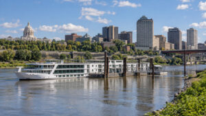
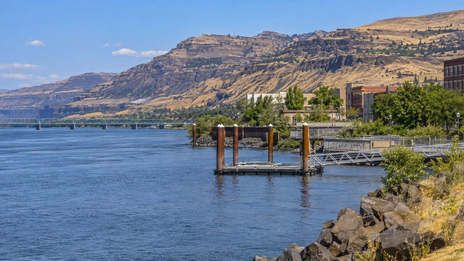
The best current orientation is the City of The Dalles’ Columbia River Marine Terminal, a commercial passenger dock adjacent to downtown near West First Street. The city’s adopted budget describes the terminal as next to downtown and records use by multiple overnight cruise vessels.
American Cruise Lines leases the dock, but that does not create a permanently assigned ship position or an airport-style terminal with one universal door. Vessel size, arrival order, maintenance, security, wind, river conditions, and simultaneous calls can all affect the exact placement and walking route.
The Dalles Marina is a separate facility at Columbia River Mile 190, east of the downtown commercial landing. The Port of The Dalles says it sits beside Riverfront Park and the nearly 10-mile Riverfront Trail.
Older city transportation planning documents identify the marina as a possible location for a smaller passenger vessel when another ship occupies the commercial dock. That is useful contingency context, not proof that your particular sailing will use it.
Ask the cruise director for the day’s location before making an independent pickup plan. “Meet me at the waterfront” can leave a driver and passenger enjoying two entirely different stretches of Oregon.
How Far Is Downtown?
From the downtown Marine Terminal, allow roughly 5 to 10 minutes to reach the first central blocks. That is an editorial walking estimate, not a guaranteed ship-door time, because the gangway position and temporary routing can move the starting line.
The city created a pedestrian connection using tunnels beneath the railroad, First Street, and Interstate 84. Follow the signed route, and never shortcut across active railroad tracks even when downtown appears close enough to touch.
From The Dalles Marina, downtown is roughly one mile west and generally 20 to 30 minutes on foot. That estimate assumes a suitable trail connection, comfortable weather, and no mobility constraint, so a ship shuttle or arranged ride is the smarter default for many guests.
The Riverfront Trail is scenic but not a climate-controlled concourse. Wind, summer heat, smoke, limited shade, construction, and the distance back to the gangway can turn a pleasant outward stroll into an unexpectedly ambitious return.
What Can You Do on Foot?
Downtown The Dalles rewards a loose wander more than a rigid checklist. Historic commercial blocks, public murals, cafes, shops, and small museums are close enough to combine without making the port day feel like competitive urban navigation.
The National Neon Sign Museum occupies the historic Elks building downtown and explores electric signs, advertising, and visual culture. Its colorful galleries make a cheerful counterweight to a day otherwise dominated by basalt, salmon, and enormous feats of concrete.
Hours can be narrower than a cruise call, so check the museum’s own calendar before walking over. A downtown visit also works well as a flexible backup when wind cancels kayaking or a coach excursion returns early.
The Dalles has a substantial mural collection spread around the historic center. Murals are free, always compatible with a short call, and easy to sample rather than “complete,” which is exactly the right level of ambition before lunch.
Look up as well as ahead. The brick facades, upper-story windows, and old commercial details tell a transportation story that is easy to miss if every photo is aimed at street level.
Columbia Gorge Discovery Center
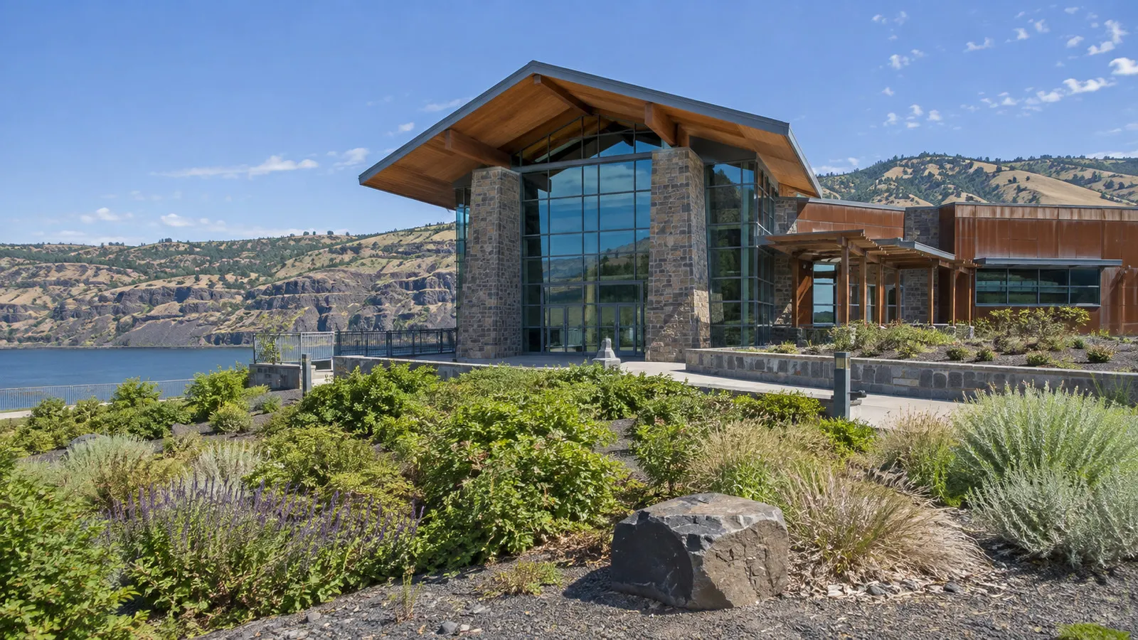
The Columbia Gorge Discovery Center and Museum is the most useful single introduction to the region. Congress designated it the official interpretive center for the Columbia River Gorge National Scenic Area, and the site combines Gorge geology, ecology, Wasco County history, Indigenous collections, migration, trade, and changing river use.
It is at 5000 Discovery Drive, several miles west of downtown, so treat it as a shuttle, coach, taxi, or rideshare destination rather than a casual port walk. Allow about 10 to 15 minutes each way by road as an editorial estimate, subject to traffic and pickup location.
The museum’s current visitor page lists daily hours from 9 a.m. to 5 p.m. and general admission of $12. It also advises checking the seasonal live-raptor presentation schedule rather than assuming a show will align with every visit.
The museum says its exhibitions and trails around Adkisson Pond are wheelchair accessible. That makes it one of the port’s stronger options for a traveler who wants regional depth without a steep viewpoint path.
Budget 90 minutes for a satisfying visit, or two hours if exhibits are the main event. A ship-provided loop bus can simplify the logistics, but confirm its final return before settling into the mammoth exhibit with the confidence of an amateur paleontologist.
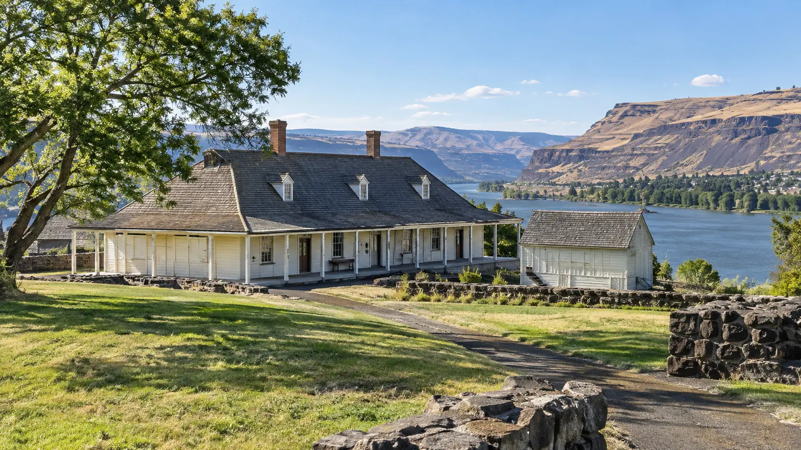
Fort Dalles Museum
Fort Dalles Museum occupies the surviving Surgeon’s Quarters of the former U.S. Army post above downtown. Its collections address military, settler, Oregon Trail, local, and Indigenous material, although visitors should read those stories as connected and often contested rather than as a tidy pioneer victory lap.
The museum stands at 500 West 15th Street, about one mile from the central business district with a meaningful uphill finish. It is better reached by shuttle or vehicle unless everyone in the party is comfortable with grades, heat, and the walk back.
The museum’s current information lists daily 10 a.m. to 5 p.m. hours from April through November, plus limited weather-dependent winter hours. It lists accessible pathways to the main exhibits and accessible restrooms, but historic structures can still have narrower circulation and partial limitations.
Allow 45 to 75 minutes. Guests especially interested in regional history can pair it with the Discovery Center, while everyone else may find that one thoughtfully visited museum beats two sprinted museums and a missed gangway.
The River Story Starts Long Before the Town
The Dalles was not created by a fort, wagon road, or cruise schedule. Indigenous people have lived, traveled, traded, fished, and gathered along this reach for thousands of years, and the fisheries around Wayám, or Celilo Falls, supported one of the continent’s great trading centers.
The National Park Service describes salmon fishing in this reach for more than 9,000 years and notes that the network brought many peoples together. Celilo Village remains a living Native community, while treaty fishing continues along the Columbia.
The Dalles Dam inundated Celilo Falls in 1957, transforming the river, the fishery, transportation, and community life. Calling the dam only an engineering marvel misses its profound cultural and ecological cost.
Lewis and Clark, French Canadian voyageurs, Oregon Trail emigrants, the U.S. Army, railroads, and steamboats belong to later chapters. The best local interpretation places those arrivals inside a much longer story instead of using them as page one.
The Dalles Lock and Dam
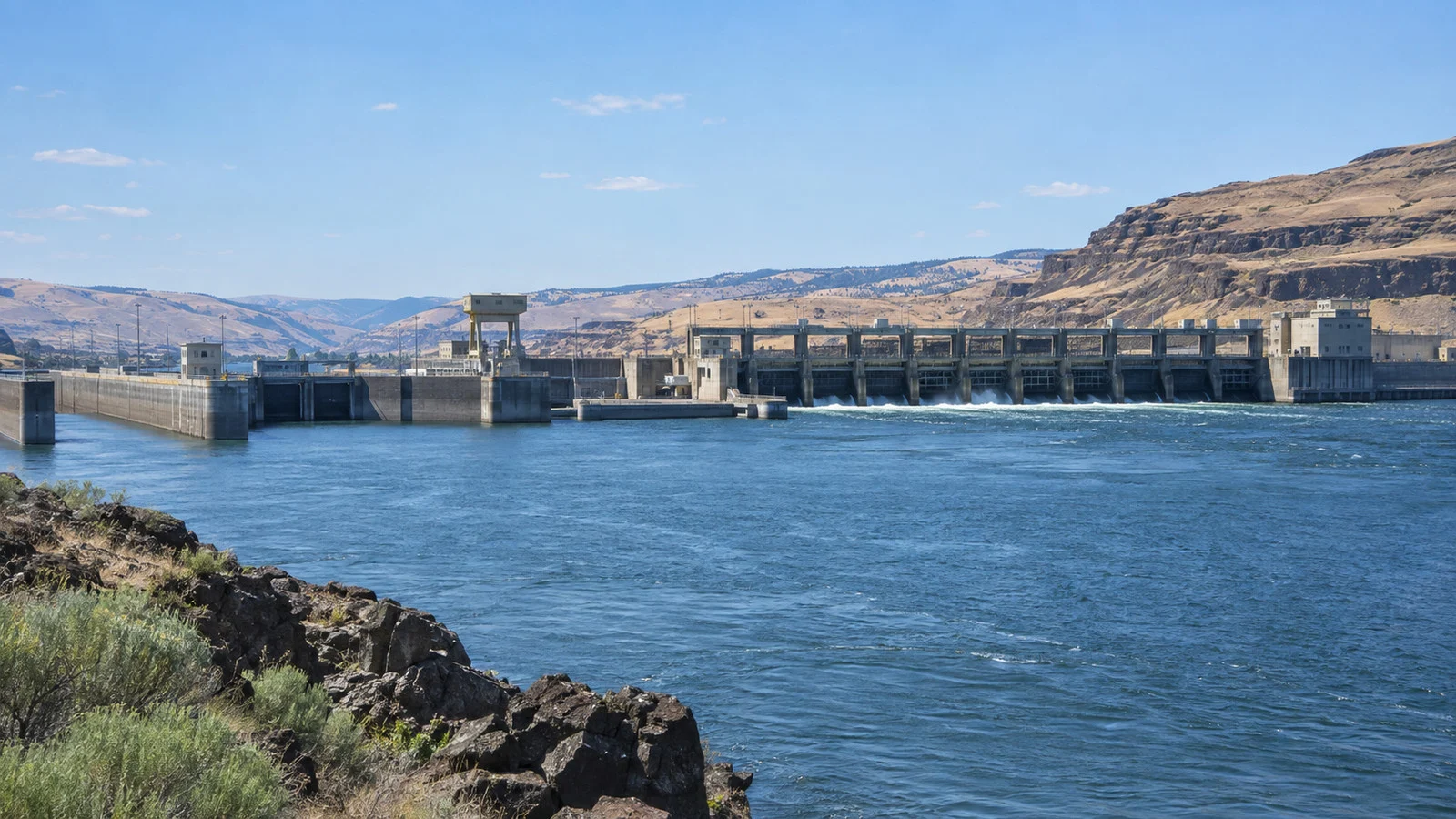
The Dalles Lock and Dam lies just east of town at Columbia River Mile 191. For cruise passengers it is both an attraction and a reminder that the day’s timetable depends on working navigation infrastructure.
The U.S. Army Corps of Engineers lists a seasonal visitor center, views of the powerhouse, fish-passage interpretation, nearby Seufert Park, and the eastern end of the Riverfront Trail. Hours can be seasonal or interrupted, so check the Corps page rather than assuming access because the ship passes the dam.
The dam is a short drive from downtown, typically about 10 minutes as an editorial estimate. Security restrictions and road access mean this is not a place to improvise a walk from the vessel.
A vessel’s lock passage does not run like an attraction with a printed showtime. Commercial priority, traffic, maintenance, water management, and lock operations can create delays that ripple into arrival, excursion, and departure times.
Can You Visit Multnomah Falls from The Dalles?
Yes, but Multnomah Falls is a full coach excursion, not a port-side stroll. It lies roughly 45 road miles west, and a realistic one-way drive is about 50 to 75 minutes as an editorial estimate before traffic, construction, or waterfall-corridor congestion.
A ship tour may instead focus on nearer Gorge viewpoints, wineries, museums, or another waterfall. Never infer a specific waterfall from the phrase “Columbia Gorge scenic drive,” because operators adjust routes to permits, road conditions, timing, and weather.
The Oregon Department of Transportation timed-use permit window for the I-84 Exit 31 lot ended September 7 in 2026. Future dates and access rules may differ, so independent visitors should check the current rule before leaving the ship.
The lower viewing area is the sensible target for many guests, while higher paths add grade, crowds, wet pavement, and stairs or steep sections. Ask exactly how far the excursion walks and whether the coach can accommodate your mobility device.
Gorge geology produces dramatic scenery and dramatic maintenance. Rockfall, wildfire, ice, landslide repair, heavy rain, and road work can close a trail or reroute a coach even when the port call itself continues normally.
Wine, Fruit, and Active Excursions
The dry eastern Gorge is orchard and wine country, with cherries, pears, grapes, and wheat sharing the wider landscape. Current cruise programs may offer wine tasting, scenic drives, paddling, or other outdoor choices, but exact venues and inclusions vary by sailing.
Wine tours require a vehicle and a sober plan, while orchard access may be seasonal or event-based. Do not arrive at a working farm unannounced because a map labels it photogenic.
Kayaking on the Gorge can be memorable, but wind is not decorative here. An operator may cancel, move, or shorten a paddle because of gusts, current, water temperature, visibility, or participant ability while keeping the rest of the port day intact.
Hikers should expect exposed terrain east of the Cascades, stronger sun, dry grass, uneven basalt, ticks, and occasionally rattlesnakes. Stay on the designated trail, carry water, and do not approach cliff edges for a photograph the ship’s lounge windows could have provided safely.
Accessibility at The Dalles River Cruise Port
The decisive accessibility feature is the gangway, not the city map. Water level, dock face, vessel design, slope, weather, and whether another vessel blocks the direct path can change the effort required to get ashore.
Ask the cruise line before travel whether crew can support your specific wheelchair, scooter, walker, or transfer needs at The Dalles. Then ask again onboard after the day’s berth is confirmed, because general vessel accessibility does not guarantee every temporary shore connection.
Downtown sidewalks and the official underpass connection make the commercial dock more practical than many industrial landings, but curb cuts, rail crossings, construction, and grades still vary. The marina adds distance and may make a shuttle essential.
The Discovery Center is the clearest published accessible attraction, with wheelchair-accessible exhibitions and outdoor trails. Fort Dalles Museum identifies accessible paths to its main exhibits, while historic buildings and outdoor surfaces warrant a direct call for detailed needs.
At viewpoints, “accessible” may describe the primary overlook and not every trail, terrace, restroom, or photo angle. Our broader river cruise accessibility guide explains the questions worth asking before a vessel or shore operator treats “a few steps” as a complete measurement system.
Weather, Wind, Smoke, and What to Wear
The Dalles sits at the Gorge’s drier eastern end, so it can be sunnier and much hotter than Portland on the same itinerary. Spring and fall can feel crisp, while summer afternoons may bring strong sun, heat, gusty wind, and wildfire smoke.
Wear layers that can handle a cool deck and a warm downtown, plus shoes with grip for the gangway. A hat needs a chin strap or a very relaxed attitude about becoming Washington’s property.
Check the National Weather Service forecast and Oregon air-quality guidance before choosing a long outdoor excursion. Travelers with heart or lung conditions should take smoke advisories seriously and keep medication accessible rather than packed in a coach’s luggage compartment.
In winter or early spring, cold rain, frost, ice, and short daylight can replace the heat problem. Gorge conditions change quickly enough that the view outside the cabin is more useful than the outfit planned three months earlier.
Safety and Independent Exploring
Use the designated downtown connection and obey rail, highway, dock, and crew instructions. Freight trains are fast, quiet until they are not, and never part of a sensible shortcut.
Do not swim from a commercial dock or step onto an unsecured shoreline. River current, cold water, underwater hazards, vessel movement, and dam operations make the Columbia more powerful than its broad surface sometimes appears.
Carry water, sun protection, the ship’s contact number, and the all-aboard time. If heading beyond downtown, arrange the return before leaving and allow a generous buffer for I-84 traffic or Gorge road disruptions.
Call 911 for an emergency. For a missed shuttle, changed pickup, or mobility problem that is not an emergency, call the vessel or cruise line rather than relying on a social-media location pin.
A Practical Port-Day Plan
With two to three free hours, stay downtown for murals, architecture, coffee, shops, and one compact museum if hours cooperate. This plan protects against a short call and lets the town feel like a place rather than an obstacle between excursions.
With four to five hours, use the ship loop or an arranged ride to pair the Columbia Gorge Discovery Center with downtown. Add Fort Dalles only if your interest and shuttle timing support it.
With a full day, choose one major coach experience such as the waterfall corridor, Gorge viewpoints, or a curated wine route. Trying to combine Multnomah Falls, two museums, a tasting, and an earnest mural survey is how a vacation becomes a logistics internship.
Use the operator’s stated return margin and stay near the dock toward the end of the call. Lock delays may change departure, but passengers should never assume that a working river has granted them extra shopping time.
Final Verdict
The Dalles is a strong Columbia River call because the landing, town, landscape, and history all explain one another. Downtown is manageable from the usual commercial dock, while the Discovery Center and Gorge excursions add real depth without pretending every attraction is walkable.
The winning strategy is simple: verify which dock you have, choose either a focused town day or one substantial excursion, and leave room for the river to edit the schedule. For more river itineraries, browse our river cruise port guides.
How this guide was researched: No firsthand visit is claimed; current itinerary, dock, marina, museum, dam, and road-access details were checked against American Cruise Lines, the City of The Dalles, Port of The Dalles, Columbia Gorge Discovery Center, the U.S. Army Corps of Engineers, and Oregon transportation sources. Logistics and time-sensitive details were reviewed September 12, 2026; see our Editorial Policy.