Santa Cruz de la Palma Cruise Port: A Cruiser’s Guide to La Isla Bonita
Santa Cruz de la Palma is one of the Canary Islands’ most rewarding cruise arrivals because the capital and the island offer two very different days. You can stay close for painted balconies, historic streets, cafes, and Atlantic views, or head inland for forests, volcanic terrain, and high mountain scenery.
The city is compact, but the rest of La Palma is steep and road travel is slower than a small-island map suggests. A satisfying call begins by choosing one clear priority and leaving enough time for clouds, traffic, mountain bends, and the gangway.
My quick take
For a short or uncertain call, I would keep the day in Santa Cruz and enjoy the old town at an easy pace. For a long call with good weather, a cruise excursion to the caldera viewpoints, volcanic south, or Roque de los Muchachos can reveal why La Palma is called La Isla Bonita.
Do not try to combine the city, a major mountain destination, and a cross-island stop unless the cruise line has built that sequence. The roads and elevation changes make a simple-looking itinerary much more demanding in real life.
Quick Facts
- Port character: An Atlantic island capital with a compact historic center close to the harbor area
- Best local walk: Avenida Marítima, the traditional balconies, Calle O’Daly, Plaza de España, and La Alameda
- Top island choices: Caldera de Taburiente scenery, Roque de los Muchachos, volcanic landscapes, and forest viewpoints
- Transport: Walking works in town, while taxis, buses, rental cars, or cruise excursions are needed for most island sights
- Main caution: Mountain roads, clouds, wind, trail closures, and cruise timing can change the day quickly
- Mobility: The seafront is the easiest area, while old streets, hills, curbs, and excursion terrain require more care
- Best planning move: Choose either a relaxed capital walk or one well-timed island excursion, then protect the return
Where cruise ships dock
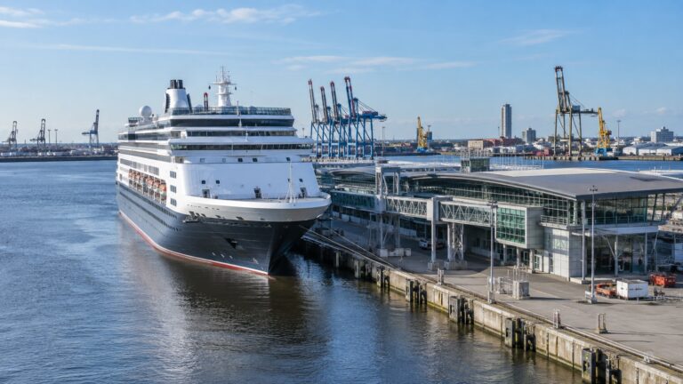
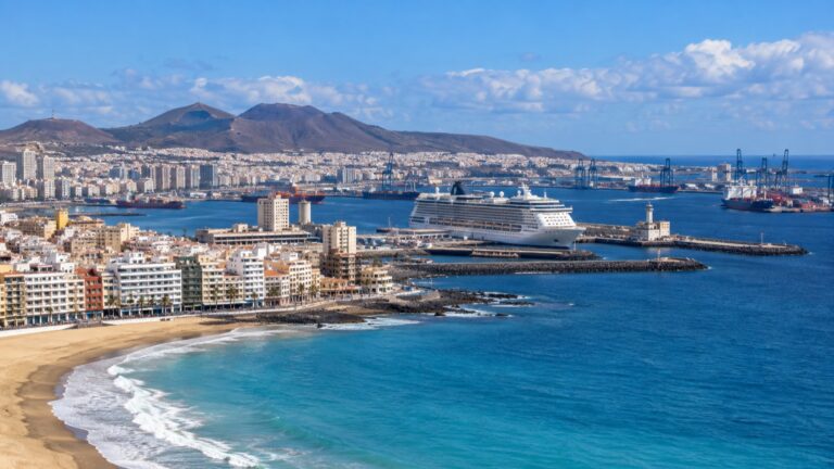
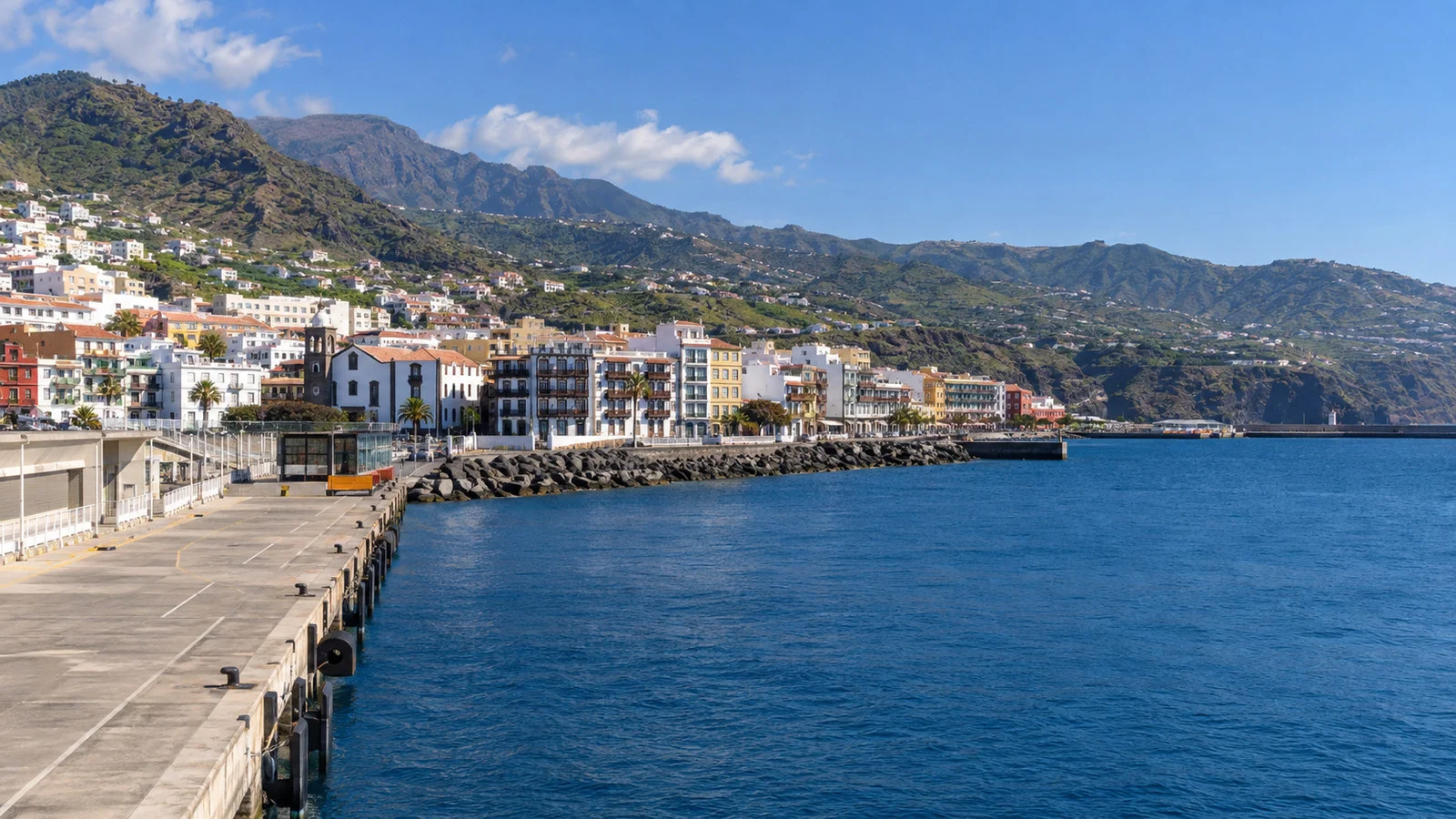
Cruise ships use the port of Santa Cruz de la Palma on the island’s eastern side. The center is close in geographic terms, but your exact walking route depends on the assigned berth, port security, and any shuttle operating that day.
Follow the marked pedestrian path and staff directions rather than taking the shortest line you see on a map. Commercial port traffic, gates, and temporary operations can change how passengers leave the harbor.
Before walking out, photograph the berth name and note the final shuttle or all aboard time. Save the ship’s contact number in a screenshot so you can show it to a driver even if mobile data becomes unreliable.
A port map cannot tell you the current gangway slope. Travelers using a wheelchair, scooter, or cane should ask the ship about the actual setup after arrival, since tide and vessel position can alter access.
A first walk through Santa Cruz
Begin along Avenida Marítima, where the ocean stays in view and the city’s famous wooden balconies create its most recognizable facade. The route is easy to understand and gives you a gentle introduction before turning into the older streets.
Calle O’Daly and Calle Anselmo Pérez de Brito form the traditional Calle Real axis through the historic center. Shops, civic buildings, small plazas, and restored houses make this the natural backbone of an independent visit.
Continue to Plaza de España for the town hall, the Church of El Salvador, and one of the capital’s strongest architectural groupings. Religious access can change around services, so treat an interior visit as a welcome bonus rather than a guaranteed stop.
From there, wander toward La Alameda and the Barco de la Virgen, a ship-shaped landmark connected with the city’s maritime identity and major festival traditions. The walk also shows how quickly the flat seafront gives way to streets climbing the hillside.
The Santa Cruz de la Palma municipal tourism pages provide official routes, cultural information, and current local contacts. Check them before your call if a particular museum, church, or event matters to you.
The seafront balconies
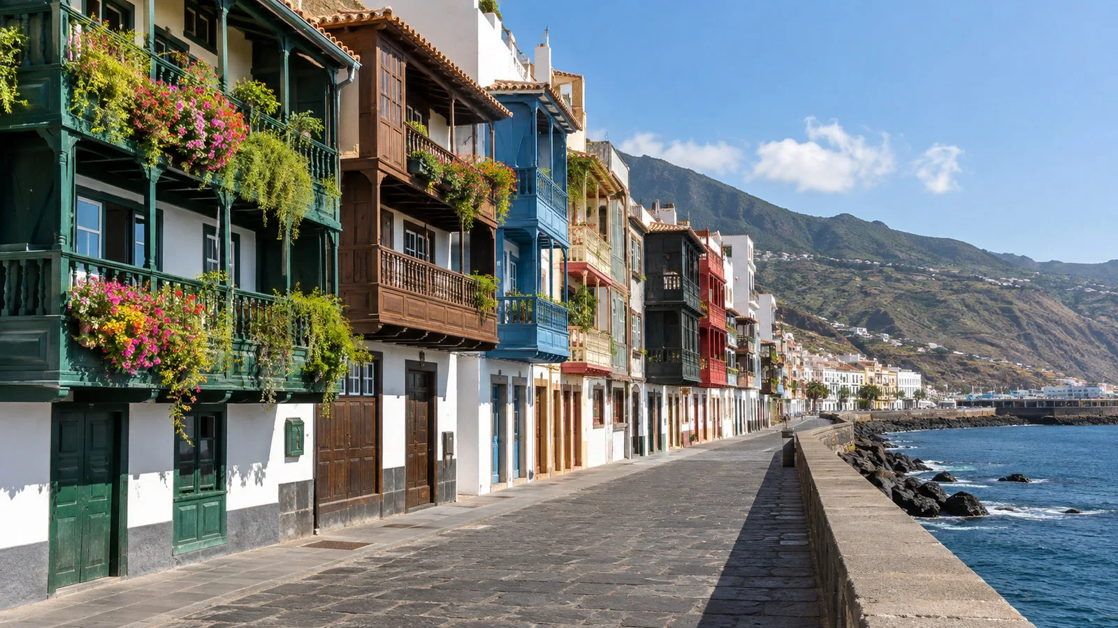
The rows of traditional balconies facing Avenida Marítima are the city’s signature sight. Their carved wood, color, plants, and close spacing tell a domestic story that feels more intimate than a monumental landmark.
Photograph them from the seafront side, but remember that these are part of real buildings rather than an outdoor museum. Keep entrances clear and avoid pointing a camera directly into private rooms.
Morning light, cloud cover, and traffic all change the best angle. A short pause across the road often produces a better view than rushing directly beneath them.
The avenue is among the easiest areas for travelers who prefer fewer slopes, although crossings, curbs, construction, and port access still need attention. If the old town becomes tiring, return to the waterfront instead of forcing a steeper loop.
Plaza de España and Calle Real
Plaza de España rewards a slower look because its church, civic architecture, fountain, and surrounding facades read as one ensemble. It also provides a useful orientation point in the middle of the historic walk.
Calle Real is the place to browse local shops, stop for coffee, and notice the mix of Renaissance, Baroque, and later island architecture. The best experience is not a march between pins, but a sequence of doorways, patios, signs, and shaded corners.
Opening hours in the Canary Islands can include midday pauses or change by season. Shop early if a purchase matters, and never leave a long lunch until the final hour before sailing.
Santa Cruz is a living capital, so delivery traffic and local errands continue around visitors. Walk predictably on narrow sections and give residents room to pass.
Museums and indoor options
The Museo Insular offers a broader look at La Palma’s art, natural history, and culture inside a former Franciscan complex. It is a useful choice when rain reaches the east coast or when you want context beyond the city’s facades.
The Naval Museum at the Barco de la Virgen connects the island with seafaring, emigration, and Atlantic trade. Confirm its current opening hours before building the route around an interior visit.
Casa Salazar and other cultural spaces may host exhibitions or events, but schedules can change. Use the city agenda or official venue information rather than relying on a review written for another season.
Choose one indoor stop and keep the rest of the visit flexible. The capital’s greatest strength is the easy relationship between architecture, street life, and the ocean.
The city beach
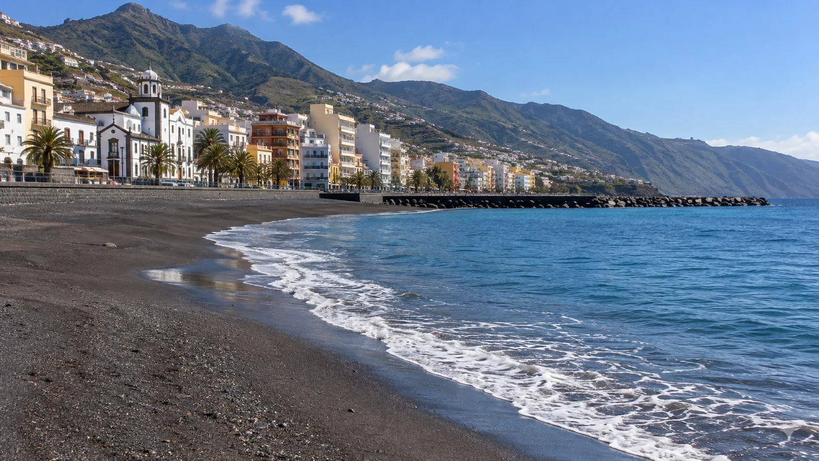
Santa Cruz has a dark-sand urban beach beside the seafront, making a brief Atlantic pause possible without crossing the island. It can work well for travelers who want a simple shore day instead of a mountain excursion.
Check sea conditions, flags, and lifeguard information before entering the water. Atlantic swell and currents deserve respect even when the beach looks calm from the promenade.
A beach visit is easiest when you can return to the ship to change, but port rules and walking distance vary. Keep valuables minimal and never let swimming erase the time needed for the port-security route.
The beach also works as a scenic break without swimming. A walk on the sand followed by a cafe can be more relaxing than adding another attraction.
Caldera de Taburiente National Park
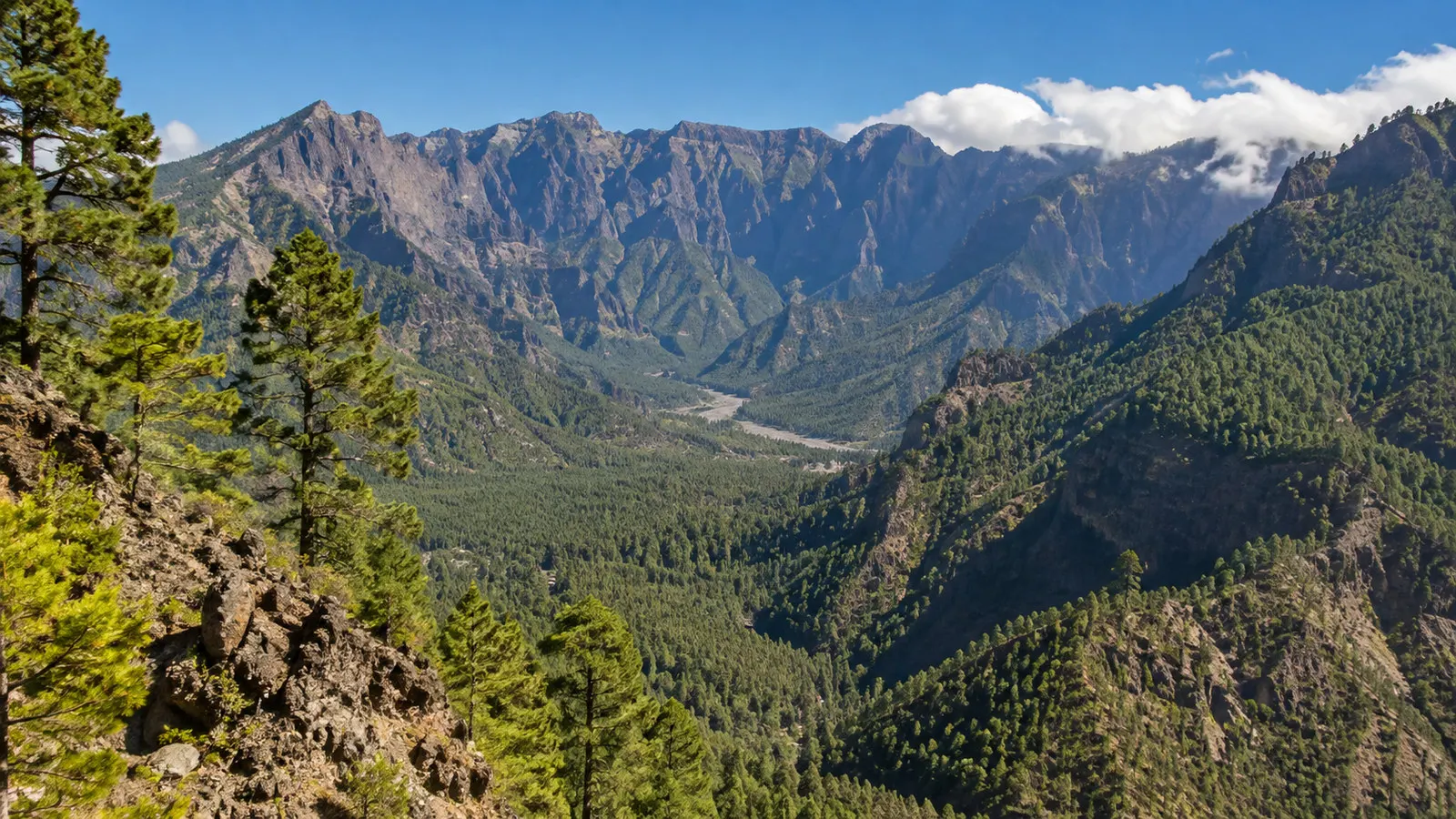
Caldera de Taburiente is the island’s defining natural landscape, but it is not one single roadside stop. Spain’s official national-parks information describes an enormous eight-kilometer cirque with elevation differences reaching almost 2,000 meters, shaped by volcanic activity, landslides, water, and erosion.
The official Caldera de Taburiente page is the right starting point for understanding the park, while current island alerts should guide any actual route. Trails, viewpoints, access roads, and parking arrangements can change because of weather, fire risk, maintenance, or landslides.
A cruise excursion may focus on viewpoints and a visitor center rather than hiking into the caldera. Read the description carefully so you know whether the day includes a forest walk, uneven ground, stairs, or mostly scenic coach stops.
Independent hikers need more planning than a port call usually allows. Distance, elevation, trail direction, taxi logistics, water, and turnaround time all matter, and a beautiful forecast at the harbor does not guarantee safe conditions inland.
If clouds hide a major viewpoint, do not pressure a driver to wait indefinitely. Move to the backup stop and preserve the return margin.
Roque de los Muchachos
Roque de los Muchachos offers the island’s most dramatic high-elevation outing, with views over the caldera rim when conditions cooperate. The road is winding, the weather can change rapidly, and the summit environment can feel cold even when the port is warm.
The Instituto de Astrofísica de Canarias places the observatory at 2,396 meters on the rim of Caldera de Taburiente National Park. It hosts a major international collection of telescopes, but scientific facilities are workplaces and public access is controlled.
Seeing observatory domes from the road or viewpoint does not guarantee entry to a telescope. Any facility visit should be booked through an authorized program and confirmed for the specific date.
Altitude can affect breathing, balance, and stamina. Travelers with heart, lung, or mobility concerns should discuss the excursion with an appropriate medical professional and the tour operator before committing.
Bring a warm layer, sun protection, water, and sturdy shoes. The change from sea level to the high rim is part of the experience, but it also makes this a poor choice for anyone seeking an easy half-day.
Volcanic landscapes in the south
The southern part of La Palma offers a different volcanic story, with dark lava, cones, pine, salt, and Atlantic viewpoints. Excursions may include Fuencaliente, interpretation sites, or viewpoints connected with historic and recent eruptions.
The 2021 eruption reshaped parts of the island, and access around affected areas must follow current official routes and safety rules. Do not enter closed ground or stop on a narrow road simply because other visitors are taking photographs.
A guided excursion adds value by explaining what you are seeing and keeping the route legal. Check whether the itinerary involves ash, loose gravel, stairs, heat, or exposed wind.
This is usually a better choice than Roque de los Muchachos when high cloud covers the summit, but weather varies across the island. Let current local conditions decide rather than forcing the original plan.
Forests and viewpoints
La Palma’s green reputation comes from its varied elevation, trade winds, ravines, and forests as much as its volcanic peaks. Official tourism information promotes forest and nature routes among the best options available from the cruise port.
Los Tilos, Cubo de la Galga, and other named areas can sound close on an island map, yet road access and trail status require current checks. Select a route that fits the ship’s hours and your actual walking ability.
A viewpoint tour can deliver much of the scenery with less physical demand than a hike. Ask how far the coach parks from each overlook and whether fog could lead to a substituted stop.
Trail shoes are preferable to smooth-soled city footwear when an excursion mentions forest walking. Bring water and a layer because shade and elevation can lower the apparent temperature.
Getting around the island
La Palma’s official tourism site lists taxis, intercity buses, rental cars, excursions, and guided visits as ways to explore. Its transport guide links to the island bus operator and notes taxi service across the municipalities.
Buses can work for simple routes, but they are less forgiving when a cruise passenger needs to connect between a trailhead, viewpoint, and fixed departure. Check current timetables in both directions before leaving the port.
A taxi is useful for a custom island drive if you agree on the route, duration, price basis, waiting time, and return point. Keep the driver’s number and make sure the plan includes traffic and weather margin.
A rental car offers flexibility but adds pickup time, parking, mountain driving, and navigation. Reserve in advance, choose a route that avoids overreach, and return the vehicle well before the final boarding window.
The cruise line excursion is the simplest option for high mountains or dispersed natural sights. It may cost more, but coordinated transport and a protected return can be worth the difference.
Accessibility and physical demand
The port-to-center outing is more manageable than many island excursions, but it is not barrier-free. Gangways, curbs, uneven historic paving, occasional steps, and streets rising behind the seafront can all affect the route.
Travelers with limited mobility can focus on Avenida Marítima, lower Calle Real, and an accessible cafe stop. Ask the local tourism office or cruise team about current construction and step-free alternatives.
For coach excursions, confirm the number of steps, the longest walking segment, the terrain at viewpoints, and whether the bus has a lift. A description such as panoramic does not guarantee minimal walking.
Roque de los Muchachos adds altitude, while volcanic and forest routes add loose or uneven surfaces. Choose the option that matches your body on the day, not the most dramatic photograph in the brochure.
Weather and schedule changes
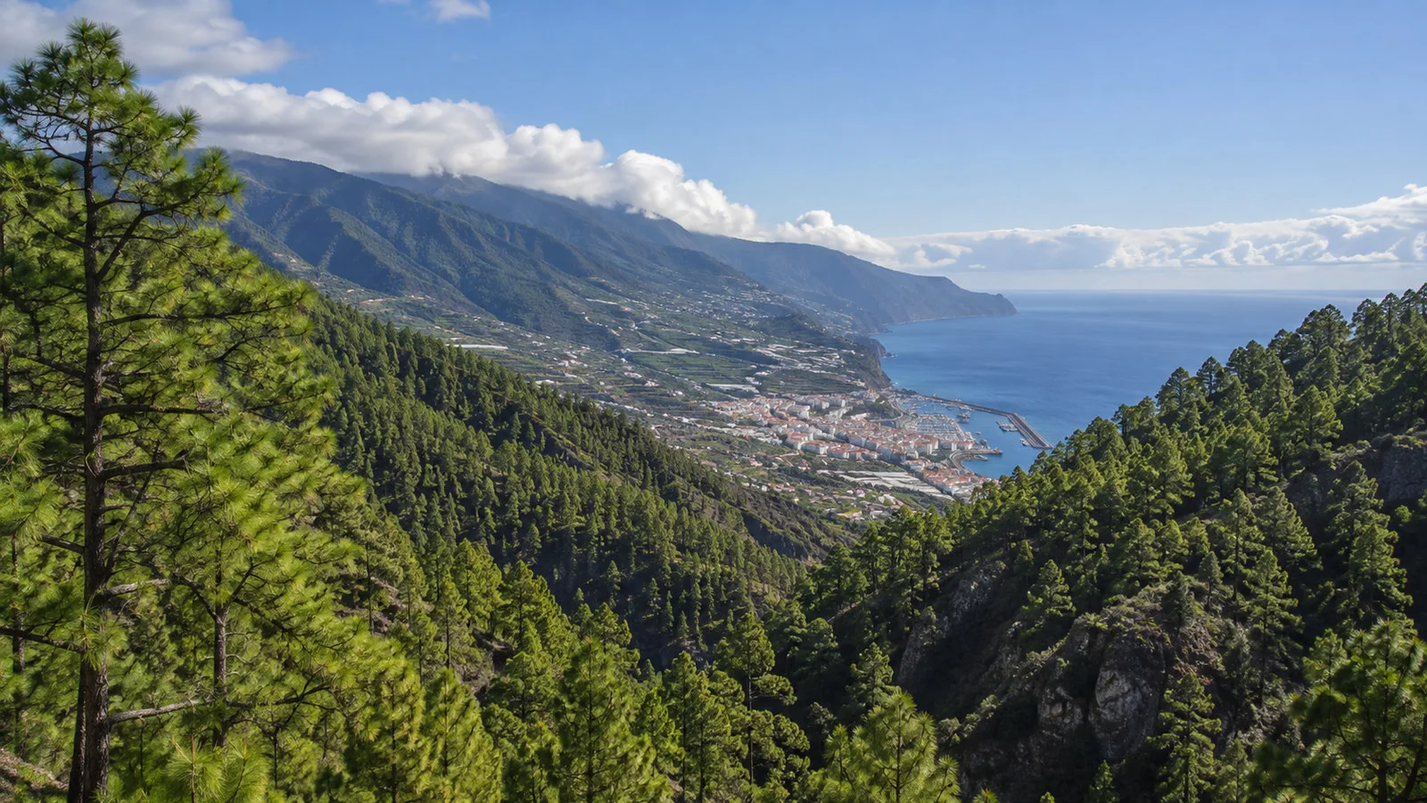
Santa Cruz can be mild while the mountains are cold, windy, cloudy, or closed. Pack for layers and check conditions at the destination, not just the harbor forecast.
Trade-wind clouds often gather on particular slopes, and visibility can change within the same excursion. A flexible guide may substitute a lower viewpoint or different side of the island.
Cruise schedules can move because of wind, swell, or operational decisions. Recheck the morning program and simplify immediately if arrival is delayed.
Sun exposure remains strong even when the air feels cool. Use sunscreen, carry water, and protect yourself at high viewpoints where shade is limited.
A simple short-call plan
Walk the seafront balconies, turn into Calle Real, pause at Plaza de España, and continue toward La Alameda if time allows. Add one museum, the city beach, or a relaxed meal according to weather and opening hours.
Set a phone alarm for the moment you need to start returning. Include time for the port gate, security, the gangway, and any shuttle wait.
If a street climbs more steeply than expected, stay lower and enjoy the waterfront. The capital offers enough detail without turning the call into an endurance test.
If you have a longer day
Choose one island excursion and let it anchor the schedule. The caldera, high observatory area, volcanic south, and forest routes are each substantial enough to stand alone.
Return to Santa Cruz with enough time for a short old-town walk rather than scheduling the city first and risking the distant excursion later. The ship is easiest to protect when the farthest point comes earlier.
Keep a backup plan in the capital because mountain weather can cancel the headline route. A museum, cafe, shopping, and balcony walk still produce a satisfying day.
Quick answers
Can I walk from the cruise port?
Often yes, but the exact route depends on the berth and port controls. Follow the ship’s current directions and use any shuttle if walking through the operational area is restricted.
What is the best thing to see in town?
The Avenida Marítima balconies and the Calle Real route through Plaza de España form the strongest first visit. They combine the island’s architecture, civic history, and everyday street life.
Can I visit the observatory independently?
You can reach the high area by road when access and weather allow, but telescope interiors require authorized arrangements. Never assume a public visit is available without a confirmed booking.
Is Caldera de Taburiente an easy excursion?
Viewpoint tours can be manageable, while serious hiking is physically and logistically demanding. Read the exact itinerary and check current park alerts before choosing.
Should I rent a car?
Only if you are comfortable with steep, winding island roads and can reserve enough return margin. A taxi or cruise excursion is easier for travelers who want to watch the scenery instead of driving.
The last word
Santa Cruz de la Palma gives you a rare choice between a graceful, low-stress capital day and a dramatic island adventure. Both are worthwhile, but combining too much weakens the experience.
Choose one clear focus, check live conditions, and protect the return to the ship. That approach lets La Isla Bonita feel beautiful rather than rushed.
How this guide was researched: Unless a first-hand visit is explicitly identified above, this guide uses official municipal tourism, national park, transportation, port, and observatory sources where available. Logistics and time-sensitive details were reviewed on September 12, 2026; see our Editorial Policy.