Îles-de-la-Madeleine Cruise Port Guide: Cap-aux-Meules & Cliffs
Îles-de-la-Madeleine looks delicate from the ship because it is. Long sandbars, grassy dunes, red sandstone cliffs, fishing harbors, and low villages stretch across the Gulf of Saint Lawrence in a shape that makes every mile feel cinematic.
This is not a port where I would try to collect the whole archipelago in one rushed loop. A good day starts by confirming how you will land at Cap-aux-Meules, choosing one geographic direction, and keeping enough slack for wind, fog, island traffic, and the return to the ship.
Quick Facts
- Port: Cap-aux-Meules, Québec, Canada
- Arrival: Alongside berth or tender landing, depending on the ship and operating conditions
- Best first check: The ship’s daily program for landing point, last tender, shuttle, and all aboard
- Currency: Canadian dollar
- Language: French is dominant, with English also spoken in parts of the islands
- Time zone: Atlantic Time, normally UTC-4 in winter and UTC-3 during daylight saving time
- Driving: Right-hand side
- Signature choices: La Grave, red-cliff scenery, fishing villages, beaches, local food, and island viewpoints
- Main risks: Tender cancellation, fast weather shifts, cliff erosion, strong currents, and overambitious routing
- Independent-day rule: Choose the central area, the southern islands, or an eastern route rather than trying to see everything
Where cruise passengers arrive
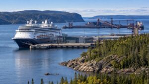
Cruise calls are centered on the harbor at Cap-aux-Meules, the commercial heart of the archipelago. Some ships may berth while others use tenders, so do not build your day around a generic port description or an old review.
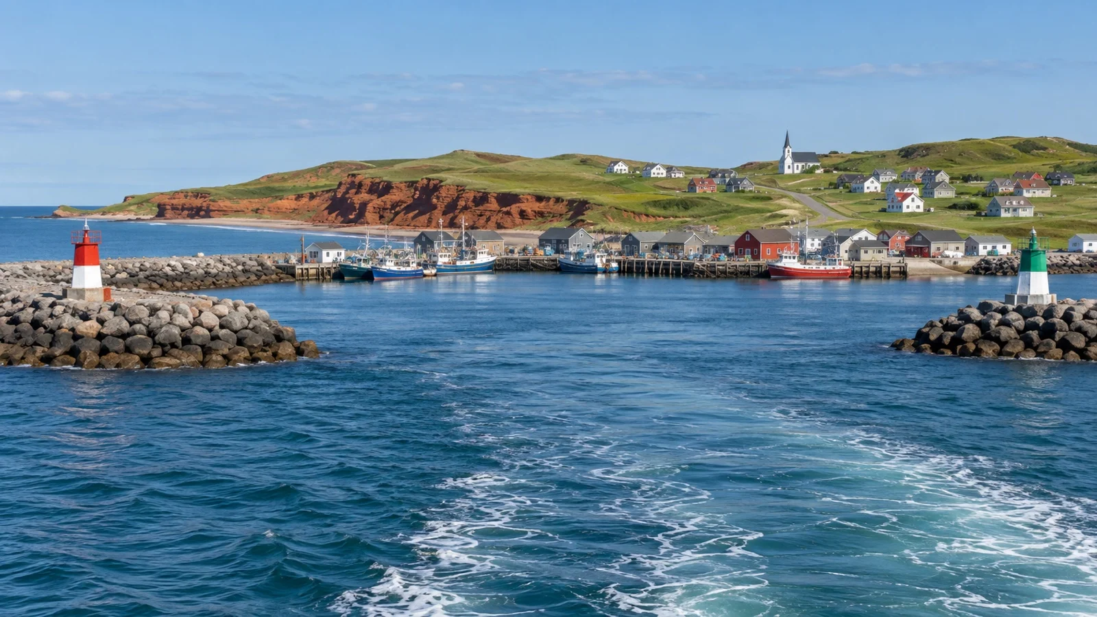
Your ship’s daily program is the operational source that matters on the morning of the call. It should confirm whether you walk ashore or ride a tender, where local tours meet, whether a shuttle runs, and when the final return service leaves.
Cap-aux-Meules is also the terminal for CTMA’s ferry connection with Souris on Prince Edward Island. Ferry activity helps explain why this is a working harbor first, not a decorative cruise village arranged around a pier.
Stay inside marked passenger routes and follow staff instructions around vehicles, ramps, and restricted areas. If your ship uses tenders, assume the gangway and small-boat transfer can be the most physically demanding part of the day.
Why this call can change quickly
The Gulf of Saint Lawrence can bring wind, swell, fog, and low cloud with little respect for a sightseeing plan. A captain may delay tendering, suspend it, change the landing procedure, or cancel the call when safe operations are no longer possible.
Treat every tender call here as conditional until you are actually ashore. Keep a compact Cap-aux-Meules backup for any day when the usable window becomes shorter than expected.
A later start should trigger a smaller route, not faster driving and thinner margins. The islands reward patience, while missed return transport is an expensive way to discover how far the next port really is.
Understand the island geography before choosing a route
Route 199 is the main road that links much of the archipelago, but the map hides how quickly viewpoint stops, village streets, roadwork, and photo pauses consume time. Driving from one end toward the other can turn a port day into a windshield tour with no room for weather or delay.
The central island area includes Cap-aux-Meules, Fatima, and L’Étang-du-Nord. Havre-aux-Maisons lies to the east, Havre-Aubert and La Grave lie to the south, and Grosse-Île with Grande-Entrée pull you farther north and east.
Choose a route by the experience you want rather than by the number of place names you can fit. I would rather have one unhurried cliff viewpoint, a village walk, and a memorable lunch than six hurried stops and a tense return.
Option one: a relaxed central-island day
The central area is the safest independent choice when the call is short, the tender begins late, or you simply want fewer moving parts. Cap-aux-Meules gives you practical services, local shopping, food, and a useful base close to the landing.
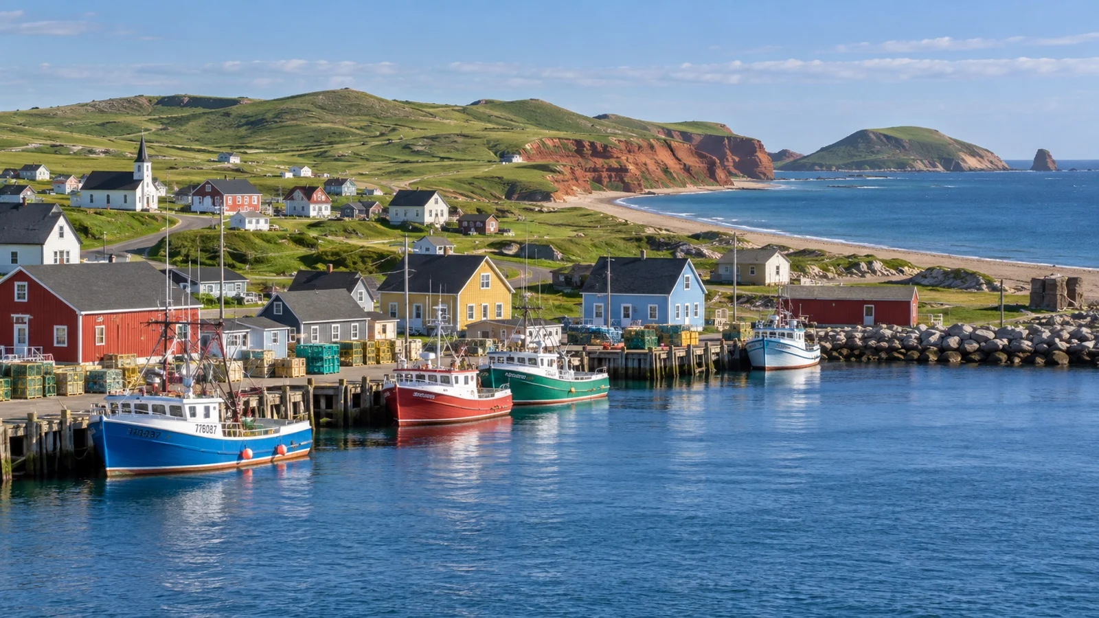
L’Étang-du-Nord adds a fishing-harbor atmosphere and coastal scenery without committing you to the far ends of the chain. Exact opening hours vary by season, so a waterfront stroll and landscape plan is stronger than a day dependent on one shop or attraction.
Butte du Vent is known for broad island views, but exposed conditions can make any high point feel colder and stronger than the harbor. Confirm local access, wear secure footwear, and skip exposed walking if wind or visibility makes it uncomfortable.
Fatima can fit naturally into a central circuit, especially with a taxi or private guide who understands the day’s conditions. Ask the driver to prioritize two or three stops and keep the final hour close to Cap-aux-Meules.
A central plan without a vehicle
If shuttle information or local transport does not support a wider outing, do not force one. A harbor-area walk, local meal, and time to browse island products can still make an honest and enjoyable call.
Sidewalk continuity, gradients, and road shoulders can vary once you move beyond the most developed streets. Ask the welcome team which walking route is comfortable that day instead of assuming every nearby pin on a map has a pedestrian-friendly connection.
Option two: La Grave and Havre-Aubert
La Grave on Havre-Aubert is the classic southern excursion and one of the strongest choices for history, food, craft, and a sense of the islands’ maritime identity. Its historic site gathers traditional buildings and visitor businesses along a narrow strip beside the water.
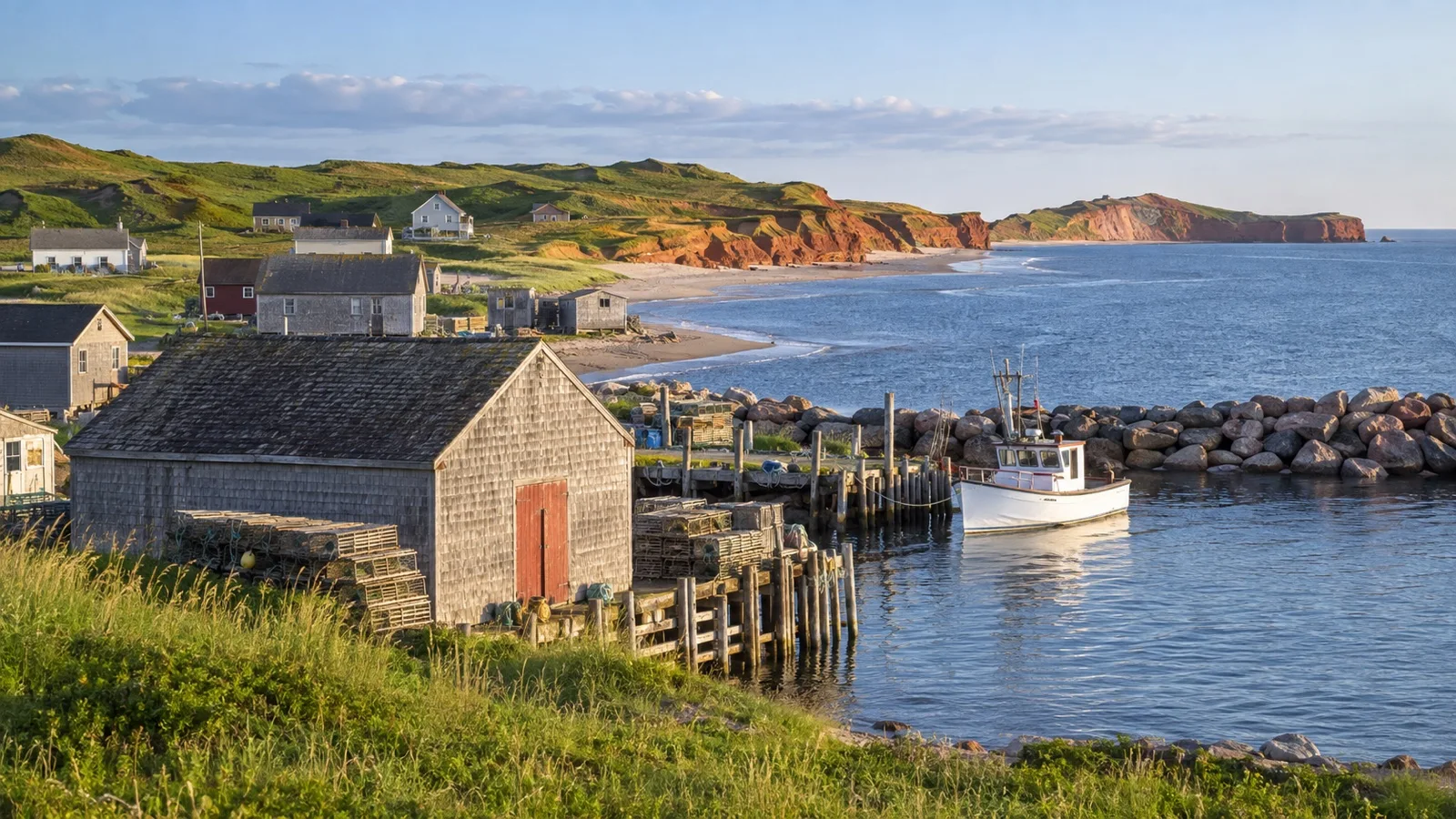
The area is associated with Musée de la Mer and a changing mix of workshops, galleries, restaurants, and seasonal activities. Check official opening information for your exact date because a beautiful historic setting does not guarantee that every door is open during a shoulder-season call.
Havre-Aubert deserves time beyond a quick photograph, which is why I would make La Grave the anchor of the day rather than one stop in an island-wide race. A prearranged tour or taxi removes much of the uncertainty around the outbound and return legs.
Tell your driver the ship’s all-aboard time before leaving Cap-aux-Meules. Agree on a pickup point and a conservative departure time in case weather, construction, or a busy attraction slows the route.
Option three: Havre-aux-Maisons and the eastern islands
Havre-aux-Maisons works well for travelers drawn to rolling landscapes, coastal views, local producers, and a less urban rhythm. It can be combined with one carefully selected stop farther east, but the route grows less forgiving as you add distance.
Grande-Entrée and Grosse-Île introduce fishing heritage, broad beaches, and communities with their own character. They are not casual add-ons to La Grave on an ordinary port day, so treat the east as a separate direction.
English has a visible historical presence in parts of Grosse-Île and around Old Harry, while French remains the main language across the archipelago. Basic courtesy in French is appreciated, and tourism staff commonly help visitors navigate language differences.
Before committing to the eastern route, confirm the actual drive time with a local operator and add a substantial buffer. A map estimate cannot account for a photo stop that becomes a long walk or a marine squall that changes the pace of the day.
The red cliffs are beautiful and unstable
The islands’ red sandstone cliffs are shaped by water, wind, freezing, and thawing, which also means they erode and can fail without warning. Never stand directly below an overhang, climb a cliff face, or approach an edge simply because other visitors have done it.
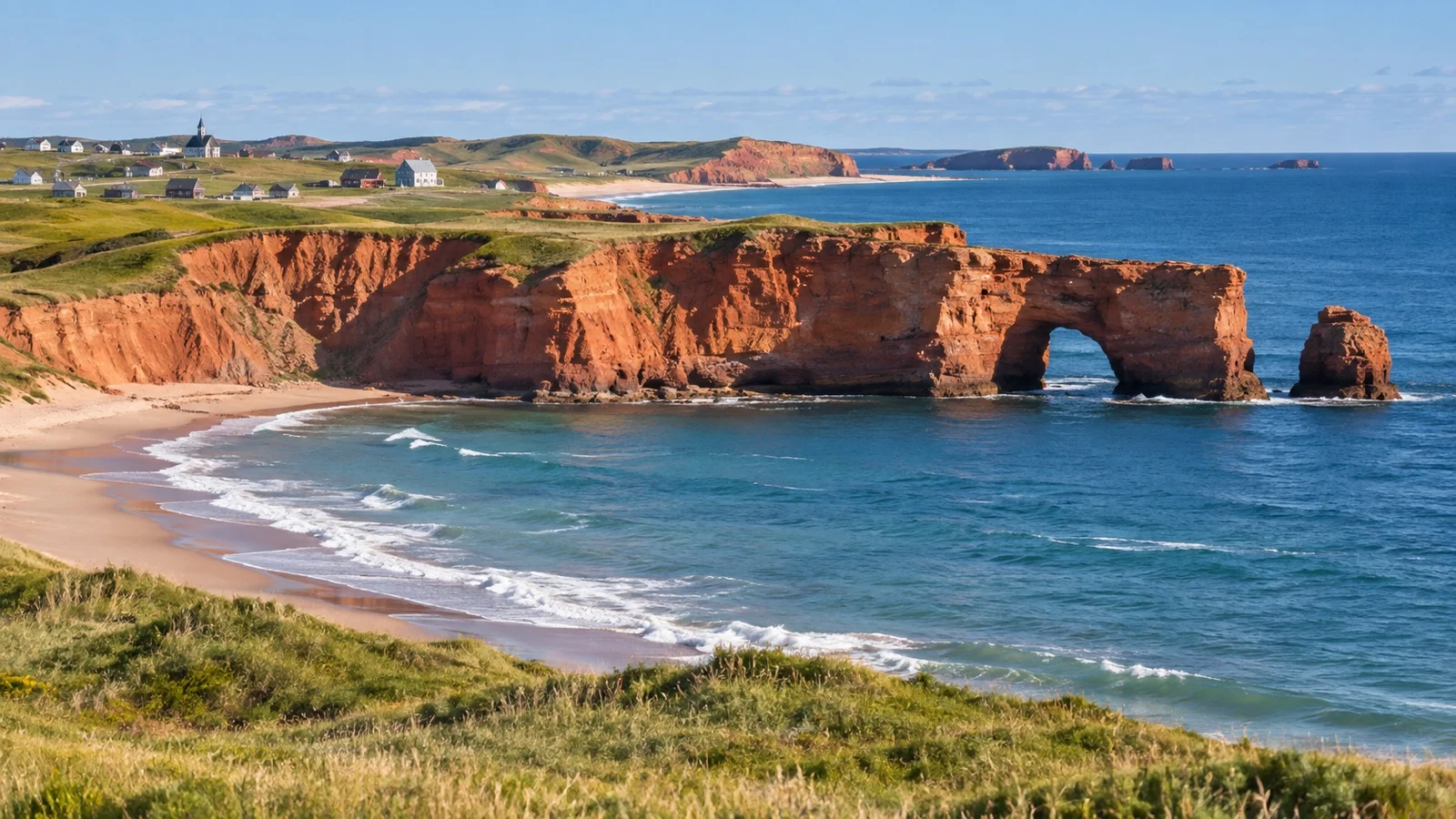
Stay well back from cliff rims because the ground beneath grass can be undercut farther than it appears. At the base, keep away from loose rock and do not linger where falling material could reach you.
Use established paths, viewing areas, stairways, and beach access points. A dramatic photograph is not worth damaging fragile vegetation or testing an edge that local erosion has already weakened.
Wind adds another hazard by affecting balance and pushing sand or spray into your eyes. If the day is gusty, lower viewpoints and village scenes can be both safer and more enjoyable than exposed headlands.
Beach and sea safety
The official island tourism guidance warns that wind, currents, tides, and sea conditions can change rapidly. Strong currents may challenge experienced swimmers, so never treat a calm-looking beach as proof that the water is safe.
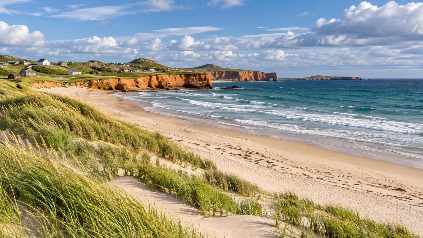
Swim only where and when conditions are suitable, stay close to shore, and use lifeguarded areas when available. Never swim alone, and ask local staff about the safest conditions instead of relying on an app or a distant visual check.
The water can feel cold even on a bright day, and wind chill matters after you get wet. For a cruise visit, a beach walk is often the wiser default unless swimming is clearly appropriate and you have enough time to dry, change, and return comfortably.
Anyone taking part in kayaking or another water activity should use a reputable operator, wear the supplied life jacket, and follow the guide’s route decision. Independent marine outings add weather, equipment, and return-timing risks that are difficult to control within a ship’s fixed schedule.
Getting around from Cap-aux-Meules
A ship excursion or locally operated island tour is the simplest way to cover distance while protecting the return. The key advantage is not just commentary, but a route designed around a finite cruise call.
Taxis and private drivers can create an excellent custom day when reserved in advance. Confirm whether the fare is hourly or fixed, which stops are included, how waiting time works, and whether the driver will remain with you.
Public transport in the region is coordinated through RÉGÎM, but schedules and reservation requirements may not align with a cruise arrival. Verify the current route, booking process, boarding point, and return trip directly before depending on it.
Rental cars offer flexibility, yet inventory can be limited and pickup formalities take time. Reserve ahead, confirm the collection location, photograph the vehicle, and make sure your license and the rental company’s requirements are in order.
Cycling is appealing in photographs, but distance, wind, narrow shoulders, and changing weather can make it a demanding port-day strategy. Rent from a professional operator, wear a helmet, ask about current route conditions, and choose a short loop with a generous turnaround point.
Build the return before you leave
Save the ship contact number and port-agent details from the daily program, but do not treat them as a permission slip to run late. Set an independent turnaround alarm that gets you back before the published deadline, with extra time for a tender queue if required.
For a taxi outing, agree on the return pickup before the first stop and keep the driver’s number. For a rental car, allow time for fueling, inspection, keys, and the walk or shuttle back to the passenger entrance.
Should you visit Entry Island?
Entry Island is a distinct community separated from the main linked islands, which makes it tempting and logistically awkward in the same measure. Reaching it adds another marine service with its own schedule and weather exposure.
I would only attempt Entry Island on a cruise call through an excursion specifically coordinated with the ship or a thoroughly verified local arrangement. A missed or canceled return boat could leave you on the wrong island while your tender operation closes.
Weather, clothing, and seasonal reality
Dress for a maritime day rather than the temperature shown for a sheltered town. A light waterproof layer, warm mid-layer, sun protection, and shoes with reliable grip cover far more possibilities than one heavy coat or summer sandals.
Fog can erase a viewpoint, while a clearing can transform the same landscape half an hour later. Build a route with village, food, or museum alternatives so the day does not depend on one distant panorama.
Many island businesses and attractions operate seasonally or keep reduced hours outside the busiest months. Verify official pages shortly before sailing and again after arrival, especially if a particular museum, restaurant, producer, or boat trip is essential to your plan.
Cell coverage is useful but not a substitute for an offline map and written return details. Download your route before leaving the ship and keep the landing point marked clearly.
Accessibility and mobility planning
Accessibility begins with the ship-to-shore process. A gangway at berth may have slope or tide-related changes, while a tender usually requires steps, balance, and crew approval based on conditions.
Ask the cruise line well before sailing whether your mobility device can be accommodated for this specific call. The final decision may still be made on the day because wind and sea state affect safe transfers.
Once ashore, request an accessible vehicle in advance rather than expecting one at the pier. Confirm lift or ramp capability, interior dimensions, securement, step height, and space for a companion.
Historic areas may include uneven surfaces, thresholds, narrow interiors, and limited accessible restrooms. Beaches, dunes, and cliff viewpoints can add sand, loose ground, steep paths, and exposure even when the road approach is straightforward.
A lower-mobility day can still be rewarding with an adapted vehicle, short waterfront stops, a scenic drive, and a relaxed meal. Ask the local tourism team to match the route to your actual needs instead of relying on a broad accessibility label.
Canadian entry and customs basics
Entry documents depend on nationality, immigration status, and how you arrive in Canada. Use the official Immigration, Refugees and Citizenship Canada checker and follow your cruise line’s documentation instructions rather than assuming every passenger needs the same visa or electronic authorization.
An electronic travel authorization is mainly associated with visa-exempt air travel and is not a universal rule for arriving by sea. Your itinerary may include air travel before or after the cruise, so evaluate the whole journey rather than only the port call.
Carry the documents required by the cruise line and Canadian authorities, and keep them accessible if the ship instructs you to take them ashore. A photocopy or phone image may be useful backup, but it does not replace an original document when one is required.
Canada regulates food, plant, animal, and agricultural items. Follow ship and border instructions, declare items when required, and do not carry food off the vessel simply because it was available at breakfast.
Money, language, and practical comfort
The currency is the Canadian dollar, and cards are commonly useful at established businesses. Small vendors, temporary connectivity problems, or a remote stop can still make a modest amount of local cash helpful.
Tell your card provider about travel if needed and choose charges in Canadian dollars when a terminal offers a conversion choice. Dynamic conversion can hide a poor exchange rate behind the convenience of seeing your home currency.
French is the everyday language for much of the archipelago, and local place names matter when confirming a route. Save the written name and address of each stop so a driver or tourism representative can resolve any pronunciation gap quickly.
Public restrooms and seating are easiest to plan around the port, established attractions, and restaurants. Do not assume a scenic beach access point has facilities, shade, or a staffed visitor service.
What to eat and bring home
The islands’ food identity is tied closely to the sea and to local producers. Lobster is seasonal, while menus may also feature scallops, mussels, fish, smoked products, cheese, baked goods, and craft beverages.
Ask what is local that day instead of arriving with one required dish. Supply, season, weather, and opening hours can shape the menu, and that flexibility often leads to a better meal.
Leave enough time for table service if lunch is a priority, or choose a bakery and local products for a faster plan. Confirm return transport before ordering a leisurely meal far from Cap-aux-Meules.
Packaged crafts and shelf-stable local products are easier cruise souvenirs than perishable food. Check Canadian rules, the ship’s policy, and the entry rules at your next country before buying anything that must cross another border.
Travel lightly on a fragile landscape
Dunes and coastal grass stabilize an environment that is constantly worked by wind and water. Stay on marked paths and boardwalks, use formal beach access, and never create a shortcut through vegetation.
Respect private property, fishing operations, and community spaces. Working harbors contain gear, vehicles, and active businesses, so a clear-looking gap is not automatically a public walking route.
Give birds and wildlife distance, especially during nesting periods, and follow seasonal closures. Take every item back with you, including food wrappers and anything that could blow away before you notice.
Spend with locally owned guides, restaurants, makers, and producers when it fits your day. The most responsible port visit is often the one that covers less ground, leaves less disturbance, and creates more meaningful local value.
Three realistic ways to plan the day
A short or weather-limited call
Stay in or near Cap-aux-Meules, confirm a safe local walk, enjoy an island meal, and browse local products. Add L’Étang-du-Nord only if transport and return timing are secure.
A history and food day
Prebook a southern route to La Grave and Havre-Aubert, then give the historic area enough time to feel like a destination. Include one scenic stop and return directly rather than stretching the day eastward.
A landscape-focused day
Choose either a central and Havre-aux-Maisons circuit or a dedicated eastern route with a local guide. Let current wind, visibility, and cliff access determine which viewpoints remain in the plan.
Common planning mistakes
The first mistake is assuming a dock when the ship tenders, or assuming a tender when the ship berths. That error can distort walking estimates, pickup instructions, accessibility expectations, and the amount of usable time ashore.
The second is trying to combine La Grave, the eastern villages, multiple beaches, and Entry Island in one call. The archipelago is long enough, and the weather changeable enough, that a geographic focus is the smarter luxury.
The third is treating red cliffs as stable viewing platforms. Erosion is active, edges can be undercut, and rockfall zones do not become safe because the sky is clear.
The fourth is making the final return depend on the last possible taxi, bus, or ferry. Your plan should include a missed-connection cushion before the ship’s own deadline, not after it.
Final checks before you step ashore
Confirm arrival mode, landing point, all aboard, last tender, tour meeting place, and the day’s weather from ship and local sources. Recheck any seasonal attraction, reserved vehicle, or marine activity before leaving the harbor area.
Carry layers, water, sun protection, offline directions, and the ship’s contact details. Share your route with your travel companion and make the return decision early if wind, fog, or delays begin changing the day.
Let the islands stay bigger than one port day
Îles-de-la-Madeleine is most memorable when you stop trying to conquer it. Pick one direction, protect the return, respect the cliffs and sea, and leave room for a harbor, a view, or a conversation to last longer than planned.
Our Editorial Policy explains how operating claims are checked and corrected. Reconfirm arrival mode, landing, transport, openings, weather, and all aboard on your sailing.
How this guide was researched: This guide was checked against official Canadian immigration guidance and official island tourism, transport, safety, attraction, and operator sources. Logistics and time-sensitive details were reviewed September 11, 2026; see our Editorial Policy.