Santa Cruz Island Cruise Guide: Puerto Ayora and Baltra
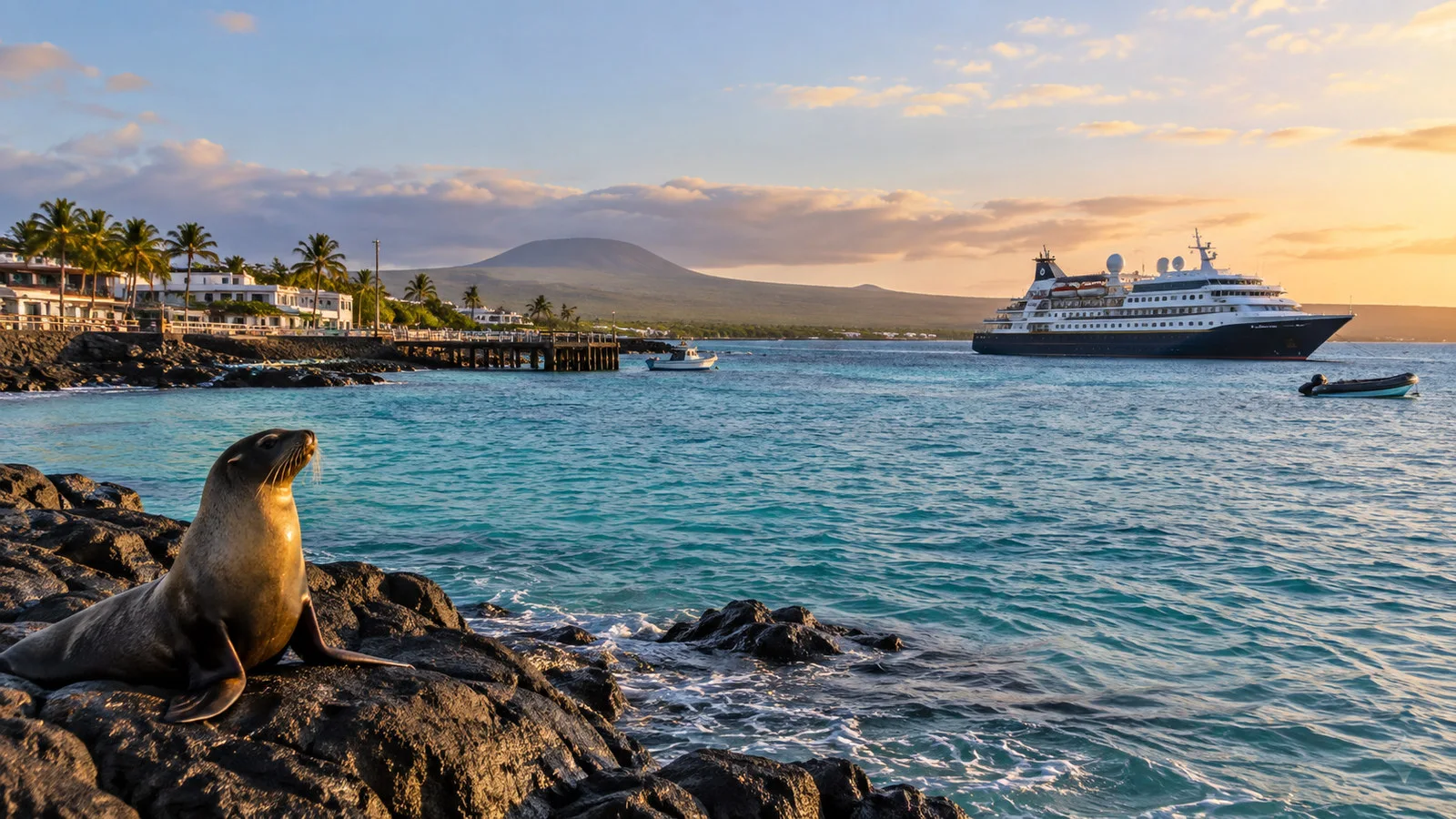
Santa Cruz is the practical hub of the Galápagos, yet it still does not work like a conventional cruise port. Expedition ships generally remain offshore near Puerto Ayora while small boats carry guests to the waterfront, and travelers flying through Baltra face a separate chain of road and channel transfers.
That mix of town, wildlife, science, and transportation makes Santa Cruz one of the most useful islands on an itinerary. It is also where loose planning creates unnecessary stress, so identify whether you are making a day call, beginning a cruise, ending one, or staying independently before choosing what to do.
My quick take
Puerto Ayora is the rare Galápagos stop where you can combine a guided nature experience with cafes, shops, pharmacies, and a genuine town. The Charles Darwin Research Station area, Tortuga Bay, and the Santa Cruz highlands are all worthwhile, but trying to fit all three into a short cruise call usually turns the day into a race.
For a first visit, I would pair the research station with the waterfront or choose a highlands tortoise excursion. Tortuga Bay deserves more time than many port schedules allow, especially when heat and the return walk are included.
Quick Facts
- Country: Ecuador
- Main town: Puerto Ayora
- Typical cruise access: Small expedition boat or panga from a ship anchored offshore
- Main airport connection: Baltra Airport, followed by road and ferry transfers
- Currency: United States dollar
- Time zone: Galápagos Time, UTC minus 6
- Top experiences: Charles Darwin Research Station area, highland giant tortoises, Tortuga Bay, and Puerto Ayora waterfront
- Independent exploring: Possible in town and at some public sites, while protected visitor activities may require authorized arrangements
- Accessibility: Mixed, with small-boat transfers, uneven surfaces, heat, and limited step-free infrastructure
- Planning priority: Confirm the exact landing, all-aboard time, and transfer provider before leaving the ship
Getting ashore in Puerto Ayora
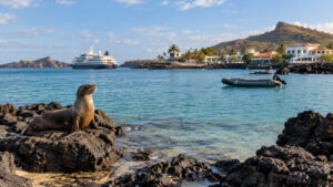
Puerto Ayora does not have a large cruise terminal where expedition guests walk down a gangway into town. Ships anchor offshore and use their own small boats or local launches to reach a waterfront landing.
Boarding usually involves steps to a platform near the water and a transfer onto a moving boat. Crew members will explain handholds, seating, life jackets, and whether spray is likely, so keep both hands free and wait for instructions.
The landing may feel urban compared with remote Galápagos sites, but it still operates around boat traffic, tides, and local harbor conditions. The ship can change the meeting point or schedule, which is why the current onboard briefing outranks an old map or online description.
Once ashore, central Puerto Ayora is walkable for many visitors. Restaurants, small stores, tour desks, and the waterfront are nearby, although sidewalks, curbs, heat, and traffic can make even a short distance tiring.
Baltra Airport to Puerto Ayora
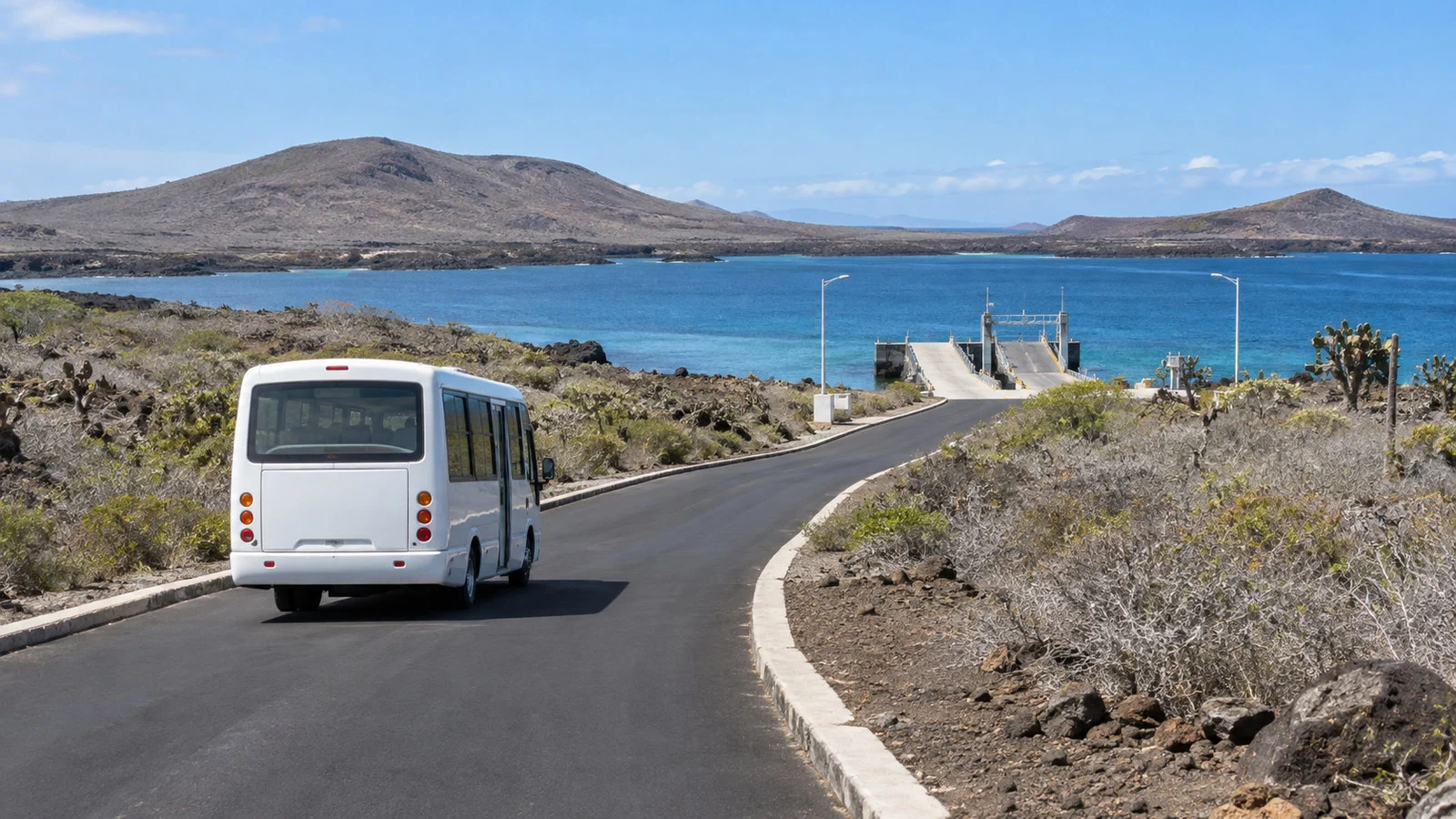
Flying into Baltra is not the same as arriving in Puerto Ayora. The airport is on a separate island, so the journey normally includes ground transportation to the Itabaca Channel, a short ferry crossing, and another road transfer across Santa Cruz.
Exact vehicles and payment arrangements depend on your cruise package, hotel, and current local operation. A fully included cruise transfer is the easiest option because the operator coordinates passengers, luggage, and timing across every stage.
If you are traveling independently, request written instructions that name the meeting point and final destination. “Transfer to the ship” is not enough when the vessel may embark from Puerto Ayora, the north side of Santa Cruz, or another designated point.
Leave generous time on departure day. A road delay, ferry queue, or baggage problem can affect an airline check-in, while the reverse trip after landing may take longer than it appeared on the arrival day.
Charles Darwin Research Station area
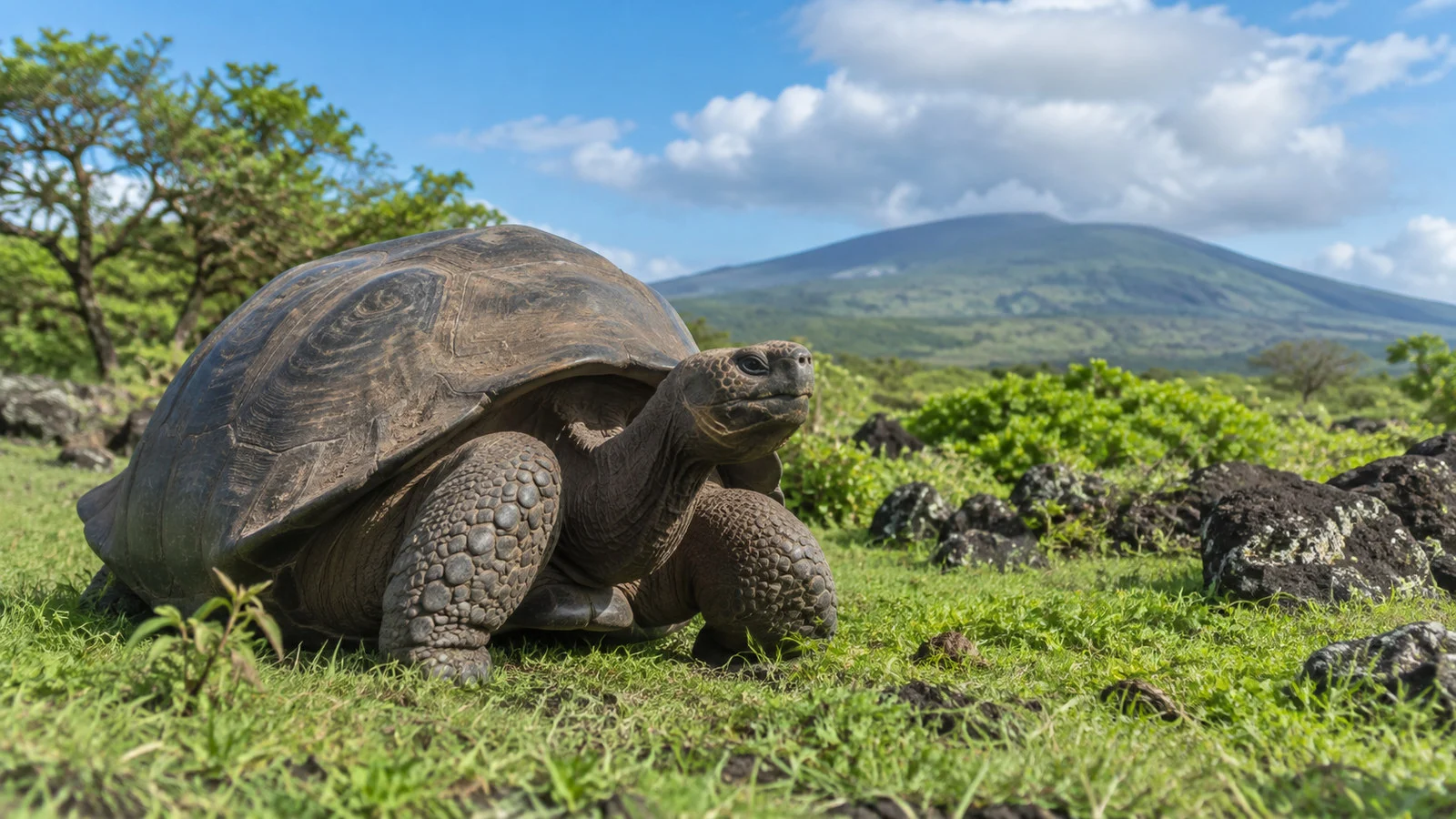
The research station campus and neighboring visitor facilities are among Puerto Ayora’s best-known attractions. Exhibits help explain the science behind conservation, invasive-species control, habitat restoration, and the long work of protecting giant tortoises.
Use the Charles Darwin Foundation visitor information for current details about its campus and exhibition hall. The foundation is a scientific organization, while visitor-site rules and protected-area management are handled by the Galápagos National Park Directorate.
Do not promise yourself a particular individual tortoise or a specific exhibit based on an old travel article. Animal management, research needs, maintenance, and visitor routing can change what is available on the day.
The route can involve sun, uneven ground, and more walking than the map suggests. Carry water if permitted, use sun protection, and ask the ship’s team whether a shorter visit or vehicle transfer is available.
Tortuga Bay
Tortuga Bay is loved for its long sweep of pale sand, coastal vegetation, and the chance to observe wildlife in a protected setting. It is not a quick beach stop directly beside the cruise landing, because reaching the shore involves a substantial walk from town or an authorized boat arrangement.
The trail is generally defined, but heat and limited shade can make the journey demanding. Save enough water and energy for the return, and do not begin if your all-aboard margin is already tight.
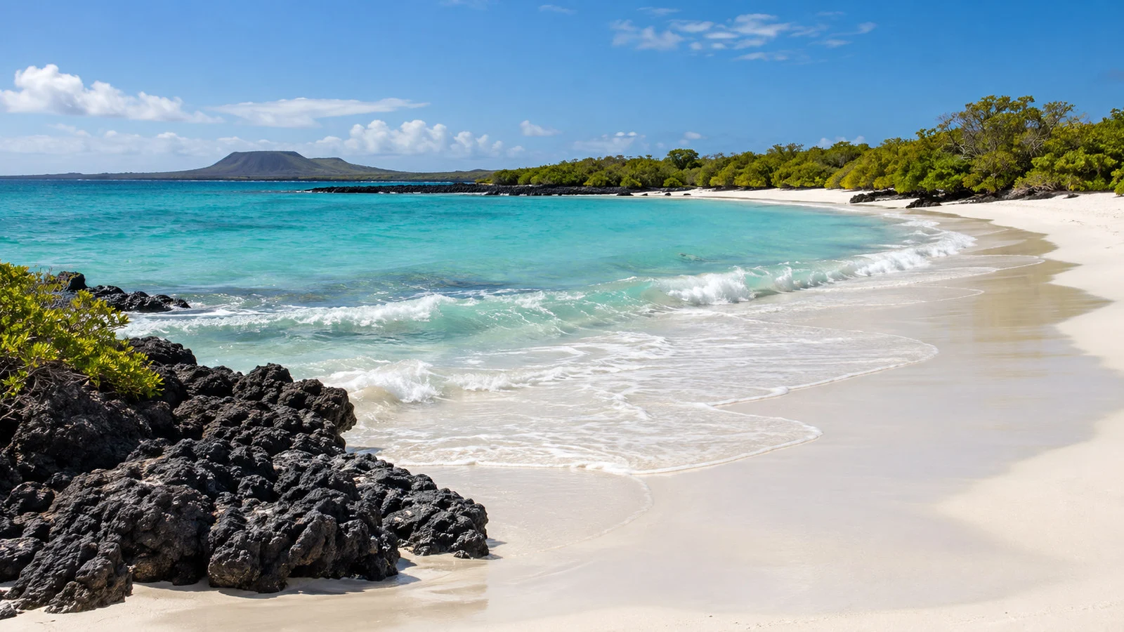
Sea conditions and protected-area instructions determine where swimming or paddling may be appropriate. Follow posted signs and ranger guidance rather than assuming that every attractive stretch of water is open or safe.
Wildlife can appear close to the path or shoreline, but proximity does not permit contact. Give animals room, avoid blocking their route to the sea, and never move beyond the allowed area for a photograph.
Highland giant tortoises
The green highlands reveal a completely different Santa Cruz from the dry coast. Private reserves and farm properties provide opportunities to see giant tortoises moving through natural habitat, often alongside lava tunnels or rural landscapes.
A highlands excursion usually requires a vehicle and takes a meaningful part of a port day. Cruise-line transport or a reputable local guide makes timing easier, especially when the ship’s landing window is short.
Tortoise sightings are likely at established reserves but should never be treated like a staged display. Stay on the instructed route, keep a respectful distance, and let the animal decide where it moves.
The highlands can be cooler, wetter, and muddier than Puerto Ayora. Closed-toe shoes with grip and a light rain layer are useful even when the waterfront is hot and bright.
Las Grietas
Las Grietas is a narrow water-filled fissure reached from the opposite side of the harbor and then by a walking route. Access procedures, authorized hours, guides, and capacity controls can change, so verify the current system before committing port time.
The experience involves boat transportation, uneven ground, rocks, and steps. It is a poor choice for anyone who needs a predictable step-free route or who has little buffer before the last ship transfer.
Water conditions and visitor rules should decide whether you enter, not a photo that makes the site look like a simple swimming pool. Follow the guide or ranger, carry minimal gear, and protect electronics from water.
Puerto Ayora waterfront and town
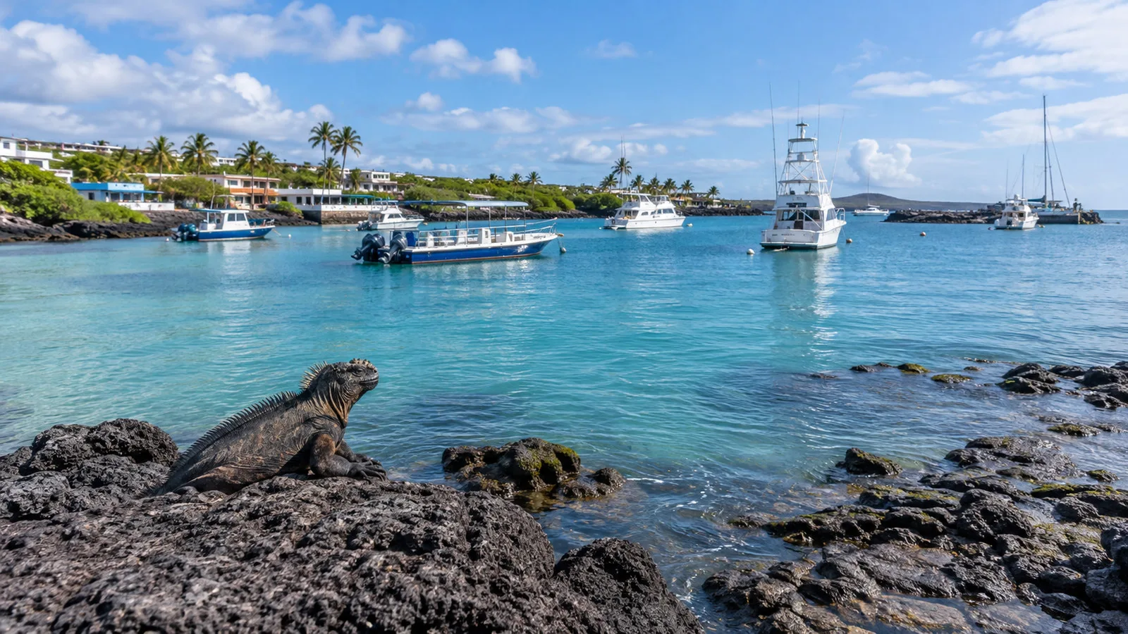
The waterfront gives independent travelers an easy way to experience Santa Cruz without committing to a long excursion. Pelicans, marine iguanas, sea lions, rays, and fish may appear around the harbor, although no particular sighting is guaranteed.
Bright Sally Lightfoot crabs are most often noticed on dark rock near the water, where their color stands out beautifully. Photograph from a respectful distance and keep an eye on your footing instead of stepping closer to frame the shot.
Puerto Ayora is also the practical place to buy forgotten toiletries, have lunch, or arrange a taxi. Prices can be higher than on mainland Ecuador because goods travel a long way, so carry a payment backup and confirm totals before purchasing.
The fish market area can be lively when boats and vendors are active. Animals sometimes gather nearby, and visitors should avoid feeding them or interfering with workers managing the space.
Ship excursion or independent day?
A ship excursion is strongest when it reaches the highlands, combines several transfers, or guarantees coordination with the expedition schedule. It also reduces the risk of misunderstanding which dock or panga departure returns to your vessel.
An independent day works well for Puerto Ayora’s central waterfront and a carefully timed visit to the research station area. Keep the plan simple, save the ship’s local contact details offline, and confirm the final small-boat departure before walking away from the landing.
Tortuga Bay and Las Grietas require more caution because access consumes time and procedures can change. If either is your priority, ask the onboard team whether the call is long enough and whether the ship offers a coordinated option.
Do not combine independent touring with an inflexible restaurant reservation near all-aboard time. Weather, harbor traffic, and small-boat loading can make the return less predictable than a walk back to a normal pier.
Park rules and responsible wildlife viewing
The Galápagos feels intimate because many animals show little fear of people, but that does not make them tame. Never touch, feed, chase, or surround wildlife, and leave a clear path between an animal and the water.
Stay on designated routes and follow ranger, guide, and crew instructions. Flash, loud voices, and sudden movement can disrupt animals and diminish the experience for everyone nearby.
Biosecurity is part of conservation, not airport theater. Clean seeds, soil, and plant material from shoes and bags, and comply with luggage inspections and restrictions on agricultural products.
The Galápagos National Park visitor portal links to official rules, authorized visitor sites, transportation information, and entry-fee guidance. Check it again close to travel because procedures can change.
Galápagos entry fee
The National Park Directorate collects an entry fee for protected areas, including at Baltra and San Cristóbal airports. Under the fee schedule currently published from the 2025 provincial ordinance, a foreign visitor older than 12 generally pays US$200, with different categories for children, Ecuadorian residents, nationals, and citizens of specified regional groups.
Do not rely on the amount in this article as your final budget. Review the official Galápagos entry-fee page and your operator’s predeparture instructions for the current rate, payment method, exemptions, and any separate transit or control charges.
Bring a payment backup even when a package says fees are included. Written confirmation from the cruise company can help resolve confusion at the airport or transfer desk.
Accessibility and mobility realities
Santa Cruz offers more infrastructure than a remote expedition landing, but that does not make the entire experience wheelchair accessible. The first obstacle may be the transfer from the ship to a small boat and then from the boat onto a public landing.
Central Puerto Ayora has some smoother areas, yet curbs, uneven paving, narrow entrances, and heat remain concerns. Ask for recent photos and exact step information when choosing a restaurant, hotel, vehicle, or attraction.
The research station route and Tortuga Bay require sustained walking, while highland reserves can be muddy and uneven. Las Grietas adds boat transfers and rough terrain, making it one of the least suitable choices for limited mobility.
A private vehicle and a reduced itinerary may provide the best balance. Discuss transfer ability with the expedition team before the call, because crew assistance, sea state, and equipment determine whether a landing is safe.
Travelers who cannot go ashore may still enjoy wildlife and harbor views from the ship. Ask whether the vessel offers a short scenic ride or an accessible observation area, but understand that alternatives depend on operations that day.
Weather and what to wear
Santa Cruz can feel hot and exposed near the coast, while the highlands are often cooler and may be damp. Dress in light layers so you can adjust between boat rides, air-conditioned vehicles, sunny paths, and misty uplands.
Sun protection matters even under cloud. A secure hat, sunglasses, long sleeves, and reef-conscious sunscreen are useful, while a compact rain layer helps when conditions change.
Wear shoes suited to the actual activity rather than the town alone. Smooth sandals may be comfortable on the waterfront but perform poorly on wet boat steps, muddy highland paths, or sharp volcanic ground.
Carry water if site rules permit, along with essential medication and a waterproof phone pouch. Keep your bag small enough to manage while leaving one hand free during boat transfers.
Safety, money, and connectivity
The United States dollar is Ecuador’s official currency, and Puerto Ayora has more payment options than remote islands. Small businesses may still prefer cash, and card or network failures are possible, so use more than one payment method.
Cell service and Wi-Fi exist in town but should not be treated as guaranteed during a port day. Download the ship contact, landing location, and map before leaving the vessel.
Protect valuables in busy waterfront areas and during boat transfers. The greater day-to-day risks are often sun exposure, dehydration, slippery surfaces, missed return times, and overestimating walking ability.
Ecuador’s integrated emergency number is 911. On an organized excursion or small boat, alert the guide or crew first so they can begin the location-specific response.
Returning to the ship
The last small boat may leave before the ship’s published departure time. Confirm both the final boarding time and the exact waterfront meeting point, then photograph any posted schedule.
Return earlier than required because launches may load in groups and harbor conditions can slow the transfer. A ship-sponsored tour usually coordinates directly with the vessel, while independent travelers carry the timing risk.
Do not assume that another water taxi can catch the ship after the official transfer closes. Security, park rules, vessel movement, and harbor authorization make that an unsafe plan.
How Santa Cruz fits a Galápagos itinerary
Santa Cruz adds human settlement, research, logistics, and highland habitat to an itinerary built around remote islands. It is not simply a less wild version of the Galápagos, because the conservation story here shows how people, science, tourism, and protected nature interact.
UNESCO describes the archipelago as a place shaped by active geology, isolation, ocean currents, and exceptional biological processes. The Galápagos World Heritage listing also emphasizes strict control of uninhabited islands and carefully planned visitor itineraries.
Use Santa Cruz for the experiences it does best rather than repeating wildlife goals from another island. A highlands visit, a conservation-focused stop, and time in Puerto Ayora create a fuller picture of the archipelago than another rushed beach checklist.
Common questions
Do cruise ships dock in Puerto Ayora?
Expedition ships generally anchor offshore and transfer guests by small boat. Follow your vessel’s current landing instructions because the exact point and schedule can change.
Can I explore independently?
Yes, parts of Puerto Ayora and some public routes can be visited independently. Protected sites, wildlife activities, and certain excursions may require an authorized guide or controlled access.
Can I visit everything in one day?
Not comfortably. Choose one major experience and one nearby addition, then protect a generous return buffer for the small-boat transfer.
Is Santa Cruz wheelchair accessible?
Accessibility is partial and highly dependent on the ship transfer, vehicle, and chosen site. Central town areas may be manageable with help, while beaches, lava terrain, and small boats create significant barriers.
The last word
Santa Cruz is the island where Galápagos logistics become visible, but it is far more than a gateway. Puerto Ayora, the research community, the highlands, and the protected coast each reveal a different relationship between people and this extraordinary environment.
Plan less, confirm more, and leave time for the transfer back to your ship. A focused day with respectful wildlife viewing will feel richer than a rushed attempt to collect every famous stop.
Research note: This guide was checked against current information from the Galápagos National Park Directorate, the Charles Darwin Foundation, and UNESCO. Fees, visitor routes, access rules, and opening details were reviewed on September 12, 2026, but your expedition team and park staff provide the final instructions for your call.