Nome Alaska Cruise Port: Gold Rush & Iditarod Guide
Nome is a remote Bering Sea expedition call where Gold Rush history, Iditarod landmarks, and open tundra matter more than polished cruise facilities. Ships normally anchor offshore, so weather and the small-boat landing shape every plan.
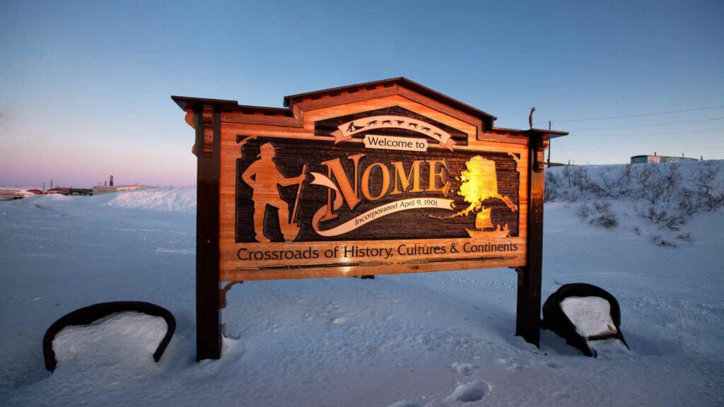
This is the town where mushers cross the finish line of the Iditarod each March under a spruce-burl arch, and where you can still pan for gold on the public beach the way prospectors did in 1899. It is blunt, remote, and about as far from a manicured cruise port as Alaska gets, which is exactly the appeal.
My quick take
Nome rewards travelers who arrive with low expectations of polish and high curiosity about frontier history. Two useful assumptions for a Nome call: it may be windy, and the rough edges are part of what makes the stop interesting.
I would not book this stop hoping for boardwalk shops and cocktail bars. I would book it to stand at the Iditarod arch, pan a little gravel on the beach, and talk to people who have spent their whole lives at the edge of the Bering Strait.
If your itinerary also covers the rest of the state, my guide to Alaska’s cruise ports shows how Nome compares to the busier stops further south.
Quick Facts
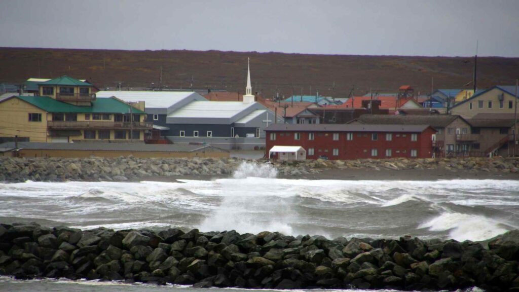
- Where you land: Nome, on the south coast of Alaska’s Seward Peninsula facing Norton Sound and the Bering Sea. There is no cruise pier, so ships anchor offshore and tenders land at the small-boat harbor and seawall near the west end of Front Street. The Nome Convention & Visitors Bureau is the best source for landing-day detail.
- Dock or tender: Cruise ships currently anchor in Norton Sound and use tenders or expedition boats. Nome’s port expansion is a multiyear project, so follow the ship’s current landing instructions rather than assuming a new deep-water berth is available.
- Into town: Barely a walk at all.
- Currency and language: US dollars and English, with Inupiaq and Siberian Yupik spoken across the region.
- Time zone: Alaska Daylight Time (AKDT, UTC−8) through the June to August cruise season, Alaska Standard Time (AKST, UTC−9) in winter.
- Operational caution: Wind, swell, fog, and the ship’s small-boat safety limits can change or cancel a landing.
Cruise arrival and practical logistics
Nome is primarily an expedition and small-ship call. Cruise ships currently anchor in Norton Sound and use tenders or expedition boats, with the landing point and sequence confirmed by the ship after local clearance.
The landing point is generally the small-boat harbor or seawall near the west end of Front Street. Once you are ashore you are, for all practical purposes, already downtown.
Because the anchorage is exposed to open water, treat a Nome landing as weather-dependent rather than guaranteed. Fog and swell have suspended tender operations here before, so do not build anything irreplaceable around this stop.
Cell and Wi-Fi: Coverage exists in town but is genuinely limited by Arctic standards. Do not count on fast data.
Medical care: Nome has a regional hospital, but it is a small facility a long way from anywhere else. Bring your own prescriptions and travel insurance that covers evacuation.
Reboarding: Give yourself a real buffer before all-aboard. Tender lines can back up quickly if the wind picks up during the day.
Getting around
Nome might be the most walkable port in Alaska, purely because there is so little of it to walk. The entire commercial core sits within about a half-mile stretch of Front Street, so once your tender lands you can cover the historic buildings, the Iditarod arch, gift shops, and a museum or two on foot in well under an hour.
Nome has a rare local road network extending into the Seward Peninsula, but routes are largely gravel and can lose cell coverage quickly. Prebook a guide or vehicle, carry cold-weather gear, and do not treat a distant turnaround point as a casual cruise-day drive.
Before you go, I would check the Nome Convention & Visitors Bureau for licensed tour operators and current road information.
Before you leave Front Street
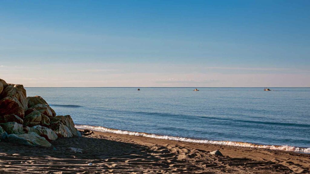
Download maps and meeting details, carry identification and the ship contact card, and dress for wind even when town feels mild. Cell service weakens outside Nome, rental vehicles and guides are limited, and an expedition ship will not wait for an independent road trip.
Ask before photographing residents, working dogs, or subsistence activity, and never approach wildlife. If the sea turns rough, be ready for the ship to shorten or cancel landing operations with little notice.
The stops I would actually spend time on
Nome is small enough that I would rather do three things properly than rush through a long checklist. These are the ones worth your time.
The Iditarod finish-line arch: The race finish stands on Front Street and is easy to include in a town walk outside race season. The ceremonial arch has been replaced over time, so check the official Iditarod schedule if a future land trip is built around the March finish.
Gold panning on designated public beach: Recreational hand panning is possible in designated areas, but not every stretch of shoreline has the same land status or rules. Confirm the current public area locally, use hand tools only where allowed, and leave active claims alone.
Bering Land Bridge National Preserve visitor center: The Front Street center explains the land bridge, living Iñupiat connections, and the preserve’s remote landscape. Opening days are seasonal and the preserve itself has no road access from Nome, so check the National Park Service calendar.
How I would plan the day
Short call, 3 to 4 hours: Walk Front Street end to end, stand under the Iditarod arch, and visit the Bering Land Bridge Heritage Center and the Carrie M. McLain Memorial Museum before heading back to the tender.
Half day with gold panning: Do the downtown walk, then spend an hour or two panning on the public beach, using your own pan or one rented in town.
Full day: Reserve a local guided road trip and choose one corridor based on weather, road condition, and wildlife reports. Muskoxen and birds are possible, never promised, and the guide should set a turnaround time that protects the final tender.
A realistic word on accessibility
I want to be straightforward about this one: Nome is one of the harder Alaska calls for anyone using a wheelchair or with limited mobility. Getting ashore means a tender or Zodiac transfer that depends entirely on sea conditions, and once you are in town, Front Street itself is manageable but many side streets and the beach are gravel or uneven ground.
If step-free tender access matters to you, I would contact your cruise line directly about their boarding procedure for this specific call, since it varies by ship and by weather on the day.
Travelers who can manage the transfer should still expect uneven gangways, exposed wind, and gravel surfaces. A compact mobility aid and a companion can make the short waterfront route considerably easier.
When to go, and the weather
Nome only sees cruise traffic in a short window, roughly June through August, when Norton Sound is reliably ice-free. Even then I would not call it warm, with daytime highs somewhere in the 40s to low 60s Fahrenheit and a wind off the Bering Sea that cuts through anything but a real jacket.
Nome can swing from calm sun to horizontal drizzle quickly, so pack layers and a windproof shell no matter what the forecast says the night before. Outside the cruise season, Nome becomes famous for a different reason each March, when mushers finish the Iditarod under the arch and the town’s population effectively swells for a week.
Quick answers
Do cruise ships dock in Nome?
No, there is no cruise pier, so ships anchor offshore in Norton Sound and passengers come ashore by tender or Zodiac.
Can I really pan for gold?
Yes, recreational hand panning is possible in designated public areas, but confirm the current location and rules locally before starting.
Is Nome walkable?
Yes, the commercial core along Front Street is only about half a mile long, so most cruise passengers can explore entirely on foot.
When does the Iditarod actually finish in Nome?
The finish is in March, well outside the cruise season, so most summer visitors simply see the arch standing on Front Street.
If Nome has you hooked on this kind of far-flung, small-ship Arctic call, it is worth looking at where else these itineraries go. Many of the same expedition ships continue on through the Northwest Passage, and Canada’s Cambridge Bay shares a lot of Nome’s frontier character, from tundra and Indigenous culture to a similarly tender-only arrival.
Between the three, you get a fairly honest picture of what Arctic cruising actually looks like.
How this guide was researched: Unless a first-hand visit is explicitly identified above, this guide uses official port, tourism, transit, government, and attraction sources where available. Logistics and time-sensitive details were reviewed on September 10, 2026; see our Editorial Policy.