Rhine Gorge Cruise Castles: Scenic Cruising, the Lorelei and Where to Sit
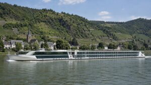
The Middle Rhine Gorge is the rare cruise experience where the ship itself becomes the excursion. Between Bingen and Koblenz, vineyards, railway tunnels, villages, ruined walls, working river traffic, and castle after castle appear so quickly that lunch can wait.
There is no single perfect side because the river bends and the strongest sights occupy both banks. The useful strategy is to learn your sailing direction, start in an open forward position, and move across the deck when the landscape calls for it.
The practical take
Protect this scenic-cruising block from competing activities. Eat beforehand, charge the camera and reach a viewing area before the formal narration begins.
If weather or stairs keep you indoors, claim a forward lounge seat with views to both sides. A fixed chair beside one cabin window gives you a narrow slice of a landscape designed to be read across the whole valley.
Quick Facts
- World Heritage area: Upper Middle Rhine Valley between Bingen and Koblenz
- Protected length: About 65 kilometers, or roughly 40 miles
- Castle count: Around forty castles and fortresses within the UNESCO cultural landscape
- Downstream direction: Bingen toward Koblenz
- Upstream direction: Koblenz toward Bingen
- Best viewing: Open deck with freedom to cross between sides
- Indoor fallback: Forward lounge or another public room with windows on both sides
- Signature sequence: Pfalzgrafenstein, Loreley, Rheinfels, Katz and Maus, Marksburg, and Stolzenfels
- Water reference: Kaub is an important official gauge, but gauge height is not the same as navigable depth
- Best planning rule: Check the daily program because direction, timing, current, traffic, and water conditions vary
What UNESCO actually protects
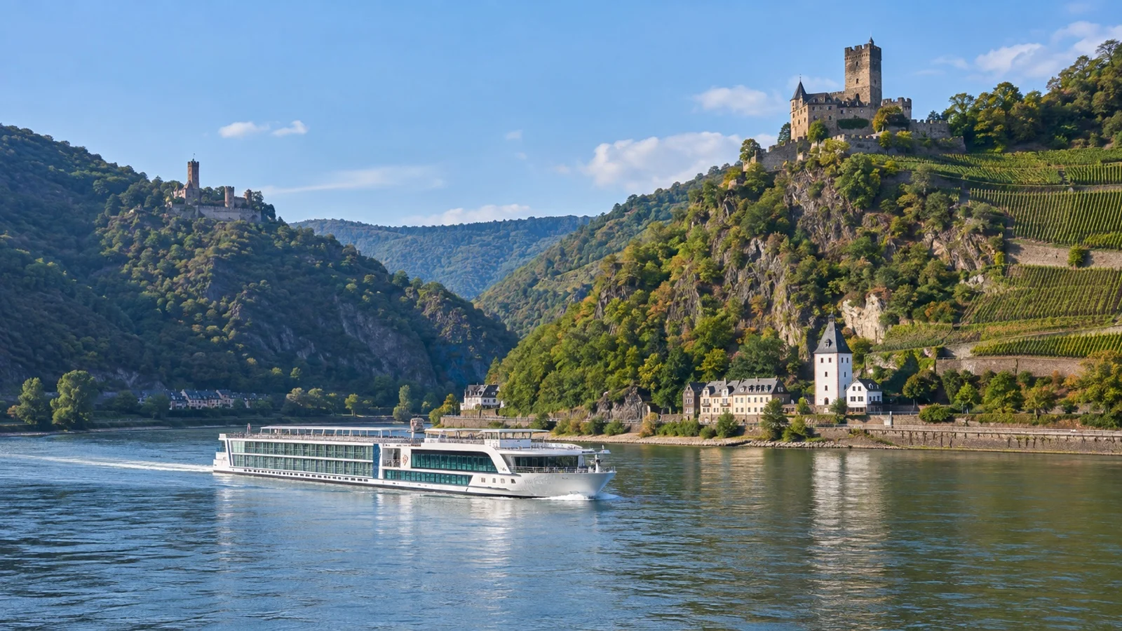
UNESCO inscribed the Upper Middle Rhine Valley in 2002 as a cultural landscape shaped by transportation, settlement, terraced vineyards, castles, towns, and the difficult river corridor. The designated stretch covers about 65 kilometers from Bingen and Rüdesheim to Koblenz.
The official description notes roughly forty castles and fortresses, which sounds almost excessive until you see the slopes. Some are complete, others are romantic reconstructions, and many are ruins that merge with trees unless you know where to look.
The UNESCO World Heritage listing is useful before sailing because its maps and background explain why the valley is more than a row of picturesque buildings. This was a strategic trade route long before it became a cruise highlight.
Where the Gorge fits into a Rhine itinerary
Many guests meet the Gorge on a longer Rhine cruise that begins or ends around Amsterdam or Basel. The scenic transit often sits between calls near Rüdesheim or Mainz and Koblenz, though the exact schedule and direction depend on the itinerary.
Basel is far upstream in Switzerland and is not part of the Middle Rhine Gorge. Its appearance on the same cruise explains why travelers sometimes confuse the entire Rhine route with the protected castle section.
Breisach also lies well south of the Gorge and often serves as a gateway for other excursions. The vineyards there are part of a broader Rhine journey, while the dense castle sequence begins much farther north around Bingen and Rüdesheim.
Read the daily program for the words “scenic cruising,” then ask reception for the approximate start and finish. A printed itinerary may name the day but not the hour, and downstream current can make the transit feel surprisingly fast.
How to understand left bank and right bank
River banks are named while facing downstream. On a downstream sailing from Bingen to Koblenz, the left bank is on the vessel’s port side and the right bank is on the starboard side.
On an upstream sailing, your ship points south, so the same geographic banks appear on opposite sides of the vessel. This is why advice that simply says “sit on the right” can be useless without direction.
German place names and narration may switch between towns on opposite banks in quick succession. Keep a simple route map open and use the ship’s forward movement, not your chair, to orient yourself.
Where to sit downstream from Bingen to Koblenz
Downstream, the port side gives strong views of the left-bank sequence around Rheinstein, Reichenstein, Sooneck, Bacharach, Stahleck, Oberwesel, Schönburg, Rheinfels, and later Stolzenfels. The starboard side collects Gutenfels, the Loreley side, Katz, Maus, the Hostile Brothers, and Marksburg.
Downstream, starboard covers the Loreley, Katz, Maus and Marksburg sequence. Cross for Bacharach, Oberwesel, Rheinfels and Stolzenfels because important sights appear on both banks.
A forward section of the sun deck makes switching easier and shows each bend opening ahead. The extreme stern creates a lovely wake view but reveals landmarks later, when other guests may already be standing in front of your camera.
Where to sit upstream from Koblenz to Bingen
Upstream, the river landmarks arrive in reverse order and the transit usually feels slower against the current. The geographic right bank appears on the vessel’s port side, while the geographic left bank appears to starboard.
Start with Koblenz and Stolzenfels, then watch for Marksburg above Braubach before the valley tightens. Loreley, Katz, Rheinfels, Oberwesel, Kaub, Bacharach, and the southern castles follow as the ship works toward Bingen.
Morning or afternoon light can change which side photographs best, but cloud often matters more than compass direction. Move with the view and let the camera exposure adapt rather than treating sunlight as a reason to ignore a whole bank.
The southern gateway around Bingen and Rüdesheim
The landscape begins tightening around Bingen on the left bank and Rüdesheim on the right. Vineyards climb the slopes, the channel becomes more dramatic, and early castles appear before some passengers have finished finding a deck chair.
The Mouse Tower near Bingen and Ehrenfels above the opposite side help announce the transition. Rheinstein and Reichenstein then rise above the left bank near Trechtingshausen, creating one of the first dense visual sequences.
Sooneck follows farther north on the left bank, its present appearance shaped by restoration as well as medieval history. These early sights are easy to miss if you wait for the public-address narration to become urgent.
Bacharach, Stahleck, and the river towns
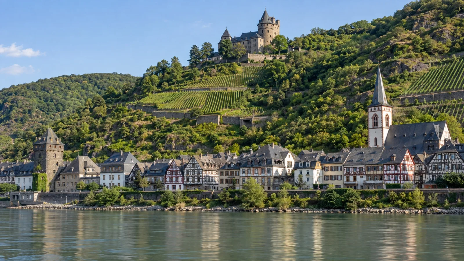
Bacharach is one of the valley’s most complete visual compositions, with old roofs at river level, towers, vineyard slopes, and Stahleck Castle directly above. The castle now serves as a youth hostel, a wonderfully practical afterlife for a fortress.
Watch beyond individual buildings and read the way town, wall, slope, vineyard, railway, and river occupy the narrow available space. The cultural landscape makes sense when seen as an engineered whole rather than a castle checklist.
Upstream or downstream, Bacharach deserves attention even when the narration moves quickly. The village can disappear behind the next bend before a passenger returns from the coffee machine.
Kaub and Pfalzgrafenstein
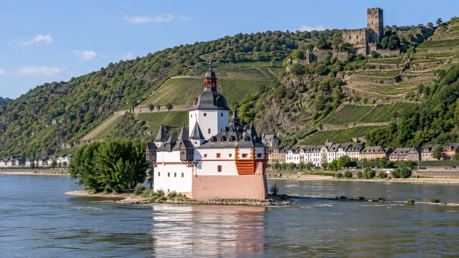
Pfalzgrafenstein is the castle no one confuses with another because it stands on an island in the river near Kaub. Its compact, ship-like form reflects its historic role in the toll system controlling traffic along the Rhine.
Gutenfels rises above Kaub on the right bank, creating a layered view with the island castle below. This is one of the places where a wide lens and a forward deck position work better than zooming tightly on one building.
The Kaub gauge sits nearby and has enormous practical importance for navigation. Use the official PEGELONLINE service for current readings, while remembering that a gauge value is a reference height rather than the literal depth beneath your ship.
Oberwesel and Schönburg
Oberwesel sits on the left bank with a long surviving line of medieval walls and towers. Schönburg crowns the slope, but the town fortifications can be more revealing from the water than the castle itself.
This is a good moment to lower the camera and look with your eyes. Railway lines, roads, houses, vineyards, and walls are squeezed into a strip that shows exactly why the Rhine corridor required so much adaptation.
Loreley, Rheinfels, Katz, and Maus
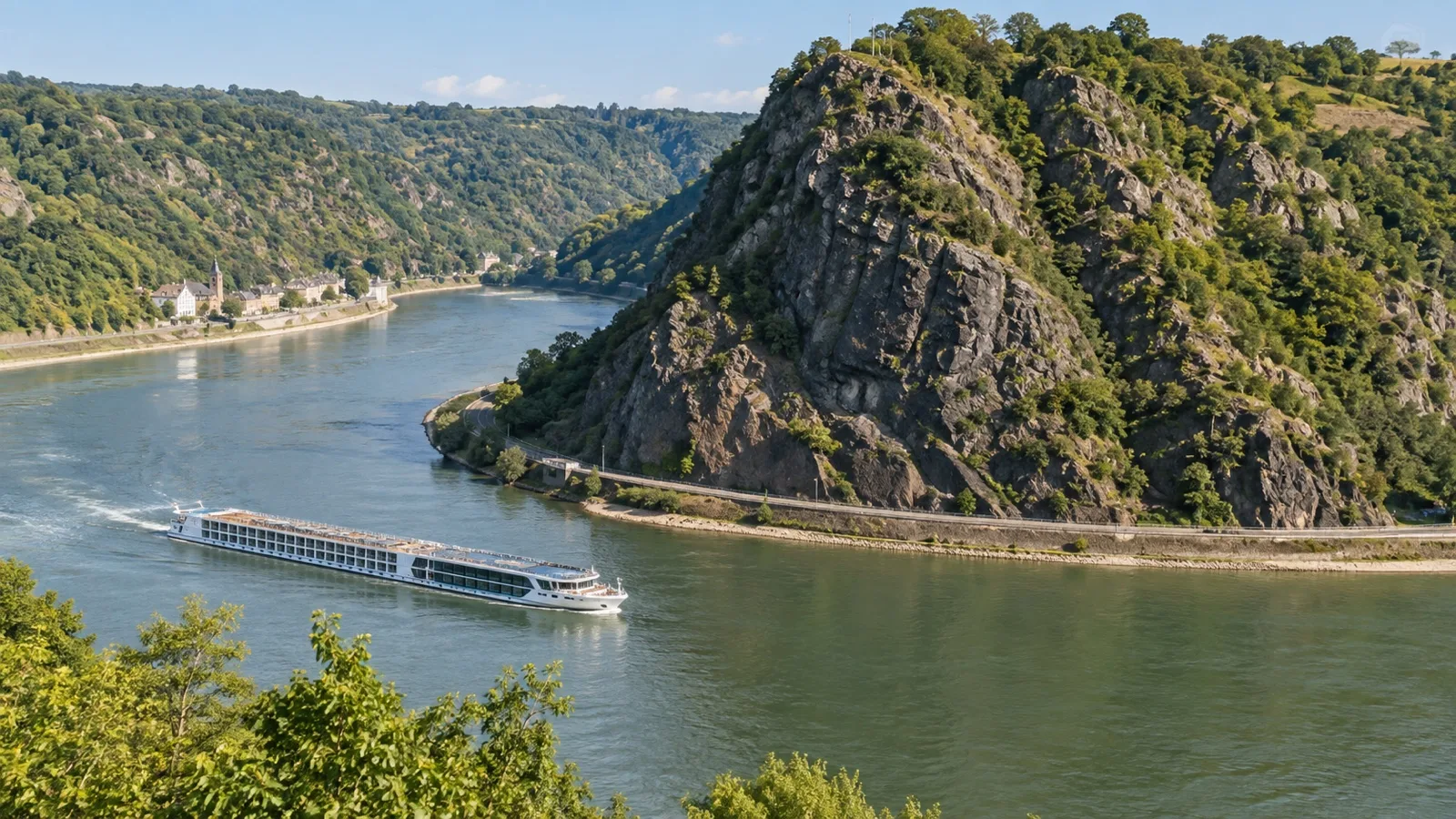
The Loreley is a steep slate rock on the right bank near Sankt Goarshausen, where the valley narrows and the river bends. It can look less theatrical than expected from water level, so watch the shape of the channel and the rising cliff rather than waiting for a fairy-tale tower.
The famous legend tells of a woman whose song distracted boatmen, but the underlying navigation challenge was real. Current, bends, rock, limited sight lines, and heavy commercial traffic made this stretch dangerous long before modern traffic control.
Rheinfels spreads across the left-bank hillside above Sankt Goar and reads as an enormous ruin. Opposite, Katz and Maus occupy the right-bank side, giving downstream starboard viewers a particularly strong run while everyone should still cross for Rheinfels.
Keep binoculars ready because castle scale and distance can deceive. Details that look obvious in promotional photography may be several hundred feet above the river and partly obscured by summer foliage.
The Hostile Brothers and Marksburg
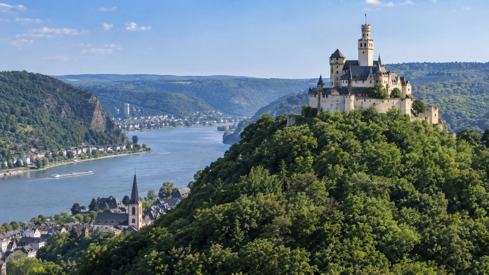
Sterrenberg and Liebenstein stand close together above Kamp-Bornhofen on the right bank and are popularly known as the Hostile Brothers. The story of feuding brothers is legend, but the paired silhouettes remain one of the valley’s memorable sights.
Marksburg then rises above Braubach on the right bank near the northern end of the protected valley. It is celebrated as the major hilltop Rhine castle that was never destroyed, which helps explain its more convincingly defensive appearance.
The German Castles Association owns Marksburg and operates visits under its current schedule. If you want to tour a castle on land, use the official Marksburg site for hours, languages, access, and seasonal conditions rather than relying on the shipboard view.
Stolzenfels and the approach to Koblenz
Stolzenfels appears on the left bank as the valley begins opening toward Koblenz. Its pale, romantic appearance reflects nineteenth-century rebuilding and offers a visual contrast with the more fortress-like Marksburg.
At Koblenz, the Moselle joins the Rhine at Deutsches Eck while Ehrenbreitstein Fortress dominates the opposite bank. The confluence marks a satisfying end or beginning to the Gorge, depending on your sailing direction.
Do not disappear below deck the moment the castle density eases. The approach to the confluence, cable car, fortress, bridges, and city waterfront provides the final geographic explanation of the route.
The Loreley story without the souvenir-shop version
Loreley became internationally famous through poetry, music, and Rhine Romanticism, particularly the nineteenth-century story of a beautiful singer above the river. The legend transformed a difficult navigation point into one of Europe’s best-known scenic symbols.
From the ship, the rock is better understood as landscape than monument. Listen for the narration, watch the channel narrow, and look for the figure of the valley rather than expecting an obvious attraction entrance.
Commercial vessels still share this water with passenger ships. Respect crew instructions about open decks, railings, drones, and movement while the bridge team handles traffic and the bends.
Photography without missing the experience
Use a wide view for towns and castle pairings, then a modest zoom for individual fortresses. A phone handles the broad landscape well, while binoculars often contribute more than a long lens when haze softens distant stone.
Photograph through an open deck whenever permitted because tinted glass and interior reflections reduce contrast. If you must stay indoors, press the lens close to clean glass and turn off lights behind you where that is allowed.
Do not spend the transit reviewing every frame. Landmarks arrive too quickly, and the best image may be the one you never take because a neighboring castle appears while you are editing.
Bring a lens cloth, charged battery, and enough storage. Cold, drizzle, sunscreen, fingerprints, and river mist all have an uncanny ability to find the camera on the one day it matters.
Food, narration, and timing
Ask the cruise director the night before when the protected stretch is expected to begin. River current, traffic, locks elsewhere, berths, and operating decisions can move the time from what appeared in the original schedule.
Eat before the transit or assemble a quick plate you can carry to an allowed viewing area. A formal multi-course lunch can block much of a transit that the ship completes only once.
Narration quality varies, and ship announcements may be hard to hear in wind. A printed map or downloaded guide helps you identify the next town without spending the day beside a loudspeaker.
If the itinerary includes Rüdesheim or Koblenz on the same day, protect enough energy for both the port call and scenic block. The deck requires more standing, side-switching, and weather exposure than a passive schedule description suggests.
Low water and the Kaub gauge
Kaub is closely watched because this section can constrain navigation during low water. Cargo vessels reduce loading as conditions tighten, while passenger-ship decisions depend on draft, vessel design, forecast, route, and operator judgment.
There is no universal gauge number at which every river cruise stops. A reading that affects one ship may be workable for another, and the official gauge is not a direct statement of water depth across the channel.
Low water can lead to a ship swap, hotel stay, bus segment, shortened route, or canceled scenic transit. Read the operator’s same-week communication and contract rather than translating a social-media gauge screenshot into certainty.
High water can also change operations through current, bridge clearance, berths, and local restrictions. The river authority and captain determine safe navigation, not the optimism of a fixed itinerary.
Accessibility and the best indoor alternative
The Gorge is one of the most accessible headline experiences on a river itinerary because the scenery comes to the ship. The main barrier is reaching a viewing position that provides more than one narrow window.
Many river-ship elevators do not reach the sun deck, and operational conditions can close an open deck even without a low fixed bridge in the Gorge itself. Confirm elevator stops on the named ship and ask which indoor lounge provides views across both banks.
River ships differ in layout, including ships used elsewhere in Europe, so never infer access from a generic photograph. Claim an indoor seat early if stairs, cold, or standing for several hours will be difficult.
Marksburg and other land-based castle visits often involve slopes, stone, and stairs. Request the actual route, transport steps, surfaces, and restroom access before treating a castle excursion as the accessible alternative to scenic cruising.
Weather and what to wear
The open deck can be cooler than the town forecast because the ship is moving and the gorge channels wind. Carry a warm layer and a light waterproof shell even when the morning begins pleasantly.
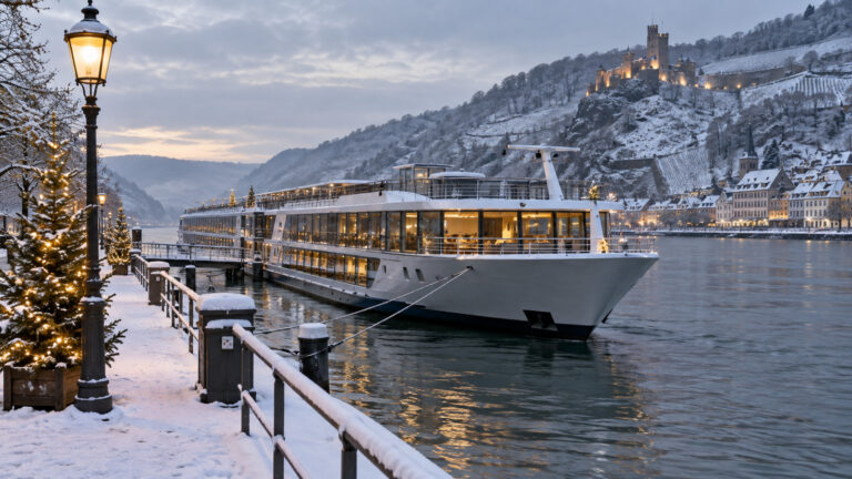
Spring and fall often deliver clearer light and comfortable temperatures, while summer foliage and haze can soften distant ruins. Winter brings bare slopes and atmospheric views, but short daylight can place part of a late transit in darkness.
Check sunrise, sunset, and the scheduled scenic window on Christmas-market itineraries. A castle count means very little after the valley has gone dark.
Sun protection matters on long summer deck sessions. Shade can be limited after low-bridge equipment has been folded elsewhere on the route, and passengers often underestimate reflected light from the water.
Common Rhine Gorge mistakes
The first mistake is choosing a side without knowing the sailing direction. Geographic banks stay fixed while port and starboard reverse when the ship turns around.
The second is waiting for Loreley before going on deck. The southern castles and Bingen gateway have already passed by then.
The third is defending one chair. Walk across for the opposing bank and use the forward deck to see bends develop.
The fourth is treating the Kaub gauge as the river depth or a universal cancellation switch. It is an important reference, but ship-specific decisions require more information.
The final mistake is scheduling a meal or treatment during the transit. The ship will not circle back after the scenic block.
Quick answers
Which side is best downstream?
Starboard has a strong Loreley, Katz, Maus, and Marksburg sequence, while port captures Bacharach, Oberwesel, Rheinfels, and Stolzenfels. The best plan is to start forward and switch sides.
Which side is best upstream?
The geographic right bank appears on the vessel’s port side when sailing upstream, and the geographic left bank appears to starboard. Stay mobile because the landmark order is reversed but still split between banks.
How long is the protected Gorge?
UNESCO describes the Upper Middle Rhine Valley as about 65 kilometers, or roughly 40 miles, between Bingen and Koblenz. The sailing time varies with direction, current, traffic, and the ship’s operating plan.
How many castles will I see?
UNESCO identifies roughly forty castles and fortresses in the cultural landscape. You will notice the major examples clearly, while smaller ruins can be easy to miss in foliage or haze.
Does the sun deck stay open?
Often, but no passenger should assume it. Wind, weather, maintenance, bridge approaches outside the core Gorge, or another operational reason can close the deck, so ask about the indoor fallback.
Can low water cancel the Gorge transit?
Low water can disrupt navigation and lead to changed ships, bus segments, or a revised itinerary. The Kaub gauge provides context, but your vessel’s draft and the operator’s plan decide the outcome.
A practical scenic-cruising plan
The night before, confirm direction and timing, mark the major sequence on a simple map, charge the camera and set out warm waterproof layers. Eat early enough to be in position before Bingen downstream or the Koblenz confluence upstream.
During the transit, stay forward when practical, cross sides often and watch towns as carefully as castles. If weather becomes unpleasant, use a public lounge with views to both banks rather than a one-sided cabin.
The last word
The Middle Rhine Gorge earns its reputation because the landscape never asks you to imagine the history separately from the river. Castles, vineyards, towns, railways, and modern traffic occupy the same narrow corridor in one continuous scene.
Learn the direction, arrive early, and refuse to become loyal to one chair. The reward is not merely a collection of castle photographs, but a clear view of why this short valley has shaped European travel for centuries.
How this guide was researched: This guide is based on independent research, not a first-hand Rhine Gorge sailing. Sources included UNESCO World Heritage material, official German waterway gauge data, regional heritage information, castle visitor guidance, and current river-cruise operating information. Details were reviewed on September 12, 2026. Water levels, deck access, schedules, castle hours, excursions, and accessibility can change, so confirm time-sensitive details before travel and see our Editorial Policy.
More on this topic: browse every guide on river cruise planning.