Klaksvík Cruise Port: Quays, Ánir and Northern Islands
Klaksvík compresses an astonishing amount of Faroe Islands drama into one small fishing town. Steep green mountains rise from narrow sounds, tunnels connect villages that once felt remote, and working boats keep the harbor honest.
The first decision is not which waterfall or viewpoint to see. It is finding out whether your gangway is in central Klaksvík, three kilometers north at Ánir, or attached to a tender operation, because that answer controls the rest of the day.
Quick Facts
- Possible arrivals: North Quay at Ánir, West Quay, Kósin Quay, or an anchorage and tender operation.
- Ánir distance: About 3 kilometers north of central Klaksvík.
- Town access: Shuttle details are call-specific, while closer town quays can offer a shorter marked walk.
- Currency: Faroese króna at parity with the Danish krone, with cards widely accepted.
- Language: Faroese, with Danish and English also widely understood.
- Time: WET in winter and WEST during summer time.
- Road rule: Traffic drives on the right.
- Best strategy: Confirm the quay, choose one northern-island direction, and keep an earlier return than the last possible connection.
The Quay Name Changes Everything
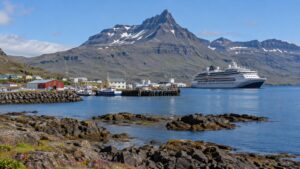
Klaksvík has several cruise-capable quays rather than one universal cruise terminal. The port identifies North Quay at Ánir, West Quay, and Kósin Quay, with ship size, draft, traffic, and operational needs shaping the assignment.
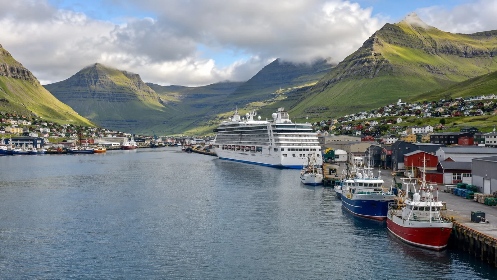
Large ships commonly use North Quay by Ánir, a small settlement roughly 3 kilometers north of the center. West Quay and Kósin sit closer to the town’s everyday streets, although working-port boundaries still determine where passengers may walk.
Anchoring and tendering remain possible when the berth plan or conditions require it. A tender changes accessibility, the time you reach shore, and the final safe return in ways that a town-quay berth does not.
Read the ship’s daily program after arrival and look for the exact quay, shuttle destination, final departure, and port agent contact. The berth can change after you booked a tour, so send the updated location to an independent guide.
From Ánir to Central Klaksvík
North Quay is not beside the main shopping and visitor area. A call-day shuttle is often arranged, but its price, frequency, route, wheelchair capacity, and final return belong to that sailing rather than a permanent public promise.
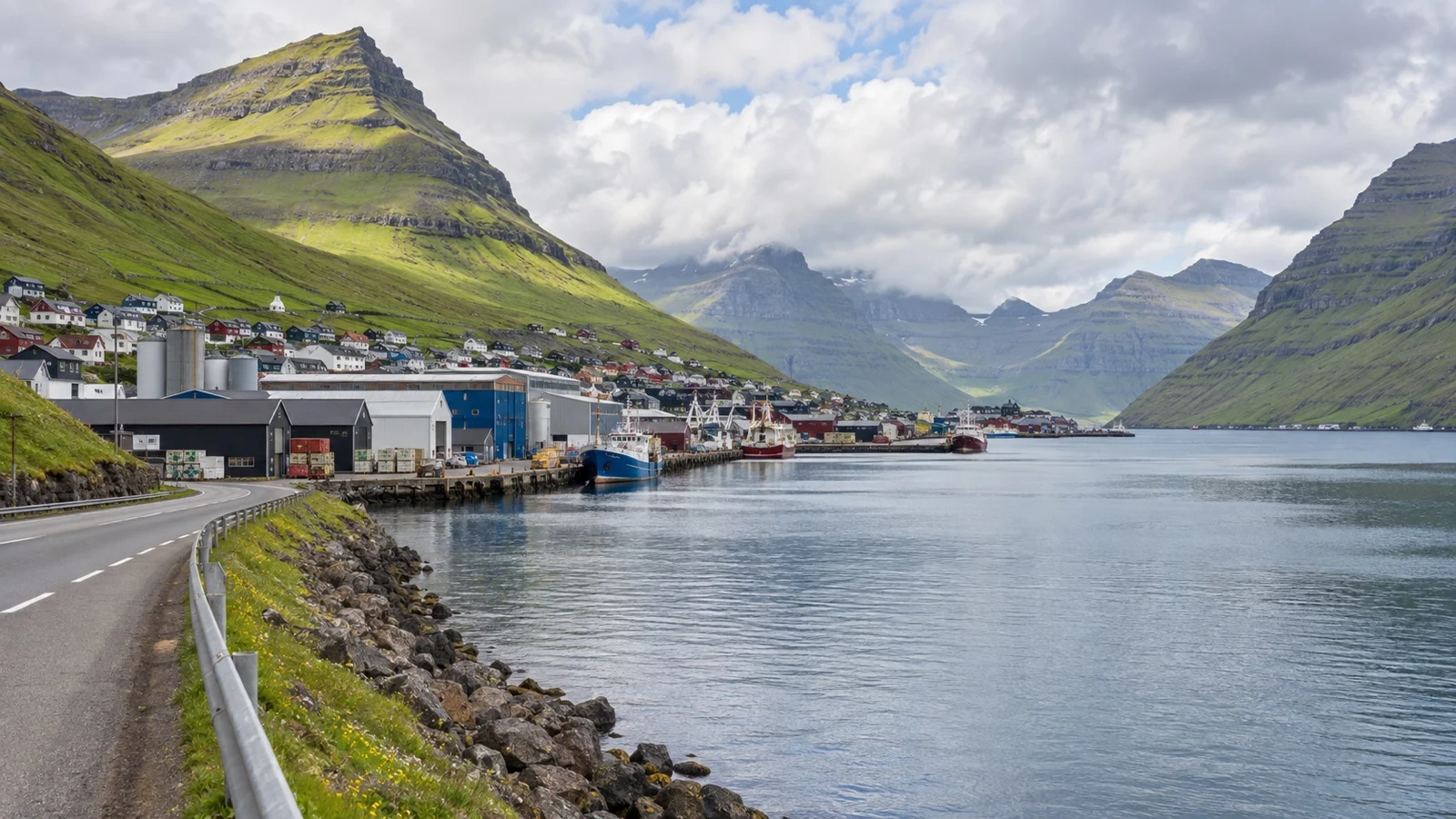
Ask crew where the shuttle stops in town and photograph the pickup point. A different street can look very similar after rain settles over the harbor.
Fit passengers may be allowed to walk the roughly 3-kilometer route on the approved path. Allow 35 to 50 minutes each way, then add time for wind, rain, road crossings, photos, and any port security procedure.
I would use the shuttle when it is running. The walk consumes a large part of a short call and feels much longer when a headwind arrives during the return.
Passengers at West Quay or Kósin may begin much closer to central sights. Follow port signs instead of stepping through a fishing or processing yard that appears to offer a shortcut.
A Town Day Without an Excursion
Klaksvík works surprisingly well as a local day because the harbor, church, cafes, visitor center, and mountain views are all part of the experience. It is not a polished promenade, and the industrial edges make the town more interesting rather than less.
Christianskirkjan
Christianskirkjan is the architectural landmark most visitors remember. Basalt walls, timber, the detached bell structure, and a traditional Faroese boat inside connect modern church design with the seafaring community outside.
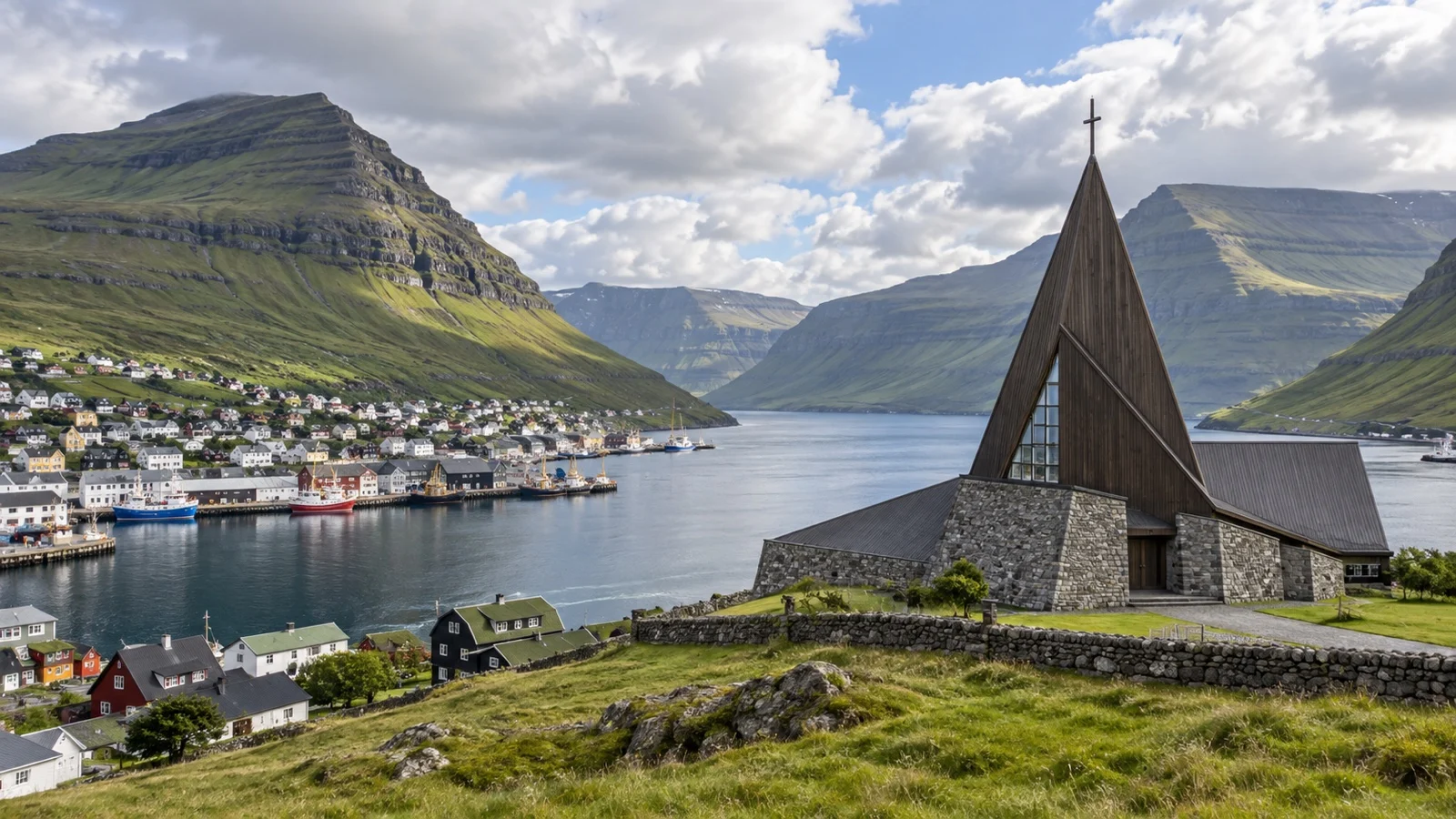
This is an active church rather than a guaranteed attraction. Check opening access, enter quietly, dress respectfully, and accept that worship, a funeral, or a private event may limit an interior visit.
Harbor and Town Center
Klaksvík is one of the islands’ major fishing centers, so working vessels, processing buildings, gear, and practical quays define the view. Watch operations from public areas and obey every security barrier.
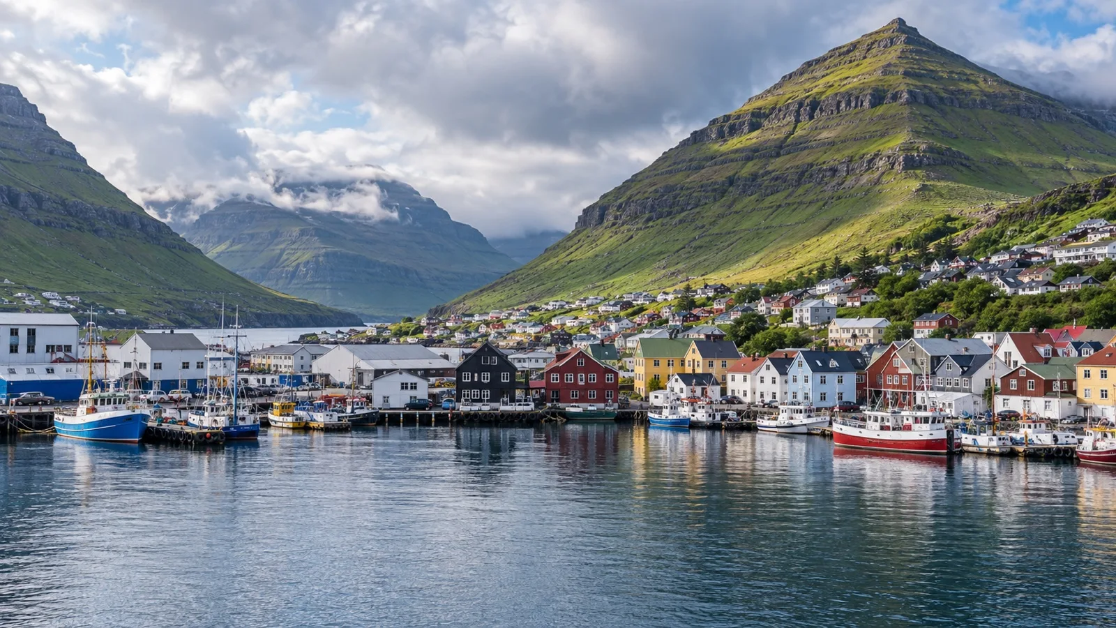
Cafes, shops, and services cluster around the center, but hours vary by weekday, season, and cruise traffic. Buy a meaningful item when you see it because a later return may meet a lunch break or early closing.
Northern Isles Museum
Norðoya Fornminnissavn preserves domestic, commercial, and maritime history in historic buildings. Seasonal hours can be limited, so confirm the current opening through Visit North or the visitor information center.
The museum is a good rainy-day addition rather than something to assume will open because a ship is present. Give the collection time if it is available and keep a cafe alternative nearby.
Klakkur Viewpoint Is a Hike, Not a Photo Stop
The view from Klakkur brings Klaksvík, Kalsoy, Kunoy, and the surrounding channels into one sweeping composition. Reaching it still requires transport toward the trailhead, a real ascent, a weather decision, and a safe descent.
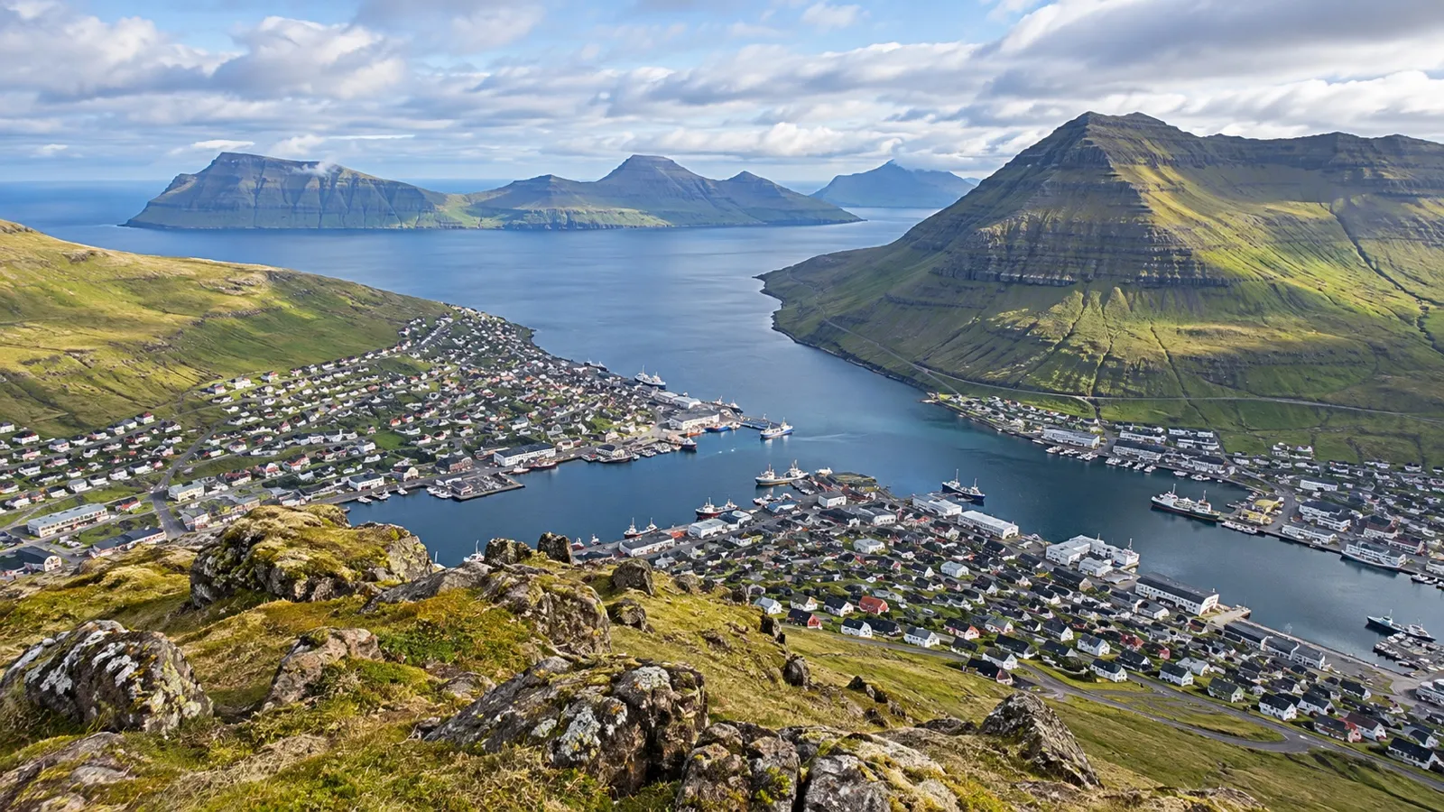
Online time estimates often begin at the parking area, not at North Quay or the shuttle stop. Add the drive, possible taxi wait, ascent, photo pauses, descent, transfer back, and port buffer before deciding whether the hike fits.
The trail can be muddy, slippery, and exposed to sudden gusts. Visit Faroe Islands advises hikers to use sturdy footwear, avoid fog or darkness, stay away from cliff edges, and turn back when conditions become unsafe.
A local guide adds far more than navigation. The guide can judge wind, land access, farming activity, visibility, and the correct turnaround time for your ship.
Cloud may hide the summit while the harbor remains bright, then reverse within minutes. Keep Christianskirkjan and the town as a complete alternative rather than a consolation plan.
Northern Islands by Road
The roads north of Klaksvík create one of the best small-scale scenic drives in the Faroes. Tunnels, causeways, narrow valleys, churches, fish farms, and villages reveal how daily life fits into the terrain.
A local driver is the most efficient choice because rural public transport is designed for residents, not a ship’s all-aboard time. Agree on the route, vehicle, price, meeting point, and return time in writing.
Kunoy
Kunoy connects to Borðoy by road and offers steep mountains, a small village, and a sheltered plantation. It is one of the simpler ways to leave Klaksvík without adding a ferry.
The approach includes narrow roads and a tunnel, so use a driver comfortable with local priority rules and limited visibility. A “Kunoy tour” may mean a brief village stop or a longer walk, and the difference should be clear before booking.
The plantation can provide shelter when wind makes higher ground unpleasant. Paths may still be wet, uneven, or muddy, and accessibility must be confirmed rather than assumed.
Viðareiði
Viðareiði sits between high mountains on Viðoy and delivers the classic village, church, and sea setting many passengers hope to find. The road connection avoids a ferry, which makes it more forgiving than Kalsoy.
Photography stops, sheep, tunnel traffic, and changing weather still use time. A guide can combine Viðareiði with Kunoy while keeping the route compact enough for a medium-length call.
Do not climb onto private land or cross fences without permission. Faroese fields are working agricultural property even when no house is visible.
Kalsoy Adds a Ferry and Real Schedule Risk
Kalsoy is the most demanding independent option because the journey normally begins with the public ferry from Klaksvík to Syðradalur. On the island, onward bus or vehicle arrangements create another connection before you reach northern villages or a trail.
Strandfaraskip Landsins currently lists route 56 for the Klaksvík to Kalsoy ferry and route 506 between Syðradalur and Trøllanes. The dated schedule, capacity, vehicle policy, service notices, and return connection must all be checked for your exact call.
A full or canceled sailing may have no fast alternative. If the last workable ferry is also the only ferry that gets you back to the ship, the plan is too fragile for an independent cruise day.
Kallur Lighthouse is not beside the ferry pier and requires onward transport plus an exposed hike on privately managed land. Access rules, any hiking fee, trail condition, wind, visibility, and local restrictions need current confirmation.
A ship excursion or established port-aware tour is the sensible choice when Kalsoy is the main goal. Even then, read what the operator does if the ferry or trail is unavailable.
Public Buses Are Useful but Not Ship-Timed
The national operator lists route 500 between Klaksvík and Viðareiði, route 504 for Kunoy, and routes 400 and 401 toward Tórshavn. A route number proves a connection exists, not that it works for a particular ship call.
Check the exact weekday, school holiday, seasonal timetable, stop, payment method, and service notices. Sunday service and transfer patterns can differ substantially from a normal weekday.
Download the outbound and return schedule before leaving the ship. Mobile coverage can weaken in tunnels, and a screenshot remains useful when an app stops refreshing.
A public bus to a road-connected village can be reasonable on a long call with an earlier backup return. A bus and ferry chain with no spare connection is not reasonable simply because every segment appears on the same planner.
Tórshavn Is Possible but Often the Wrong Priority
The road to Tórshavn now benefits from the undersea tunnel network, yet a trip to the capital still turns Klaksvík into a transfer point. Travel time, tunnel traffic, pickup logistics, and the ship deadline reduce what you can actually enjoy.
First-time visitors usually gain more by staying in the Northern Islands, where the scenery and villages differ from a Tórshavn-focused call. Save the capital for an itinerary that docks there whenever possible.
If Tórshavn is essential, use an organized excursion or private driver with a firm turnaround. Do not depend on the final public bus that can make the ship.
Tunnel tolls may be built into a tour or rental price, but the arrangement should be stated. A surprise fee is less important than a driver who understands the return deadline.
Weather Runs the Day
Faroese weather is cool, wet, windy, and fast-changing even in summer. The forecast for Klaksvík harbor does not necessarily describe Klakkur, Viðareiði, or Kallur at the same moment.
Wear thin warm layers beneath a waterproof and windproof shell, and choose footwear with an aggressive sole. Jeans become heavy when wet and smooth city shoes are poor protection on grass or mud.
Fog is a genuine navigation and cliff hazard rather than an inconvenience that a phone map solves. If you cannot see the route or safe edge, turn back and return to town.
Strong gusts can arrive around saddles, tunnel exits, ridges, and exposed viewpoints. A competent guide may cancel a walk while keeping the scenic drive, and that is good judgment.
The official hiking guidance also asks visitors to stay on paths, respect farming activity, and avoid disturbing sheep work. Follow seasonal notices about hunting or land closures even on a short port call.
Four Port-Day Plans That Actually Work
Easy Klaksvík Day
Take the shuttle from Ánir when needed, visit Christianskirkjan, explore the harbor and center, then check whether the Northern Isles Museum is open. Add lunch and return on an earlier shuttle than the final advertised run.
This plan survives low cloud and light rain. It also works well for passengers who prefer atmosphere and local life to a full vehicle tour.
Klakkur Day
Prearrange a taxi or guide toward the trailhead and hike only if visibility, wind, access, and ground conditions are suitable. Finish with the church or a cafe rather than adding a second long excursion.
Set a turnaround time before starting uphill. A summit is optional, while the ship is not.
Northern Villages Day
Book a guided drive to Kunoy and Viðareiði with short walks and scenic stops. This route gives a broad sense of the Northern Islands without relying on a ferry.
Let the driver change the order with the weather. The best viewpoint early in the morning may be inside a cloud by noon.
Kalsoy Mission
Use a ship excursion or thoroughly verified local tour with protected ferry timing. Treat Kallur, northern villages, and any hike as conditional parts of the plan rather than guaranteed trophies.
Do not add a separate Klakkur hike before or after. Kalsoy’s ferry and road network already supply enough moving pieces.
Accessibility and Reduced Mobility
An alongside berth is easier than a tender, but North Quay at Ánir still creates a transport requirement for many passengers. Ask whether the shuttle has a lift, ramp, securement, and space for the exact mobility device.
A folding wheelchair and a heavy powered scooter need different vehicle solutions. Give dimensions and weight in advance and ask where the accessible vehicle meets the gangway.
Central Klaksvík has useful level stretches, yet curbs, slopes, wet pavement, and working-port surfaces interrupt a completely smooth route. Historic church and museum thresholds should be checked directly.
A vehicle tour to Kunoy and Viðareiði can provide excellent scenery with limited walking. Confirm step height, time outside the vehicle, toilets, surface at each stop, and whether companions can remain seated.
Klakkur and Kallur are not suitable substitutes for an accessible viewpoint simply because a car approaches part of the route. Weather, mud, steep grass, gates, and exposed ground remain beyond the drop-off.
Tender operations impose the ship’s own transfer limits and can exclude certain devices or passengers when conditions deteriorate. The captain and crew make the final safety decision.
Money, Food, and Connectivity
The Faroese króna circulates at the same value as the Danish krone, and Danish notes are generally accepted. Faroese notes can be difficult to use after leaving the islands, so avoid taking out more cash than the day needs.
Cards are widely accepted in shops, cafes, tours, and taxis. Carry a backup card and a small amount of local cash for a terminal outage or minor purchase.
Seafood, lamb, baked goods, and open sandwiches suit the climate and fishing culture. Restaurant capacity can tighten when a large ship arrives, so eat before the main crowd or reserve through an established operator.
Mobile coverage is useful around town but can disappear inside tunnels and weaken in remote valleys. Keep the route, tickets, ferry information, berth, and port agent number available offline.
Entry and Document Rules
The Faroe Islands are a self-governing part of the Kingdom of Denmark but are outside the European Union and outside the Schengen Area. Entry and visa rules therefore require more care than simply checking whether a traveler can enter Denmark or another Schengen country.
A visa for Denmark or Schengen does not automatically authorize travel to the Faroe Islands unless it is valid for the islands. Nationality, residence status, and itinerary matter, so confirm requirements through the official Danish immigration authorities and the cruise line.
The ship may coordinate group clearance or hold passports, but passengers remain responsible for correct documents. Carry the identification specified in the daily program, especially on an excursion that uses ferries or approaches another port.
Rules can change between booking and sailing. Recheck close to departure and never rely on a tour seller to determine immigration eligibility.
Safety and Responsible Visiting
The greatest practical risks are weather, traffic, cliffs, slippery ground, and transport connections. Klaksvík itself feels comfortable, but the landscape becomes serious within minutes of town.
Keep well away from cliff edges because grass can overhang an unstable drop and fog destroys depth perception. No photograph is worth stepping beyond a guide’s limit.
Drones require current aviation, privacy, wildlife, landowner, port, and ship checks. Harbors, villages, nesting birds, and other visitors all create reasons not to launch.
Respect private land, close gates, avoid disturbing livestock, and follow local hiking fees or access systems. Tourism works here only when the small communities retain control of their own fields and paths.
Return Timing by Quay
North Quay passengers must add the Ánir shuttle or roughly 3-kilometer walk after sightseeing ends. Aim for an earlier shuttle and allow at least 60 to 90 minutes between leaving central Klaksvík and all aboard.
Passengers at a closer town quay still need time for the correct gate and security. A ship visible across the harbor may not be reachable through the nearest industrial road.
Tender passengers should work backward from the published last tender, not the ship’s sailing time. Lines, boat loading, swell, and a changed landing can all affect the final transfer.
Kalsoy needs the largest margin because ferry capacity and cancellation can remove the backup. Kunoy and Viðareiði avoid the ferry, but tunnel traffic and weather still justify an early turn back.
The Mistakes I Would Avoid
I would not leave the gangway without learning the quay name. North Quay at Ánir and a central quay produce completely different walking and shuttle plans.
I would not make the last possible Kalsoy ferry the only route to the ship. A full or canceled sailing can turn an ordinary delay into a missed departure.
I would not hike into fog because the trail was clear in a morning webcam. Faroese conditions change locally and quickly, and turning around is a successful safety decision.
I would not combine Klakkur, Kalsoy, Kunoy, and Viðareiði in one call. Every tunnel, ferry, trail, and photo stop must earn its place in the schedule.
Final Planning Advice
Confirm North Quay, West Quay, Kósin, or tender first. Then choose town, Klakkur, the road-connected northern villages, or Kalsoy as the main theme and protect the return before adding anything else.
Klaksvík rewards travelers who accept the weather instead of fighting it. A church, fishing harbor, bowl of soup, and sudden shaft of light on Kunoy can make a complete day.
Keep the plan northern, keep it flexible, and let the landscape set the pace. The smaller the itinerary becomes, the more of the Faroe Islands you may actually notice.
Planning more calls in the Faroe Islands? Explore our other CruisePorts.co guides for practical port-day ideas, and confirm live details with your cruise line before sailing.