Lewiston and Clarkston River Cruise Port: Docks and Hells Canyon Guide
Lewiston and Clarkston form one river-cruise gateway with two states, two city governments, three documented cruise-dock areas, and one extremely easy way to tell where you are: Idaho is on the Lewiston side, Washington is on the Clarkston side.
The practical complication is newer than many guidebooks. Clarkston has welcomed overnight vessels for decades, but Lewiston opened Idaho’s first dedicated cruise dock in 2025, so “the Clarkston dock” is no longer a safe universal answer.
Lewiston and Clarkston River Cruise Port Quick Facts
Into Town: Most cruise docks need a shuttle. Clarkston’s Gateway Dock adjoins riverfront paths; Lewiston’s Confluence dock is separate from the downtown core.
Currency and Language: U.S. dollar. English is dominant; the Nimiipuu language and cultural presence are essential to the region’s identity.
Time Zone: Pacific Time: PST (UTC-8) in winter and PDT (UTC-7) during daylight saving time in both cities.
Call Changes: No reliable public cancellation rate is available. Wildfire smoke, wind, river conditions, lock delays, dock conflicts, or itinerary changes can disrupt the call.
No port or cruise line publishes a reliable combined local missed-call rate. A delayed arrival, different dock, revised excursion, or shortened stay may be more likely than a complete cancellation, but no trustworthy percentage can be assigned.
Do River Cruises Really Stop Here?
Yes. American Cruise Lines’ current 2026 Columbia and Snake Rivers itinerary lists Lewiston, Idaho and Clarkston, Washington on Day 8 of its Portland-to-Clarkston direction, followed by Clarkston on Day 9.
The operator also says exact itineraries and excursions vary by departure. That small sentence deserves more respect than the confidently placed dock marker in a third-party cruise app.
Both ports independently document cruise infrastructure. The Port of Clarkston says passenger ships operate there from April through October, while the Port of Lewiston records American Cruise Lines vessels using its new Confluence Riverfront dock.
Which City Does the Ship Actually Dock In?
The answer can now be Lewiston or Clarkston, and the combined itinerary label does not settle it. Verify the day’s berth onboard before arranging a pickup, walking independently, or telling a friend to meet you “at the port.”
- Confluence Riverfront: This Lewiston facility sits on the Clearwater near the Snake confluence. The American Cruise Lines dock opened in 2025 with an access road, bus turnaround, parking, paths, lighting, and landscaping; expect organized transfers instead of assuming a downtown walk.
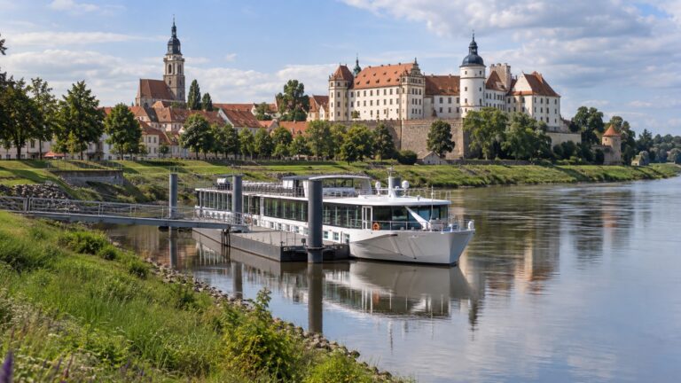
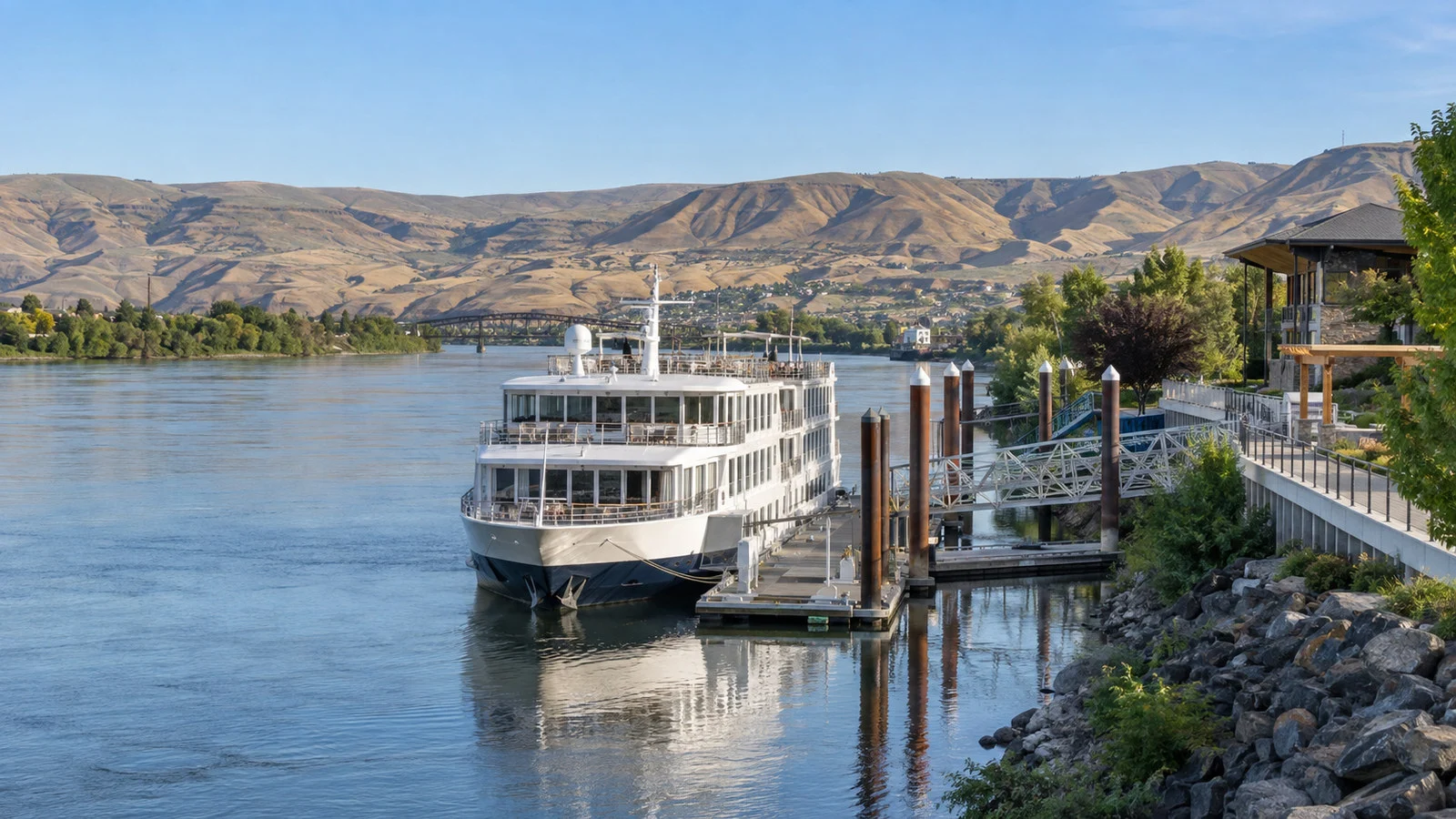
- Gateway Dock: This Clarkston landing sits on the Snake. The Port documents a 580-foot passenger dock, two secured ramps, and direct jet-boat capability; riverfront paths are convenient, but downtown still takes planning.
- 14th Street Dock: This Clarkston facility also sits on the Snake and serves larger cruise vessels during the April through October season. Its setting is industrial, so use the ship shuttle instead of improvising a walk.
This list identifies facilities, not tomorrow’s assignment. Vessel length, maintenance, simultaneous calls, security, water level, fueling, gangway geometry, and operator contracts can all move the ship.
Lewiston’s New Confluence Riverfront Dock
The Port of Lewiston says American Jazz made the inaugural docking at its new Confluence Riverfront facility in April 2025. American Cruise Lines also joined the formal opening, making the berth active infrastructure rather than a concept rendering with unusually happy pedestrians.
The dock sits on the Clearwater River near its meeting with the Snake. Phase one included a paved access road, coach turnaround, passenger parking, walkways, landscaping, lighting, and a new gangway operated by American Cruise Lines.
The Port retains dock ownership, while American manages dock operations. Later amphitheater and visitor-space concepts remain development plans, so do not expect every proposed building or amenity to exist on your sailing date.
Downtown Lewiston is not immediately outside the gangway. Allow roughly 5 to 10 minutes by shuttle or taxi as an editorial estimate, depending on the actual pickup point and downtown destination.
Clarkston Gateway Dock
The Port of Clarkston’s Gateway Dock is the valley’s established passenger landing at 849 Port Way. The Port describes a 580-foot dock with two secured ramps and says the layout allows passengers to transfer to jet boats bound for Hells Canyon.
The dock adjoins waterfront green space and paths, making a short riverside stroll more plausible here than at the industrial 14th Street facility. A pleasant path, however, is not the same thing as having Clarkston’s shops and every attraction at the gangway.
Central Clarkston is roughly a 15- to 25-minute walk from Gateway as an editorial estimate. Heat, wind, path closures, mobility, the ship’s exact position, and what you call “downtown” can move that number.
The Port’s visitor office is near the dock, and a local welcome crew may meet cruise calls. Availability is not guaranteed, so keep the ship’s contact and excursion instructions rather than treating a volunteer greeting as the information desk of a permanent terminal.
Clarkston’s 14th Street Dock
The 14th Street Dock began as freight infrastructure and also accommodates larger passenger vessels. The Port still identifies it as a cruise facility operating during the April through October season.
Its setting is more industrial and less useful for an independent walk. If assigned there, take the cruise line’s transfer and confirm which dock will handle any Hells Canyon boat connection.
Older planning reports explain that low water, capacity, vessel size, fueling, and simultaneous calls influenced its use. Those reports help explain the system, but they do not prove why your ship chose a particular berth today.
How Lewiston and Clarkston Fit Together
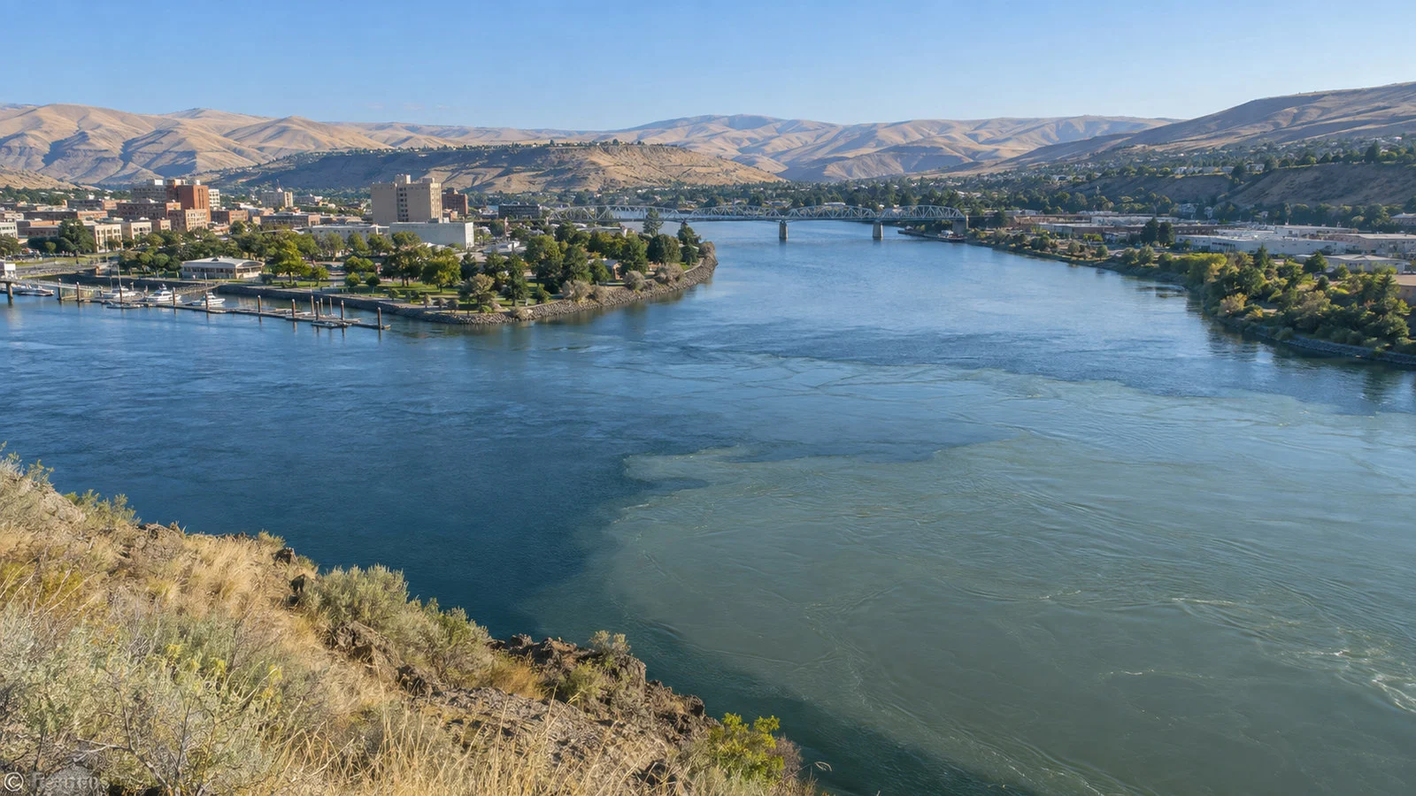
Lewiston occupies the Idaho side around the meeting of the Clearwater and Snake rivers. Clarkston faces it from Washington on the west bank of the Snake, with bridges joining the two cities and the smaller community of Asotin farther south.
The combined urban area is commonly called the Lewis Clark Valley. Crossing the bridge changes the state but not the clock, since northern Idaho and eastern Washington both observe Pacific Time.
Allow about 10 to 15 minutes by vehicle between the principal riverfront areas as an editorial estimate. Bridge traffic, road work, a coach turnaround, and the precise dock can lengthen the trip.
Walking across town and state is possible on selected routes, but it is a poor default on a timed call. Distances are longer than the two-city map suggests, summer heat can be severe, and not every bridge approach feels designed for a leisurely visitor stroll.
Hells Canyon Jet-Boat Excursions
Hells Canyon is the headline excursion, reached by jet boat upstream on the Snake. American Cruise Lines currently markets a Hells Canyon boat adventure from this stop and rates it moderate and not ADA accessible.
The vessel, departure dock, duration, rapids, meal, and turnaround point vary by program.
Gateway Dock can support direct transfer to a smaller jet boat, while other sailings may bus guests to another departure point. Follow the operator’s instructions instead of assuming every excursion begins beside the overnight ship.
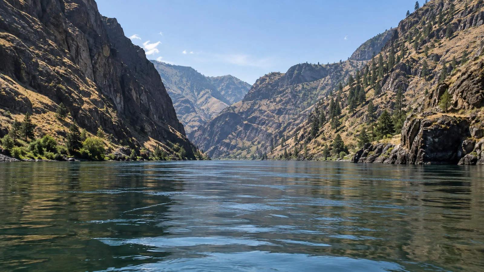
The trip moves from the broad developed river into steep, increasingly remote canyon country. It may include wildlife, geology, cultural sites, ranch history, and whitewater, but sightings and route access are never guaranteed.
A jet boat is not a placid glass-roofed sightseeing bus. Expect engine noise, wind, spray, vibration, sun exposure, steps or a sloped boarding surface, and stretches without immediate shore facilities.
Ask about restroom availability, shade, flotation devices, hearing protection, boarding steps, seat backs, and whether a wheelchair or walker can be secured. A passenger who can walk the overnight ship’s gangway may still find the smaller excursion craft inaccessible.
Hells Canyon National Recreation Area protects archaeological, historical, and natural resources. Leave artifacts in place, keep a respectful distance from wildlife, and do not treat petroglyphs or other cultural sites as props.
Whose History Is This?
The valley is the homeland of the Nimiipuu, also known as the Nez Perce. Their communities, government, language, cultural practices, fisheries, businesses, and stewardship are present realities, not an introductory chapter that ends when Lewis and Clark arrive.
The Corps of Discovery entered Nimiipuu country in 1805 after an exhausting Bitterroot crossing. Nimiipuu people provided food, knowledge, and assistance that were essential to the expedition’s survival and onward journey.
Later treaties, land loss, missionization, conflict, forced removal, and the 1877 flight require careful interpretation. A tour that jumps from “helpful tribe” to scenic canyon without those later consequences tells only the comfortable fraction of the story.
Nez Perce National Historical Park at Spalding
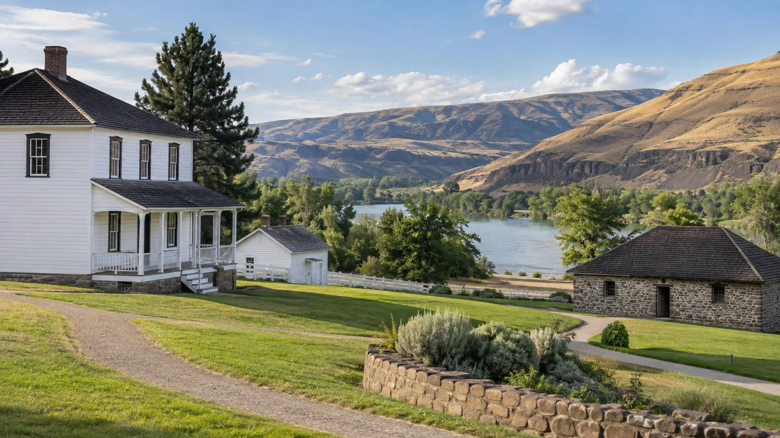
The Spalding visitor center of Nez Perce National Historical Park is the strongest regional history excursion. It lies about 11 road miles east of Lewiston on U.S. 95, generally 15 to 25 minutes each way by coach as an editorial estimate.
The National Park Service interprets Nimiipuu culture, homeland, encounters, treaties, the Lewis and Clark expedition, mission history, and the conflict of 1877 across 38 sites. At Spalding, the visitor center offers a museum, films, information, and access to outdoor sites and trails.
NPS accessibility planning documents describe a flat route from accessible parking, an automatic entrance, accessible restrooms, spacious exhibits, movable seating, tactile interpretation, and open-captioned films. Some outdoor trails are less accessible, and shade can be limited.
Check the park’s current alert and hours page before leaving, since staffing, weather, programs, and holiday closures change. Allow at least 60 to 90 minutes at the visitor center if you want more than a brisk lap around the exhibit cases.
Hells Gate State Park and the Discovery Center
Hells Gate State Park sits south of Lewiston on the Snake and should not be confused with Hells Canyon itself. It is a developed riverfront park, marina, campground, trail area, and home to the Lewis and Clark Discovery Center.
The Discovery Center presents the expedition and local landscape, while the park’s paths offer an easier outdoor option than a long canyon journey. Current Idaho Parks reporting lists the center open 9 a.m. to 5 p.m. daily except holidays, but confirm before travel.
From either city’s cruise area, allow about 10 to 20 minutes each way by vehicle as an editorial estimate. This is a sensible short excursion when a full jet-boat trip is too long, noisy, hot, or physically demanding.
Museums, Downtown, and Wine
The Nez Perce County Historical Society Museum at 0306 Third Street in Lewiston covers local and regional history. The valley visitor bureau currently lists Tuesday through Saturday hours from 10 a.m. to 4 p.m., which excludes some cruise-call days.
Downtown Lewiston offers restaurants, coffee, galleries, shops, historic commercial buildings, and public art. It is better reached by a ship loop or arranged ride from either cruise dock, then explored on foot in a compact cluster.
The Lewis-Clark Valley is also an American Viticultural Area with wineries on both sides of the state line and in the surrounding hills. Current cruise programs may include a tasting, but venues, included wines, food, and drive time vary.
Independent tasters should reserve transportation, verify hours, and carry identification. A scenic winery name is not evidence that it sits within walking distance of a dock, and the roads home deserve a sober driver.
Riverfront Trails and a Low-Key Port Day
Levee and greenbelt paths trace sections of the Snake and Clearwater, offering broad water views and connections among parks. The U.S. Army Corps of Engineers maintains the Lewiston Levee Parkway along the river system.
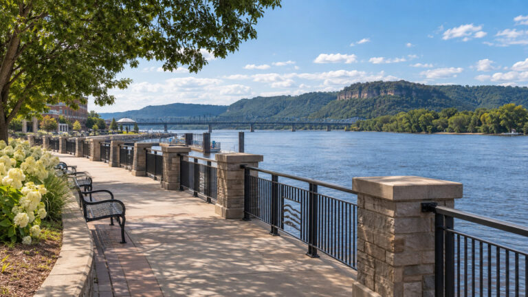
A short walk near Gateway Dock is the easiest independent option. At Lewiston’s Confluence Riverfront, use only opened, signed paths and remember that later project phases may still be under development.
For a relaxed day, combine a riverfront stroll with downtown lunch or one museum rather than treating both cities as a checklist. The state line is delightfully close, but collecting it on foot is less important than returning before the ship.
Accessibility at the Cruise Docks
All three cruise facilities involve a gangway or ramp whose slope changes with water level and vessel position. Secured ramps, paved access, and coach turnarounds help, but they do not guarantee step-free boarding for every mobility device.
Ask the cruise line whether your day’s dock requires stairs, a steep ramp, a transfer chair, rafting through another vessel, or a shuttle without a lift. Ask again after arrival, because berth and water conditions can change after the pre-cruise answer.
The Lewiston facility was built with paved walkways and a bus turnaround, while Gateway Dock has two secured ramps. The 14th Street facility is more industrial and should be approached as a transfer point, not an independent accessible promenade.
For broader mobility planning, compare our wheelchair-friendly cruise ports guide. At Lewiston and Clarkston, still ask specifically about gangway angle, coach lifts, smaller-boat transfers, restrooms, shade, and seating.
Heat, Smoke, Wind, and River Conditions
The valley has hot, dry summers, and triple-digit Fahrenheit temperatures are possible. Spring and fall can be pleasant, but mornings on the water may still feel cool before the afternoon turns warm.
Wildfire smoke can reduce visibility and make outdoor activity unhealthy, especially for guests with heart or lung conditions. Check the National Weather Service forecast and regional air-quality alerts before choosing a canyon trip or long walk.
Wind can affect gangways, small boats, and exposed riverfront paths. Wear grippy shoes, secure hats, carry water, and bring a light layer even when the forecast reads like an advertisement for iced tea.
Cold river water, current, commercial navigation, and dam operations make swimming from a dock unsafe. Use designated recreation areas and follow posted rules rather than interpreting a calm surface as an invitation.
Locks, Dams, and Schedule Changes
Reaching the valley by overnight ship requires passing the four lower Snake River locks at Ice Harbor, Lower Monumental, Little Goose, and Lower Granite. The U.S. Army Corps of Engineers operates all four for navigation alongside power, recreation, fish passage, and other purposes.
Those dams extend the navigable waterway to Lewiston, roughly 400 river miles inland from the Pacific system. They also make a cruise schedule vulnerable to lock maintenance, traffic, mechanical issues, sediment management, and water operations.
A late arrival does not automatically mean the port is “missed.” Operators may shorten a coach loop, swap excursion times, change the berth, or sail later to preserve the essential call.
Embarkation, Airport, and Transfer Planning
Lewiston Nez Perce County Airport, code LWS, is the local commercial airport. Its official site lists nonstop service to Seattle and Salt Lake City as of September 2026, but routes and frequency can change.
Allow roughly 15 to 25 minutes between LWS and the riverfront docks as an editorial estimate. The airport lists rental cars and notes that some valley hotels offer courtesy shuttles, but cruise transfers must be confirmed with the operator.
Current American Cruise Lines itineraries include a hotel stay, yet the hotel, meeting point, baggage rules, and actual embarkation city belong to your documents. A webpage naming Clarkston on the final day does not authorize you to send luggage independently to a Washington dock.
Arrive at least one day early when the cruise begins here. A small airport, limited flight frequency, wildfire disruption, and long ground alternatives leave little recovery room for same-day travel.
A Practical Port-Day Plan
With two to three hours, take the ship’s transfer to one downtown, visit one museum if open, and return with a generous buffer. If at Gateway Dock, a short greenbelt walk can fill leftover time without creating a cross-state rescue mission.
With four to five hours, choose Spalding or Hells Gate State Park plus a compact downtown stop. Both provide context and keep road time moderate.
With a full day, make Hells Canyon the main event and resist stacking another substantial tour afterward. Sun, noise, boat motion, and travel time make it a richer but more demanding outing than the words “scenic cruise” imply.
Final Verdict
Lewiston and Clarkston work best as one regional gateway with two honest labels. The new Lewiston berth improves access and changes old assumptions, while Clarkston’s Gateway and 14th Street docks remain important parts of the operating picture.
Verify the exact dock, choose one meaningful excursion, and give Nimiipuu history as much attention as expedition mythology. Sailing the full route also brings you to our documented Astoria cruise port near the Columbia’s Pacific end.
How We Researched This Guide
This guide was researched and fact-checked on September 12, 2026 using current American Cruise Lines schedules, Port of Lewiston and Port of Clarkston facility records, National Park Service accessibility material, Idaho Parks information, U.S. Army Corps of Engineers navigation pages, and official airport guidance.
Walking and driving times and several route descriptions are explicitly editorial estimates; no numerical missed-call rate is claimed. We do not claim a personal visit, and we do not turn a facility’s historical use into a guarantee about the next ship.
Dock assignments, hours, prices, flights, wildfire conditions, river operations, and excursions can change after publication. Our Editorial Policy explains sourcing, corrections, and how we handle operational uncertainty.
How this guide was researched: Unless a firsthand visit is explicitly identified above, this guide uses official port, tourism, transit, government, attraction, and operator sources where available. Details were checked against American Cruise Lines, Port of Lewiston, Port of Clarkston’s Gateway Dock and the US National Park Service.
Logistics and time-sensitive details were reviewed on September 12, 2026. See our Editorial Policy.