Vicksburg River Cruise Port: Landing, Battlefield and Downtown Guide
Vicksburg combines a close riverfront with a battlefield that is much larger and farther away than a downtown map suggests. The smart day starts by confirming the assigned landing and floodwall gate, then choosing either a reserved vehicle through the military park or a relaxed walk among the city museums and murals.
Quick take
Vicksburg is an active 2026 river cruise port and one of the Lower Mississippi’s most substantial history days. The National Military Park is the headline, but the floodwall, river museum, downtown streets, and modern working-waterway story make the call much richer than one battlefield tour.
Take the included park excursion if this is your first visit. The park’s 16-mile tour road is not a sensible walk from the ship, and a guide helps connect wooded earthworks, enormous memorials, the USS Cairo, and the human consequences of the siege.
Save some energy for the riverfront afterward. Vicksburg sits on steep loess bluffs, so a distance that looks delightfully tiny on your phone may arrive wearing a hill.
Quick facts
- Into Town: A city-front landing may put you by Levee Street; downtown lies beyond the floodwall and climbs uphill, with operator shuttles commonly provided.
- Currency and Language: US dollar and English. Cards are widely accepted, but small cash helps at museums, cafes, and for tips.
- Time Zone: Central Time, UTC-6 standard and UTC-5 daylight time, observed from March to November.
- Operational note: High or low water, floodwall access, river traffic, maintenance, or itinerary changes can move or shorten the call. No audited local missed-call rate is published.
A shifted landing, changed tour order, or shortened visit does not necessarily remove the Vicksburg call. Follow the operator’s daily program and current river and city notices.
Is Vicksburg an active river cruise port in 2026?
Yes. Visit Vicksburg publishes an official 2026 riverboat docking schedule, updated September 1, 2026, and warns that its dates remain subject to change.
Viking’s 2026 America’s Great River itinerary also schedules a Vicksburg day with the National Military Park, while American Cruise Lines continues to include Lower Mississippi programs built around Civil War sites. The evidence is clear that Vicksburg is an operating call, but it does not make one gangway location permanent for every ship and date.
Vicksburg usually appears between Natchez and ports farther north in the Delta or near Memphis, depending on direction and itinerary length. The Mississippi River cruise ports guide helps place it in the full sequence.
Where does a Vicksburg river cruise ship land?
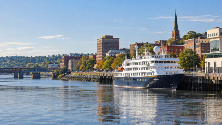
The useful answer is the city-front waterfront near Levee Street and the floodwall, subject to the operator’s assignment on the day. Do not treat a map pin, an old docking photo, or another ship’s position as a berth guarantee.
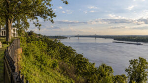
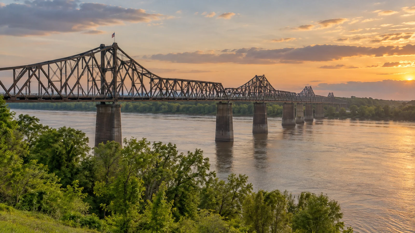
The more surprising answer is that this waterfront is on the Yazoo Diversion Canal rather than directly on the Mississippi’s present main channel. The City of Vicksburg explains that the Mississippi shifted away in 1876, and a federal project later diverted the Yazoo River through part of the former channel to restore harbor access.
The canal reconnected Vicksburg with river commerce and still links the waterfront to the Mississippi. Your vessel has unquestionably been cruising the Mississippi system, even if the water under the gangway carries a more specific label.
Ships may use a city dock, landing structure, or another operational position arranged with local authorities. River stage, dredging, commercial traffic, maintenance, vessel size, and the needs of other boats can all change where the crew secures the ship.
The floodwall is not just scenery
The long concrete floodwall between Levee Street and downtown is both infrastructure and an outdoor gallery. Its gates connect the waterfront with city streets during ordinary conditions and can be closed when the river rises.
A City of Vicksburg high-water notice documents closures at the China and Clay Street gates and says Levee Street at Jackson Street may close if a forecast reaches 50 feet. That page describes a specific high-water response, so it should not be read as a universal promise about every future event.
For a cruise guest, the practical lesson is simple: follow the ship’s designated route through the floodwall. A closed gate can turn a five-minute map line into a longer shuttle or walk through another opening.
The city also maintains pumping systems and flood gates along the Yazoo Diversion Canal to protect downtown businesses and streets. This is working flood protection, not decorative concrete that somebody forgot to remove.
Can you walk into downtown?
Usually, yes, if the assigned landing and floodwall gate are convenient and you are comfortable with slopes. The murals, Catfish Row area, and river museums are on or close to Levee Street, while Washington Street’s shops and restaurants sit inland and generally uphill.
Allow an estimated 5 to 15 minutes from a city-front landing to the murals and roughly 10 to 25 minutes to the central Washington Street blocks. Those are editorial walking estimates because the precise gangway and open gate can change.
Heat and humidity can make the return feel longer, especially from an attraction on the bluff. Take the shuttle when offered if steep grades, uneven paving, fatigue, or a tight all-aboard time could turn a pleasant ramble into competitive hill climbing.
Do not walk to Vicksburg National Military Park from the landing. The visitor center is at 3201 Clay Street, and the park is designed around a vehicle tour rather than a quick waterfront stroll.
Getting to Vicksburg National Military Park
Most cruise programs use coaches or smaller vehicles for the battlefield. The ride from the city-front area is roughly 10 to 15 minutes in normal traffic, an editorial estimate rather than a guaranteed operator transfer time.
The National Park Service planning page says orientation begins at the Clay Street Visitor Center with an 18-minute film. Visitors can then drive the historic 16-mile tour road through Union siege and Confederate defensive lines.
That scale is why an included excursion earns its keep. The park is a landscape of ridges, ravines, artillery positions, earthworks, memorials, cemetery ground, and separate stops rather than one museum behind a handsome front door.
A shorter cruise tour may sample only the visitor center, major monuments, and one or two signature sites. If the USS Cairo or African American Monument matters to you, check that it appears by name in the daily description instead of assuming every circuit includes it.
Understanding the siege without sanding off the history
Vicksburg’s position above the Mississippi made it strategically crucial during the Civil War. Union forces under Ulysses S. Grant campaigned to isolate the city, then besieged it until Confederate lieutenant general John C. Pemberton surrendered on July 4, 1863.
The military story is dramatic, but it did not happen in a moral vacuum. The Confederacy fought to preserve a slaveholding republic, and Union victory at Vicksburg advanced federal control of the Mississippi while slavery was being destroyed by war, emancipation, and the actions of enslaved people seeking freedom.
Civilians endured bombardment, hunger, displacement, and fear during the siege. Black Mississippians were not background figures: enslaved labor had built wealth and military infrastructure, freedom seekers reached Union lines, and African American soldiers and laborers contributed to the Union war effort.
The park’s memorial landscape was largely shaped decades after the battle, during an era of reconciliation that often centered white soldiers and softened slavery’s central role. Read monuments as historical objects with their own dates and agendas, not as neutral captions carved into stone.
What to notice in the park
The tour road and earthworks
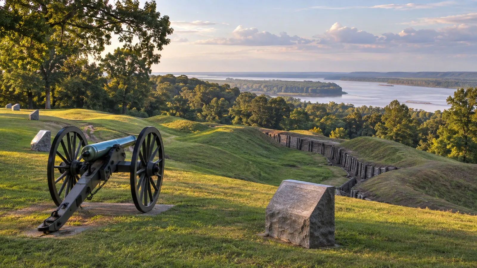
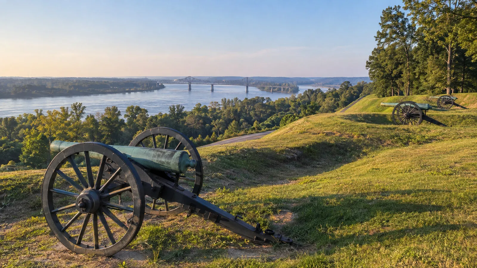
The NPS route traces opposing lines across terrain that explains the campaign better than a flat diagram can. Ravines and ridges repeatedly interrupt sight lines, revealing why attacks, artillery placement, supply, and trench work were so difficult.
The monuments range from modest regimental markers to elaborate state memorials. Ask when each was erected and whose story it emphasizes, because commemoration is part of the history here.
The USS Cairo
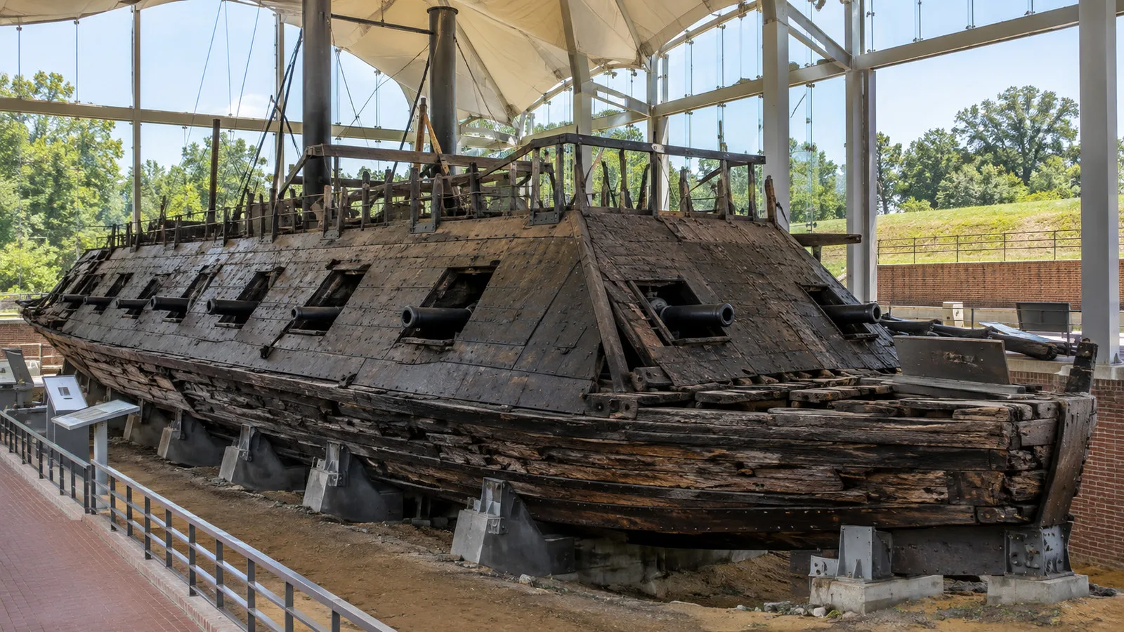
The ironclad USS Cairo was sunk by an electrically detonated mine, then called a torpedo, in the Yazoo River on December 12, 1862. It was raised exactly 102 years later and is now displayed with a museum inside the park.
The NPS USS Cairo guide identifies it as a 175-foot City-class gunboat with a crew of 251. Seeing its timbers and armor after arriving by modern river ship creates one of those unusually tidy connections between transportation and history.
The African American Monument
The Mississippi African American Monument portrays a soldier, a wounded soldier, and a civilian laborer looking back toward slavery. It broadens a memorial landscape that long underrepresented African American experiences.
If your tour bypasses it, ask whether a stop can be included or use the park map to understand its location. Its presence does not complete the entire story, but it helps correct a tour that might otherwise become a parade of tactics and marble generals.
Vicksburg National Cemetery
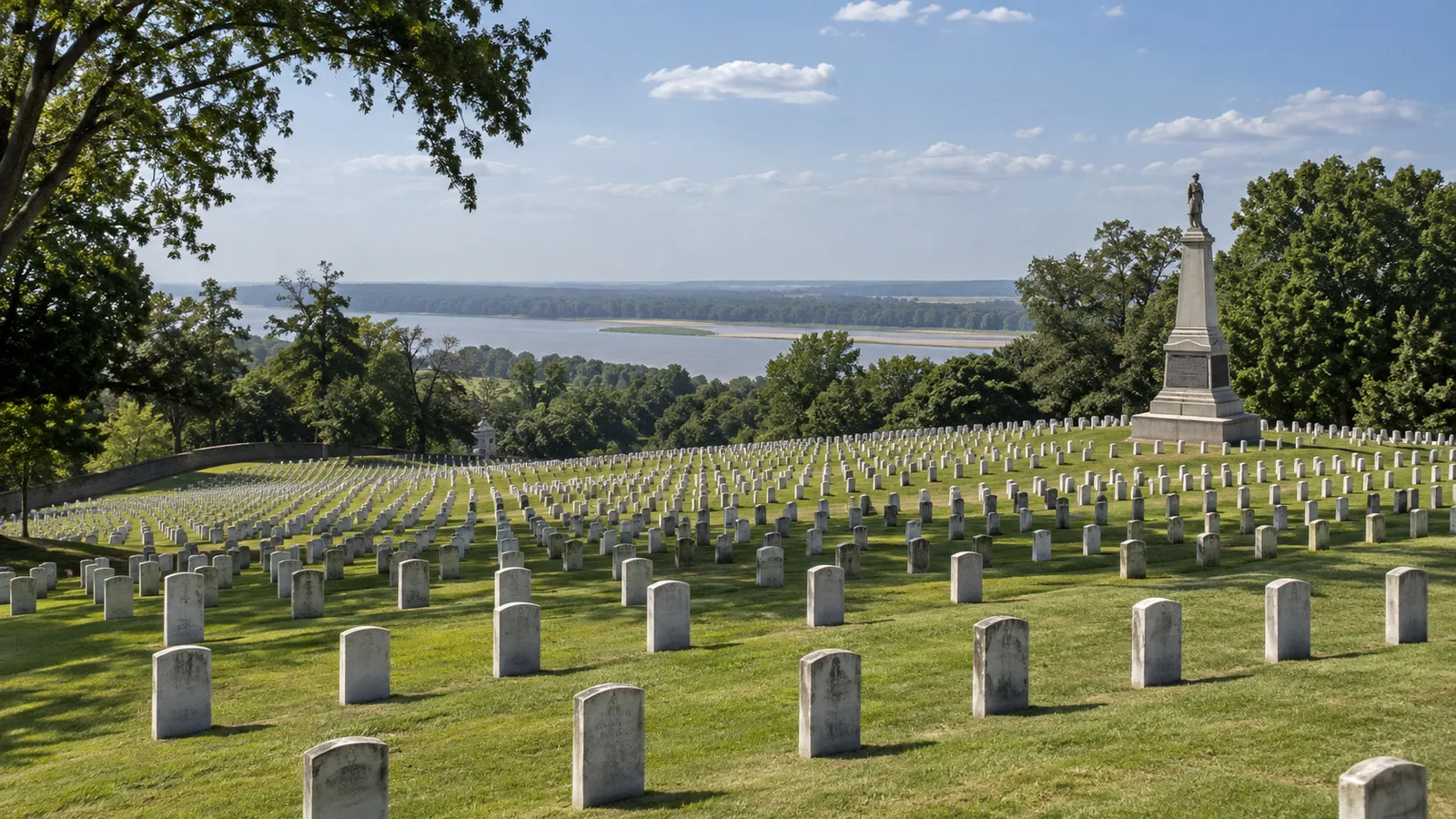
The national cemetery contains the remains of Union soldiers and later veterans, while Confederate dead are largely buried elsewhere. The rows make the cost of the campaign visible in a way that casualty numbers alone cannot.
Keep voices low, follow posted access rules, and remember that this remains a burial ground. A fast photograph is not worth separating from your group on a one-way tour road.
Accessibility at the park and waterfront
The National Park Service says the park has 16 miles of paved touring roads, accessible parking at the Visitor Center and USS Cairo, and mobility-friendly exhibits and restrooms. It also cautions that uneven surfaces and weather can affect access.
A vehicle tour is therefore the best starting point for limited-mobility guests, but not every monument overlook or historic surface will be step-free. Ask whether the coach has a lift, how many times passengers disembark, and whether the USS Cairo platform is included.
The waterfront is a separate accessibility question. Gangway slope changes with water level, the floodwall may channel pedestrians through a particular gate, and downtown’s bluff creates grades that a generic “walking tour” label does not describe very well.
Request exact measurements and assistance from the cruise line before sailing, then confirm the day’s arrangement with the crew. The river cruise accessibility guide has a practical checklist for gangways, coaches, restrooms, and mobility equipment.
If you stay downtown instead of touring the battlefield
Start with the Vicksburg Riverfront Murals along the floodwall. Their 32 pictorial panels and one abstract work cover river, railroad, military, commercial, and community history, though each panel deserves the same source-aware reading you would give a battlefield monument.
Nearby, the Lower Mississippi River Museum interprets navigation and the work of the U.S. Army Corps of Engineers. Confirm same-day opening hours before building your entire plan around it, since small museums can close for federal holidays, maintenance, or special conditions.
Catfish Row Children’s Art Park is an easy open-air pause, and the Washington Street district adds restaurants, galleries, and shops. The Old Court House Museum, Biedenharn Coca-Cola Museum, and Old Depot Museum can fill more time, but verify hours and admission directly because they are separate institutions.
Choose one or two interiors instead of collecting museum tickets like poker chips. Vicksburg rewards time spent looking across the canal and understanding how the city, floodwall, bluff, and river fit together.
High water, low water, and itinerary changes
High water can close floodwall gates, alter road access, steepen or flatten gangways, and change where passengers meet coaches. Low water can affect channel margins, landing geometry, sailing speed, and the sequence of calls even when the main navigation channel remains open.
Commercial tow traffic, fog, storms, mechanical issues, and port conflicts can also move the visit. The ship’s captain and local authorities make operational decisions from conditions that a long-range weather app cannot see.
Check the official National Weather Service river gauge, the city’s notices, and the cruise line’s daily briefing close to the call. The river cruise low-water guide explains why a changed berth or coach plan does not automatically mean the destination is canceled.
A practical battlefield route and return
Use the included excursion or reserve a driver who will wait through the complete Vicksburg National Military Park tour road. The park is not a practical walk from the landing, and a one-way taxi does not solve transportation between the scattered memorials, USS Cairo, and cemetery.
Check National Park Service alerts, operating hours, admission, and road closures on the morning of the call. Stay on open roads and paths, do not climb earthworks or monuments, leave artifacts where they are, and treat the national cemetery as an active place of remembrance.
Use the operator’s stated return margin and add more time if your driver is covering the full 16-mile park road. The floodwall gate and gangway are the final links, so seeing the vessel across the barrier does not mean you are back aboard.
Ask about an accessible excursion vehicle, secure mobility-device storage, gangway slope, and the exact stops the tour can reach without stairs or rough ground. Heat, thunderstorms, high water, low water, and a changed landing can alter an otherwise accessible plan.
Foreign visitors must meet current United States entry requirements for their nationality and voyage, even when the line handles port clearance. Carry the passport or ship identification specified in the daily program rather than assuming a domestic river itinerary removes document checks.
Three realistic ways to use the call
First visit: battlefield first
Take the included National Military Park tour, prioritizing the visitor center, terrain, major memorials, and USS Cairo if offered. Use any remaining time for the floodwall murals rather than racing uphill to a third museum.
Repeat visit: downtown and river engineering
Walk the murals, visit the Lower Mississippi River Museum if open, and explore Washington Street at a comfortable pace. This version replaces military chronology with the equally Vicksburg story of navigation, flood control, commerce, and city life.
Limited mobility: vehicle-centered day
Confirm lift-equipped transport and stay aboard for the park’s scenic drive, choosing only the most accessible disembarkation points. Back at the ship, use any operator shuttle rather than tackling the bluff simply because the map says “0.4 miles.”
Quick answers
Does the ship dock on the Mississippi River?
Usually not on the present main navigation channel. The city-front waterfront uses the Yazoo Diversion Canal, which follows part of the Mississippi’s former course and connects with the river.
Can I walk from the ship to Vicksburg National Military Park?
It is not a practical cruise-day walk. The park begins several miles from the waterfront, has a 16-mile tour road, and is best visited by operator coach, taxi, or arranged vehicle.
Is downtown close to the landing?
The riverfront attractions can be very close to a city-front landing, while Washington Street lies inland and uphill. The actual walk depends on the gangway location and which floodwall gates are open.
Is Vicksburg suitable for wheelchair users?
Much of the park can be experienced by vehicle, with accessible parking and facilities at major sites. The variable gangway, uneven outdoor surfaces, coach equipment, and steep downtown grades require advance confirmation.
Will high water cancel the call?
Not automatically. High water may close gates or change access, while operators can sometimes adjust the landing, shuttle route, timing, or excursion before canceling Vicksburg entirely.
The last word
Vicksburg is not a soft-focus river town designed to supply one battlefield and a biscuit. It is a bluff city shaped by water, war, slavery, emancipation, engineering, commerce, memory, and the continuing need to decide which stories receive the biggest monument.
Let the ship handle the variable landing, take a vehicle to the park, and leave room for the riverfront itself. The best Vicksburg day connects the canal beneath your gangway with the larger Mississippi story unfolding beyond it.
How this guide was researched: No firsthand visit is claimed; current docking, floodwall, battlefield, accessibility, itinerary, and river details were checked against Visit Vicksburg, the City of Vicksburg, the National Park Service, Viking, American Cruise Lines, and official river sources.
Logistics and time-sensitive details were reviewed September 12, 2026. See our Editorial Policy.