Pago Pago Cruise Port: A Practical Guide to Tutuila
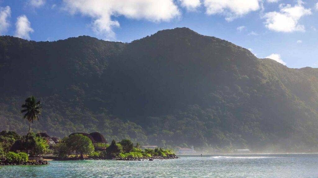
Pago Pago places your ship inside a steep volcanic harbor, with Fagatogo nearby and the National Park of American Samoa spread across Tutuila. A town morning is easy, while north-coast trails require arranged transport and realistic time.
Use the market, museum, and park visitor center for a flexible short call. Choose Vatia, Pola Island Trail, or a beach only with a driver who understands village access and the ship’s return time.
My quick take
The waterfront core is compact, but heat, rain, traffic, and uneven sidewalks can make the walk slower than the map suggests. Nature is the highlight, and most national-park scenery begins with a drive.
If this is part of a wider Polynesian itinerary, it pairs naturally with Apia in independent Samoa and the other South Pacific cruise ports.
The quick facts
- Where you land: the main wharf in Pago Pago Harbor on the island of Tutuila, right below Rainmaker Mountain and about half a mile from Fagatogo, the territory’s downtown.
- Dock or tender: Ships come alongside the wharf, so you step straight off onto the pier.
- Into town: Fagatogo’s market, Jean P. Haydon Museum, and National Park Service visitor center are roughly a 10 to 20 minute walk depending on the berth and port exit.
- Currency and language: The US dollar, since this is a US territory, with ATMs in Fagatogo.
- Time zone: American Samoa Standard Time (SST, UTC−11), with no daylight saving time. Independent Samoa is one calendar day ahead despite being nearby.
- How often the call is missed: Low (under 1%): tropical storms can make the approach unsafe.
Fun fact worth knowing before you look out from the rail: the harbor is a flooded volcanic crater, which is why it forms one of the deepest, best-sheltered natural anchorages in the South Pacific.
Getting around
Walk only after the ship confirms the safe port exit and route toward Fagatogo. For anything outside the harbor core, arrange a taxi, aiga bus, or tour before spending too much of a short call waiting.
- Taxis: Agree the destination, waiting time, total fare, and currency before departure because meters are not standard. Keep the driver for remote trailheads or beaches where a return car may not appear.
- Aiga buses: These cash buses follow village routes but do not keep a visitor-friendly fixed timetable and may finish early. Use them for a flexible ride only, never for the last possible return from the north coast.
- Ship or local tours: The simplest way to reach the north coast and the national park in a short day is a guided tour or a hired driver.
The stops I’d actually spend time on
1. National Park of American Samoa
This is the reason to come. The National Park of American Samoa is the only National Park Service site south of the equator, protecting rainforest, coral reef, and the islands’ giant fruit bats.
Start at the free National Park Service visitor center for current trail, weather, and village-access advice. Hours can be limited, so check the official NPS page before walking over.
2. Mount Alava
Mount Alava Trail is roughly 7 miles round trip and takes several hours in heat, humidity, mud, and elevation gain. Check current NPS conditions and attempt it only on a long call with transport to the trailhead and a firm turnaround.
A long aerial tramway once crossed the harbor to television facilities on Mount Alava. It no longer operates, so the summit is a hiking destination and the remains should not be treated as visitor infrastructure.
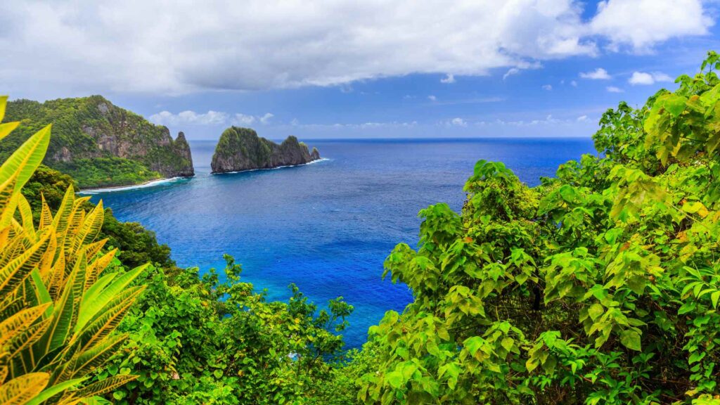
3. Pola Island Trail at Vatia
Pola Island Trail is short, but reaching Vatia from the port takes a winding cross-island drive and village roads. Ask permission where required, carry water, and stay off the coastal rocks when surf is high.
It is one of the most photogenic spots in the territory and a manageable stop on a north-coast drive. Bring water and reef-safe footwear.
4. Blunts Point Battery
Just east of the harbor, a short path climbs to the WWII six-inch naval guns of Blunts Point, positioned to defend the harbor mouth. American Samoa was a key US staging point in the Pacific war, and these wartime batteries are part of that story.
5. Jean P. Haydon Museum
A small, walkable museum in Fagatogo covering Samoan tools, tapa cloth, and island history. It is a quick, worthwhile primer on fa’a Samoa before you head out to the villages.
6. Fagatogo Market
The main market a few minutes from the pier is the best place to see everyday island life. Look for taro, breadfruit, tropical fruit, and woven handicrafts.
It is busiest early and much quieter on Sundays. Cash in small bills makes browsing easy.
7. Rainmaker Mountain (Mount Pioa)
The dramatic peak looming over the harbor is Mount Pioa, known as Rainmaker Mountain because it catches the clouds that give Pago Pago its heavy rain. You do not need to climb it to appreciate it; the classic view is from the harbor road.
8. Two Dollar Beach
Two Dollar Beach is a privately managed beach whose current admission can cost more than the historic name suggests. Confirm opening, price, facilities, and swimming conditions before making the drive.
9. Tisa’s Barefoot Bar, Alega
A well-loved beach bar on Alega Beach, a short drive from town, with fresh seafood and a laid-back setting. Call ahead if you want the umu feast, since it is prepared to order.
How I’d plan the day
- 3 hours: Walk into Fagatogo for the market and the Jean P. Haydon Museum, then stroll the harbor front for Rainmaker Mountain views.
- 5 hours: Add a taxi to Blunts Point for the WWII guns and harbor panorama, and stop at the national park visitor center.
- 8 hours: take a guided north-coast run to Vatia and the Pola Island Trail, with one beach or village-approved stop on the return. Aim to reach the port 90 minutes before all-aboard, earlier in heavy rain.
Respecting local customs
Village life here runs on fa’a Samoa, and a little courtesy goes a long way. The park service asks visitors to ask permission before entering villages or using village beaches, and to respect the quiet.
- Sundays: Expect churches full, shops closed, and villages observing rest and evening prayer. Keep noise down if you pass through.
- Dress: Cover up away from the beach, and dress modestly in villages.
- Photos: Ask before photographing people, homes, or ceremonies.
When to go, and the weather
Tutuila is tropical, warm, and humid year round, with daytime temperatures usually in the low to mid 80s Fahrenheit. The drier months from about May to October are the most reliable for hiking and beaches.
Rain can arrive fast and heavy at any time, so pack a light layer and reef-safe footwear. Humpback whales pass through South Pacific waters roughly from mid-year into late in the year, so keep an eye on the harbor.
A realistic word on accessibility
Alongside berthing avoids a routine tender, but gangway slope, port-surface condition, and the safe pedestrian exit vary. Ask the line about assistance and accessible pickup before disembarking.
Aiga buses are not reliably wheelchair accessible, and Mount Alava, Blunts Point, and beach sand require difficult transfers or rough walking. A private vehicle tour with the NPS visitor center and harbor viewpoints is the most adaptable plan.
Entry rules are not the same as the mainland U.S.
American Samoa controls its own immigration system, so a U.S. visa or ESTA does not automatically answer every entry question. Cruise passengers commonly clear under ship arrangements, but confirm your nationality and itinerary with the cruise line and American Samoa Immigration.
Carry only the passport or photo identification the ship tells you to take ashore. Keep the ship card, local contact number, and small U.S. dollar bills for buses, markets, beaches, and taxis.
Rain, heat, and the return plan
Pago Pago is one of the wetter Pacific capitals, and trails can become muddy or unsafe quickly. Ask the NPS visitor center about conditions, carry water and insect repellent, and abandon a ridge walk when clouds or heavy rain build.
Allow 60 to 75 minutes from Fagatogo and 90 minutes from an outer-village drive to the gangway. Add more for an aiga bus because there is no guaranteed departure or capacity.
Quick answers
Is Pago Pago safe for cruise visitors?
American Samoa is generally welcoming to cruise visitors, but it has its own border rules and village customs. Use normal theft precautions, avoid isolated areas after dark, and follow local permission requests.
The main things to respect are Sunday observance and village etiquette.
Do I need money, and what currency?
The US dollar is the local currency, and there are ATMs near the port in Fagatogo. Carry small bills for the market, beaches, and buses.
Can I explore on my own?
Easily around town, which is compact and walkable. For the north coast and the national park trails, a taxi or guided tour is far more reliable than the informal bus network.
For more Pacific stops, see our South Pacific hub and this guide to the most walkable cruise ports.


How this guide was researched: Unless a first-hand visit is explicitly identified above, this guide is based on independent research using official port, tourism, transit, government, and attraction sources where available. Logistics and time-sensitive details were reviewed in September 2026; see our Editorial Policy.