Kristiansund Cruise Port: Quays, Harbor Ferry & Atlantic Road
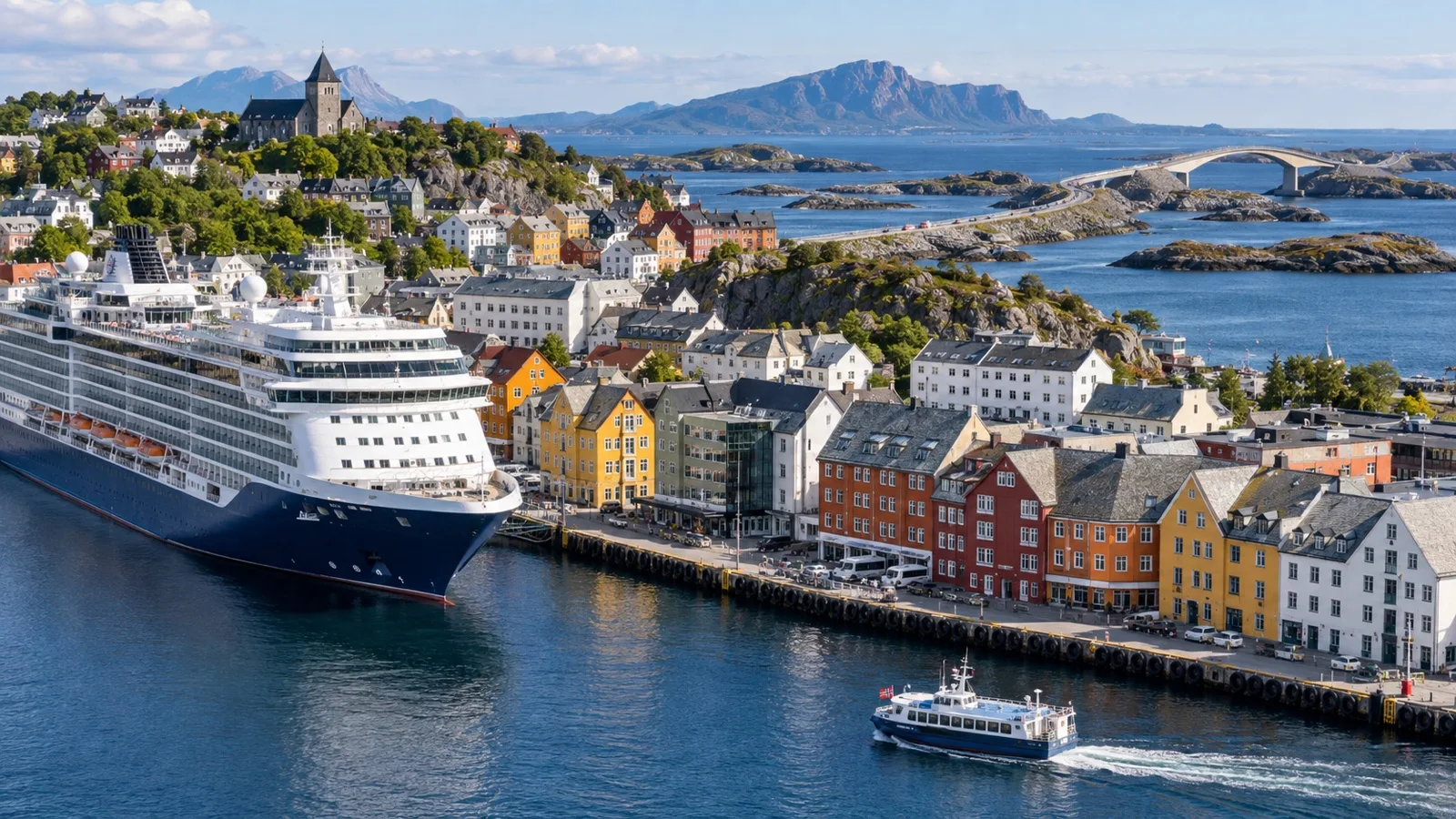
Kristiansund is a city built across islands, so the harbor is not scenery added to the destination. It is the destination’s organizing idea, and a small public boat can make the city legible faster than any bus tour.
Beyond town, the Atlantic Road curves between reefs and bridges while the old fishing settlement of Grip sits in the open sea. Both are tempting, but each asks you to choose a different scale for the day.
Two central quays, one important detail
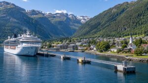
Cruise calls commonly use central Storkaia or Devoldholmen, and both put Kristiansund’s harbor city within practical reach. Your ship’s daily program remains the authority because berth assignment, gangway position, pedestrian routing, and local traffic can change.
Save the quay name before you walk away. A taxi driver, guide, or helpful resident needs more than the ship’s name if another vessel or port operation is active.
Alongside arrival removes the tender queue, but the gangway can still be steep or moved during the call. Follow the marked route through the working port and listen for announcements about any change.
Quick facts
- Main cruise areas: Central Storkaia and Devoldholmen quays, with the exact berth confirmed onboard
- Port style: Normally alongside, subject to the ship and operational plan
- Currency: Norwegian krone
- Language: Norwegian, with English widely used in visitor settings
- Best easy day: Central harbor, Sundbåten, clipfish history, and a city viewpoint
- Best road excursion: Atlantic Road with a cruise-aware driver or ship tour
- Best boat excursion: Grip only with a confirmed sailing and generous return margin
- Main risks: Weather, road timing, small-boat conditions, and returning to the wrong quay
Use the harbor as your map
Kristiansund spreads across four principal islands linked by bridges and the Sundbåten harbor boat. Begin at the water, identify the central stops, and let the ferry show you how close the islands are to one another.
The city was heavily damaged during World War II and rebuilt, so its architecture mixes maritime remnants, postwar planning, and newer waterfront development. Look for the relationship between working quays, painted houses, churches, warehouses, and open water rather than expecting a single preserved old town.
Sundbåten: public transport as sightseeing
Sundbåten is Kristiansund’s public harbor ferry and one of the most delightful ways to understand the city. It links island neighborhoods through the inner harbor, turning an ordinary local journey into a ready-made cruise-day circuit.
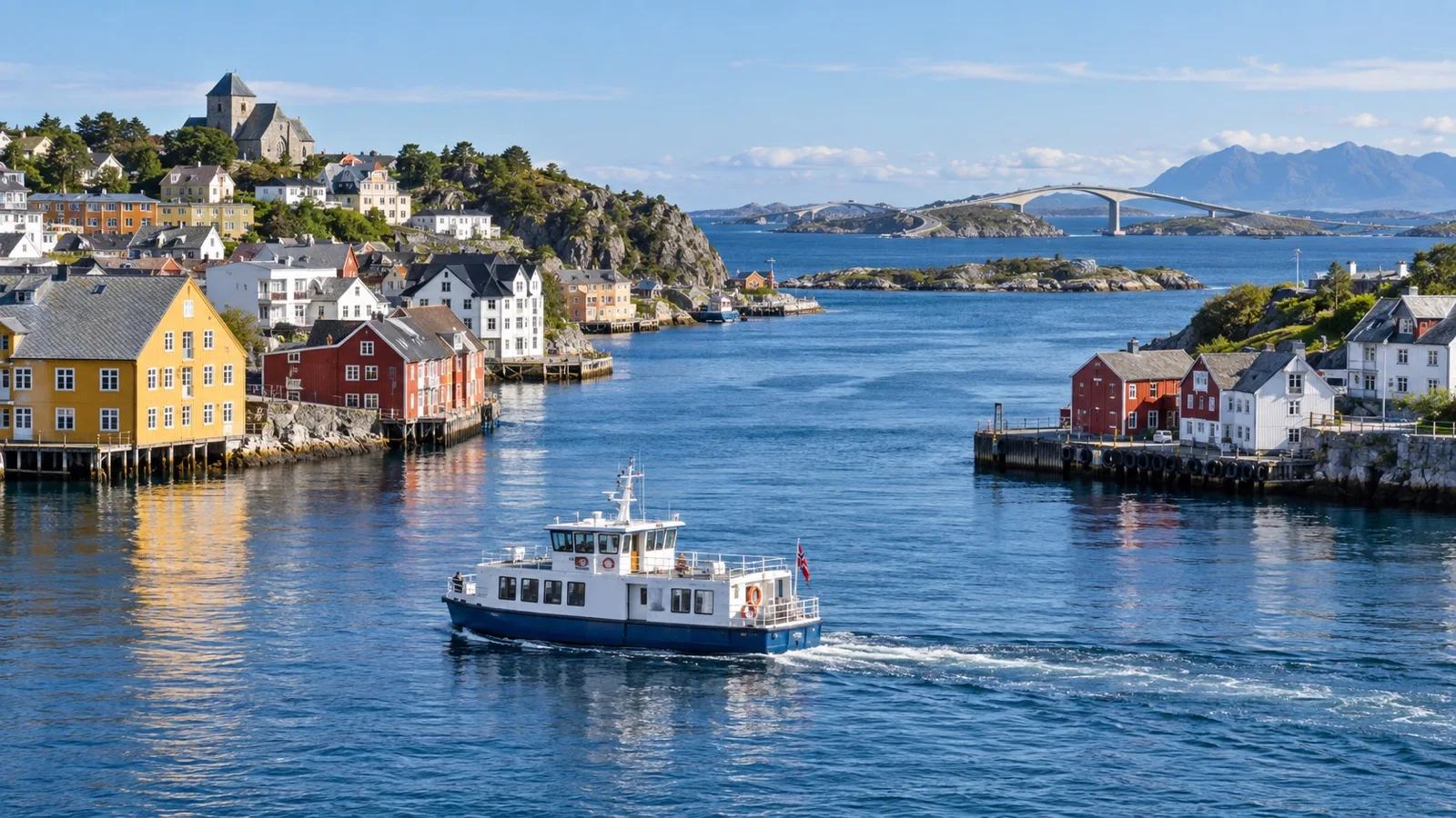
Use the municipality’s current route and timetable rather than relying on a screenshot from a previous season. Stops, service patterns, fares, and operational changes matter when your ship has a fixed all aboard time.
How to ride it well
First identify the stop closest to your cruise quay and confirm which direction the boat is traveling. Ask the crew or visitor information office if the route is not obvious, because a charming detour becomes less charming when you are counting minutes.
A full or partial loop can be enough for harbor views without a long walk. Sit where you can see the waterfront, but keep aisles clear for local passengers who use the boat as daily transport.
Do not confuse the harbor ferry with an excursion boat
Sundbåten serves the city harbor, while Grip excursions and other sightseeing boats operate on different routes and schedules. Confirm the vessel, departure point, ticket, and return before boarding anything.
The distinction sounds obvious until several boats are moving around the same waterfront. A photo of the quay sign and operator details can prevent an expensive misunderstanding.
The clipfish story explains Kristiansund
Kristiansund grew through the production and export of clipfish, cod preserved by salting and drying. That history connects the warehouses, harbor, international trade, labor, food traditions, and cultural ties you encounter across the city.
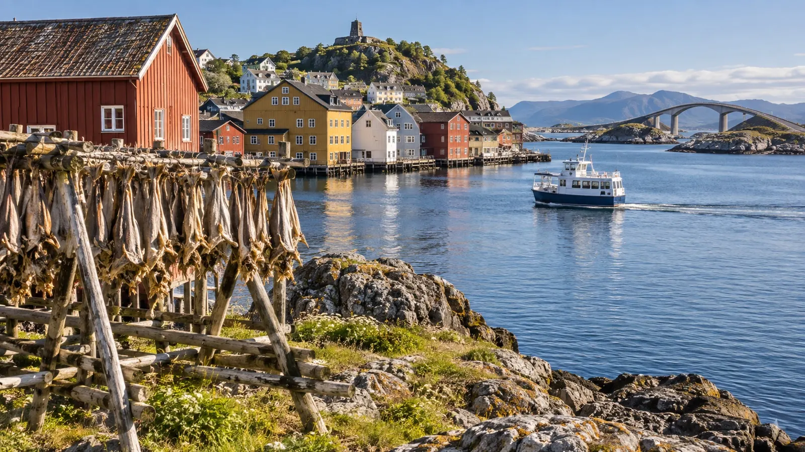
The Norwegian Clipfish Museum gives the most focused explanation, but its seasonal opening and access should be checked directly. Do not assume a museum in a historic industrial setting follows year-round city-gallery hours.
What to notice
The clipfish story is not only about a finished food. It is about weather, salt, trade routes, physical work, business fortunes, and the communities shaped by a global product.
If the museum is closed, local interpretation, harbor buildings, and a meal featuring bacalao can still connect the day to that history. Ask where the dish is prepared traditionally and check restaurant hours before postponing lunch.
A city loop for architecture and outlook
Central Kristiansund is compact, but its islands and grades make route choice important. Combine the harbor with one neighborhood, church, or viewpoint rather than trying to walk every bridge.
Kirkelandet Church
Kirkelandet Church is a striking modern landmark associated with the postwar rebuilding of the city. Check current opening and respect services, since it is an active place of worship rather than a guaranteed visitor attraction.
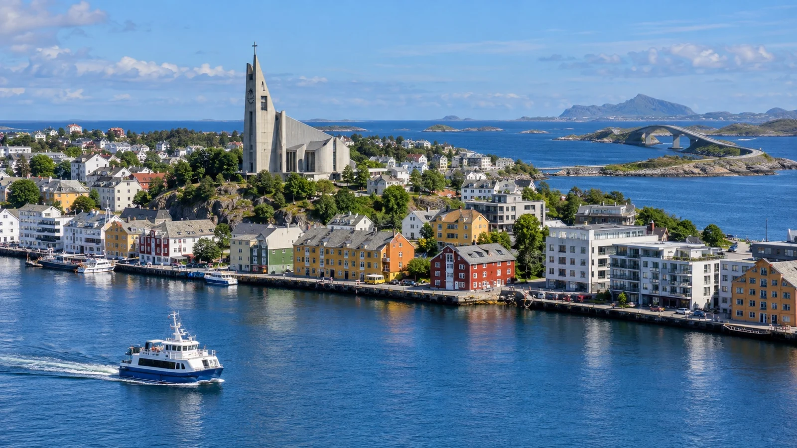
The building makes most sense when placed beside Kristiansund’s wartime destruction and reconstruction. A short visit can say more about the modern city than a long search for an untouched medieval center.
Varden viewpoint
Varden provides broad views over the islands, harbor, and surrounding sea when visibility is good. The approach and grade require more effort than a flat quay walk, so choose transport or pace based on mobility and weather.
Low cloud can remove the panorama while wet or icy surfaces increase the difficulty. Ask locally about conditions and keep an indoor backup instead of treating the viewpoint as mandatory.
Innlandet and old harbor character
Innlandet retains a quieter coastal character and can be reached as part of a ferry or walking plan. Residential areas deserve normal courtesy, so keep doorways clear and photograph the streets without treating homes as exhibits.
A partial harbor circuit often gives enough of this atmosphere. You do not need to cover every island to understand that Kristiansund’s identity is distributed across the water.
Atlantic Road: famous for good reason
The Norwegian Scenic Routes program describes Atlanterhavsvegen as a road across the sea, curving between islets and reefs with seven bridges. Its designated scenic route runs 36 kilometers between Kårvåg and Bud, though cruise excursions may cover only selected sections and viewpoints.
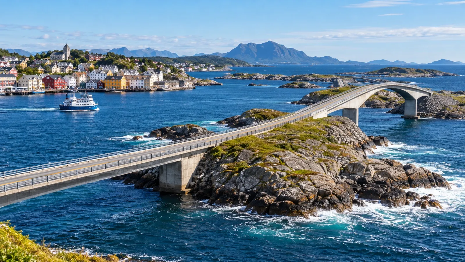
The attraction is not a single bridge beside the port. Reaching the iconic road, stopping safely, walking at viewpoints, and returning to Kristiansund require a proper vehicle plan.
Ship excursion
A ship excursion gives the clearest return protection and can combine the road with coastal interpretation or another local stop. Read the description closely because some tours cross key bridges while others continue farther along the official route.
Coach windows are part of the experience, but the best tours allow safe time outside at a designated viewpoint. Weather determines whether that stop feels dramatic, gentle, or very brief.
Private driver
A private driver can adapt the route to light, mobility, and traffic. Agree on the essential bridge or viewpoint, the turnaround point, and the latest return to the assigned quay before departure.
Do not let the route expand toward every village someone recommends. One excellent coastal stop and an unhurried crossing are better than a long windshield day followed by a nervous dash.
Driving independently
A rental car creates freedom but also adds pickup, paperwork, navigation, parking, fuel, and return logistics. Confirm that the rental office hours and location fit the call before reserving.
Norwegian road conditions can change with wind, rain, maintenance, and seasonal weather. Check the Norwegian Public Roads Administration’s live traffic information and never stop outside designated areas for photographs.
Eldhusøya and viewpoints
The official scenic-route site describes the elevated walking path at Eldhusøya as accessible to all. Current surface, wind, snow, maintenance, and individual mobility still need consideration on the day.
Viewpoints are designed to help travelers experience the coast safely. Use them rather than stepping into traffic or onto exposed rocks to recreate a photograph.
Grip Island is a real commitment
Grip is a small, weather-exposed island settlement northwest of Kristiansund, reached by seasonal passenger boat. Its historic buildings, compact lanes, church, and ocean setting make it special precisely because it is not an easy urban stop.
The official scenic-route information notes that Grip lies about 14 kilometers from Kristiansund and that the boat journey takes roughly an hour. For a cruise passenger, the meaningful number is the entire round trip including check-in, sea time, island visit, and return margin.
Book the exact sailing
Confirm that the operator is running on your date, has space, and will return early enough for the ship. Small-boat excursions can change or cancel because of sea conditions even when central Kristiansund remains calm.
A booking confirmation should identify the departure quay and check-in time. Compare those details with your ship’s berth rather than assuming all waterfront departures share one location.
What the island requires
Expect boat boarding, exposure to wind and spray, uneven outdoor surfaces, and limited flexibility once the vessel leaves. Warm layers, a waterproof shell, secure shoes, and protection for electronics are sensible even on a bright morning.
Facilities and interior access may be limited or seasonal. Ask the operator about restrooms, seating, food, mobility, and what happens if the outbound trip is delayed.
When to choose something else
Skip Grip if the return lands close to all aboard, if the sea forecast is unsettled, or if small-boat transfers do not suit your body. The harbor ferry can still deliver a satisfying water-based day without taking you into the open ocean.
Choose land, harbor, or ocean
Easy harbor day
Walk the central waterfront, ride part of the Sundbåten route, and visit the clipfish museum if open. Add a local lunch, Kirkelandet Church, or a gentle neighborhood walk before returning to the ship.
This plan flexes beautifully with weather and energy. It is the best first choice for travelers who want Kristiansund itself rather than a famous road photograph.
Atlantic Road day
Use a ship tour or cruise-aware driver to reach the scenic route and one or two designed viewpoints. Return with enough time for a short harbor walk and an early meal near the quay.
If weather slows the drive, drop the final stop. The road remains dramatic even when the schedule is simplified.
Grip day
Reserve the correct seasonal boat, verify the return, and let the island be the main event. Do not attach the Atlantic Road or a complicated museum list to the same plan.
Use any remaining time in central Kristiansund only after the excursion has safely returned. A coffee beside the harbor is a perfectly good final chapter.
City and viewpoint day
Take the harbor ferry, explore one island neighborhood, and reach Varden only if visibility and surfaces are favorable. Complete the day with the clipfish story or a city-center meal.
This gives you both the geographic overview and local history without a long road transfer. It also leaves multiple ways to shorten the day.
Accessibility from quay to island
Alongside arrival avoids a cruise tender, but the gangway angle and distance to the secure exit vary. Ask the cruise line about wheelchair, scooter, and assistance procedures before sailing, then confirm after the berth is assigned.
Central sidewalks and quay routes may be manageable for many travelers, while hills, bridges, construction, snow, and ice can change the practical path. The shortest line on a map is not always the easiest route.
Ask Sundbåten about the specific vessel, ramp, tide, stop access, and mobility equipment before depending on it. Public transport can be accessible while a particular boarding condition still requires judgment.
Grip involves a different boat and open-sea conditions, so treat its accessibility separately. The operator should explain gangways, steps, seating, toilets, island terrain, and whether assistance is available.
For the Atlantic Road, an appropriate vehicle and carefully chosen viewpoint can make the excursion more manageable. Confirm vehicle steps, wheelchair storage, walking distance, and current path condition in advance.
Weather on the ocean edge
Kristiansund’s weather is not background information because it affects road views, small boats, walking surfaces, and comfort. Bring a waterproof and wind-resistant layer, warmth you can adjust, and shoes with dependable grip.
A bright morning can become misty or wet, while strong wind is possible even when the temperature feels mild. Protect loose hats and phones on exposed viewpoints.
Grip may cancel while the Atlantic Road remains open, or the road may be unpleasant while museums and harbor boats operate normally. Keep a city plan ready so a weather decision does not feel like a lost day.
Money, food, and practical details
Norway uses the Norwegian krone, and cards are widely accepted. Carry a backup payment option because a drained phone or blocked card can still complicate a simple purchase.
Bacalao and other seafood dishes connect the meal to Kristiansund’s clipfish heritage. Check restaurant opening, serving times, and allergy details rather than expecting every waterfront kitchen to serve the same menu all day.
Download the ship’s berth name, all aboard time, maps, and operator contacts before leaving. Mobile coverage is useful but should not hold the only copy of your return plan.
Return timing by geography
For the central harbor, be back near the assigned quay well before all aboard and use the marked secure entrance. Do not return to Storkaia if the ship is at Devoldholmen merely because that is where a website’s map pin appeared.
For the Atlantic Road, work backward through photo stops, road travel, possible traffic, port access, and ship security. Ask the driver for the day’s local estimate and add a genuine delay buffer.
For Grip, the scheduled boat return must leave room for disembarkation, walking between quays, and security. A marine excursion landing close to all aboard is not a safe independent plan.
Keep your cruise card, required identification, ship contact, and funds for alternate transport with you. If a delay develops, contact the appropriate operator or port agent early rather than waiting for the final minutes.
Frequently asked questions
Where do cruise ships dock?
Storkaia and Devoldholmen are the central cruise areas commonly used in Kristiansund. Verify the exact quay and gangway route in the ship’s daily program.
Can I explore without an excursion?
Yes, and the harbor city is well suited to an independent day. Combine Sundbåten, clipfish history, central architecture, a viewpoint, and lunch according to weather.
Is Sundbåten a sightseeing cruise?
It is local public transport across the harbor, which happens to offer excellent views and geographic context. Use the current official timetable and remain considerate of everyday passengers.
How far is the Atlantic Road?
It requires a road excursion from Kristiansund, and the official scenic route itself covers 36 kilometers between Kårvåg and Bud. Cruise tours often focus on selected bridges and viewpoints rather than driving every part.
Can I visit Grip on a cruise day?
Yes, when a seasonal operator has a sailing with a safe return margin and sea conditions permit. Reserve in advance and confirm the exact boat and departure quay.
What is the best bad-weather plan?
Stay in the harbor area, use museums and cafes, and ride Sundbåten only if service is operating comfortably. The city’s clipfish history makes the close-to-ship day substantial rather than a compromise.
Which image is the classic Atlantic Road view?
The Storseisund Bridge is the structure many travelers recognize, but the experience is the wider sequence of bridges, reefs, sea, and designed viewpoints. Let the weather create your version instead of chasing one camera angle.
Sources and update note
This guide was checked against the Norwegian Scenic Routes Atlantic Road page, the Kristiansund municipality’s Sundbåten information, the Norwegian Clipfish Museum, the Kristiansund port, and current ship operating guidance. Quays, ferry routes, museum hours, boat excursions, road conditions, and weather decisions can change, so verify them for your call.
Kristiansund makes sense when you let the harbor choose the rhythm and commit to either the city, the Atlantic Road, or the open-sea journey to Grip. Confirm the quay, dress for the coast, and protect the return so the islands remain a pleasure rather than a puzzle.