Mazatlán Cruise Port: Old Town, Safety, and What to Do
Mazatlán has real old-town soul, but this Mexico stop calls for careful planning. Sinaloa state carries a serious travel advisory, so keep the day focused on established tourist areas and reputable transport.
Read this safety note first
Mexico overall sits at Level 2 (exercise increased caution), but the state of Sinaloa, where Mazatlan is located, is at Level 4 “Do Not Travel” due to crime and terrorism, per the U.S. State Department Mexico advisory.
The May 29, 2026 advisory allows U.S. government employees to reach Mazatlán only by air or sea, then limits them to the historic center from Avenida Gutiérrez Nájera to the ocean and the Malecón as far as Route 503. It also requires direct routes between permitted areas and the sea terminal or airport.
My practical recommendation is to follow those same limits, check the advisory again just before sailing, and use a ship excursion or direct regulated transport. Do not treat a tour as immunity from the Level 4 risk.
My quick take
Mazatlan is a walkable, characterful port if you respect the guidance above and keep to the tourist zones. If you want a lower-key Mexican Riviera pairing, compare it with Puerto Vallarta and Ensenada.
The quick facts
- Where you land: the working commercial deep-water port off Avenida Emilio Barragan, shared with cargo rather than a dedicated cruise pier.
- Dock or tender: Cruise ships normally berth alongside, and the port or cruise line generally provides controlled transport across the working yard to the terminal gate.
- Into town: The Centro Historico is about a 15 to 20 minute walk from the gate, following the painted line on the sidewalk to Plazuela Machado.
- Currency and language: The Mexican peso (MXN) and Spanish; US dollars are often accepted in tourist areas.
- Time zone: Sinaloa is on Mountain Standard Time (UTC−7) all year.
- How often the call is missed: Low (roughly 1 to 2%): tropical storms can make the approach unsafe.
Getting around
The port lays down a painted line on the sidewalk that leads straight to Plazuela Machado, which makes the walk into the old town simple in daylight.
For rides, Mazatlan’s signature “pulmonia” is a small open-air cab unique to the city. Agree the fare before you get in, since these are not metered.
- Pulmonias: fun, open-air, and a Mazatlan icon; always negotiate the price up front.
- Regulated taxis: flat-rate cabs wait inside the terminal courtyard.
- Walking: fine for the Centro Historico and Olas Altas end of the Malecon in daylight.
- Ship excursion: the lower-logistics choice, but it does not cancel the Level 4 advisory or make travel outside permitted areas appropriate.
The stops I’d actually spend time on
These are the real, named places worth your limited hours, all within the tourist areas the advisory points you toward.
Plazuela Machado
This 19th-century square is the beating heart of the Centro Historico, ringed by restored colonial buildings and sidewalk cafes. It is where I would start the day and linger over a coffee.
Angela Peralta Theater
A short walk from the plaza, this restored 1800s theater is named for the celebrated Mexican soprano. Step inside for the ornate interior, and check whether a performance or tour is on.
Cathedral Basilica of the Immaculate Conception
The city’s landmark church pairs a neo-Gothic facade with yellow-tipped twin towers you can spot from around downtown. Its central location makes it an easy add to a walking loop.
The Malecon
Mazatlan’s oceanfront Malecon is often cited as one of the longest seaside boardwalks in the world, lined with bronze monuments and Pacific views.
Fun fact: its length and clifftop divers make it a local institution. Stick to the Olas Altas and downtown stretches closest to the historic center.
El Faro (the Mazatlan lighthouse)
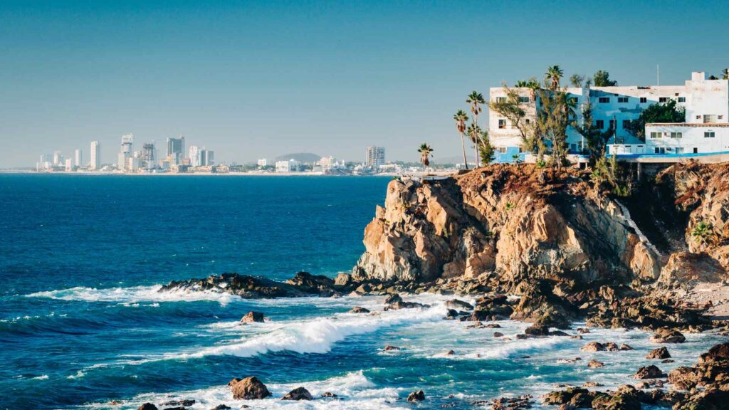
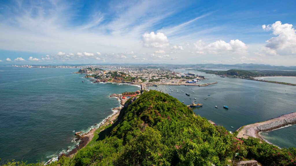
El Faro sits atop Cerro del Creston and is regarded as one of the highest natural lighthouses in the world, roughly 515 feet above the sea.
The climb ends at a glass skywalk, but Cerro del Crestón is not inside the advisory’s clearly defined historic-center and Malecón corridor. I would skip it under the current Level 4 guidance rather than treating a ship excursion as a safety guarantee.
Golden Zone (Zona Dorada) beaches
The Zona Dorada is the resort strip north along the permitted Malecón corridor, with hotels, shops, and beach clubs. Under the current advisory, use a direct regulated or app-dispatched vehicle rather than treating a public bus as the default.
Olas Altas Beach
The old-town beach closest to the historic center is a fine spot for a stroll and a sunset drink. It sits right where the Malecon meets Centro Historico.
Stone Island (Isla de la Piedra)
Stone Island is reached by a short boat crossing, but it lies outside the clearly described historic-center and Malecón limits in the current U.S. advisory. I would not recommend it while that guidance remains in force, even if a commercial excursion is available.
Deer Island (Isla de Venados)
Deer Island is reached by boat from the Golden Zone and is promoted for snorkeling and kayaking. The current advisory does not clearly authorize offshore recreation, so I would keep the day on the permitted mainland corridor unless official guidance changes.
Gran Acuario Mazatlán Mar de Cortés
The former city aquarium has been replaced by Gran Acuario Mazatlán Mar de Cortés, a modern regional marine-life attraction. Verify opening hours and use direct transport that stays within the currently permitted coastal corridor.
Mercado Pino Suarez
The century-old central market is the place for produce, crafts, and street snacks in the heart of downtown. Go in the morning when it is busiest and freshest.
How I’d plan the day
Given the advisory, keep every plan inside the tourist core and build in a generous return buffer.
- Three hours: walk the blue line into Plazuela Machado, see the cathedral and theater, browse the market, and walk back.
- Five hours: add the Olas Altas Malecon stretch and lunch in the old town before returning.
- Full day: do not automatically stretch farther; choose one ship-operated or direct-transport activity inside the currently permitted corridor, then return to Centro Histórico if conditions remain calm.
For any independent walking, go in daylight, keep valuables low-key, and use only the direct permitted routes. Aim to reach the terminal gate 90 minutes before all-aboard so the required port tram and screening do not erase the margin.
A realistic word on accessibility
The port yard is flat, but the free tram and then old-town cobblestones are the reality for wheelchair users. If steps and uneven paving are a concern, a private accessible tour or an easy Malecon roll may suit better than El Faro’s climb.
For more step-free planning, see my guides to walkable cruise ports and first-timer cruise ports.
When to go, and the weather
Most Mexican Riviera cruises call between roughly November and April, the drier and less humid season. The eastern Pacific hurricane season runs May 15 through November 30, when storms can alter the call even without a direct landfall.
Quick answers
Is Mazatlán safe for a cruise stop?
Sinaloa remains under a Level 4 Do Not Travel advisory, so read the current permitted-area limits, use direct reputable transport, and understand that a cruise call or organized tour does not remove the risk.
How far is the historic center from the port?
About a 15 to 20 minute walk from the terminal gate, or a short taxi or pulmonia ride.
Can I use U.S. dollars?
Often yes in tourist areas, but you will usually get change in pesos, and smaller vendors prefer pesos.
Planning more of the region? Compare Mazatlan with Cozumel and browse all my Mexico cruise port guides.
How this guide was researched: Unless a first-hand visit is explicitly identified above, this guide is based on independent research using official port, tourism, transit, government, and attraction sources where available. Logistics and time-sensitive details were reviewed in September 2026; see our Editorial Policy.