Nantucket Cruise Port: Tenders, Cobblestones and Timing
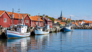
Nantucket is a tender port where the transfer ashore matters as much as the sightseeing plan. Once passengers reach the downtown wharves, the historic streets, Whaling Museum, shops, and harbor views are close together.
Wind, fog, swell, tender queues, and the last return time should decide how far the day reaches. The most reliable visit stays in town and treats any island bus trip as optional.
Quick Facts
- Arrival: Most cruise passengers reach Nantucket by tender or another small-boat transfer rather than a large ship berth.
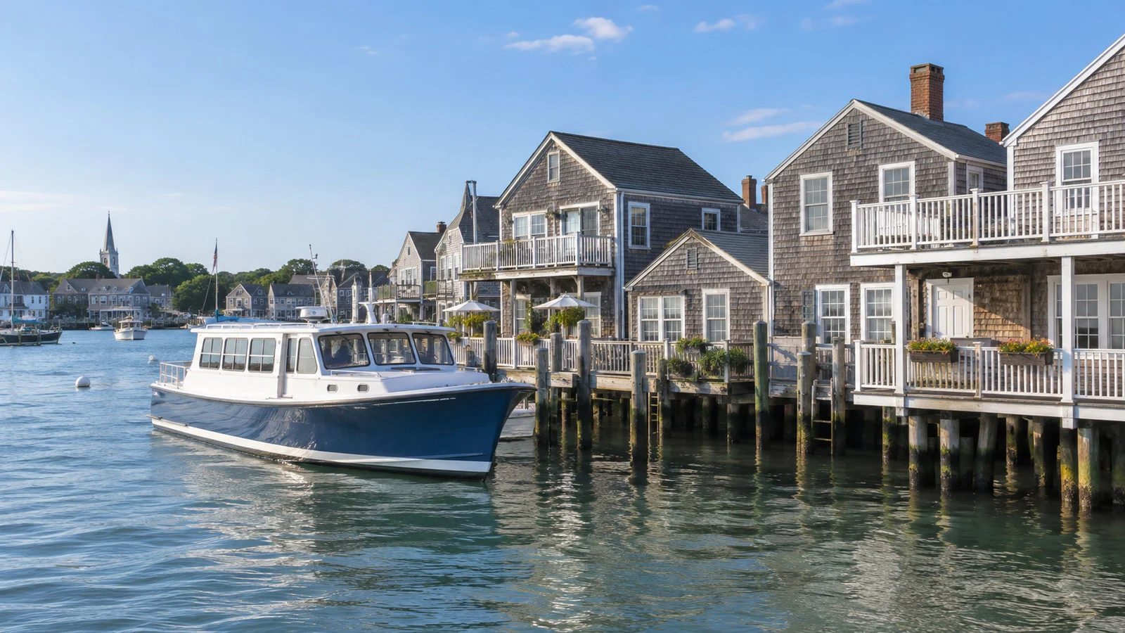
- Town access: Downtown begins beside the harbor wharves, so the main historic area is close after landing.
- Harbor channel: The federal navigation channel is maintained at 15 feet deep and 300 feet wide.
- Transit: The Wave serves island destinations, with routes and seasonal schedules that must be checked for the call date.
- Surfaces: Cobblestones and brick sidewalks make short distances harder for wheelchairs, scooters, and unsteady walkers.
- Currency: The United States dollar is used.
- Main risk: Wind, fog, and sea conditions can delay or stop tender operations.
Why most cruise ships tender
The US Army Corps of Engineers maintains Nantucket Harbor’s federal navigation project. It includes a channel 15 feet deep and 300 feet wide extending about 1.6 miles from Nantucket Sound through the entrance bar.
The project also includes two long stone jetties at the harbor entrance. The harbor regularly serves ferries, small coastal vessels, recreational craft, and fishing boats.
Those dimensions and the busy inner harbor do not suit mainstream cruise ships. Larger visiting vessels generally anchor outside and move passengers ashore in tenders.
A small coastal vessel may use a different arrangement, and some itineraries reach Nantucket through a ferry transfer. Read the ship’s own program because a destination name does not reveal the exact transport method.
How the tender operation works
Tender service normally begins after the ship is cleared and the crew confirms that conditions are suitable. Ticketing or priority rules vary by cruise line, so listen to the briefing rather than joining an unapproved queue.
The boat ride can involve steps, a moving platform, and a gap between vessels. Keep both hands available, follow crew instructions, and do not carry more than can be controlled during boarding.
Return service can become crowded near the last tender. Build a generous buffer instead of planning to arrive at the pier at the published final minute.
If wind or swell interrupts operations, the ship may hold passengers ashore until a safe transfer resumes. Carry essential medication, a layer, and the ship’s local contact information.
The easiest independent plan
Begin in the historic town directly beyond the wharves. Main Street, Federal Street, Centre Street, and the lanes between them offer shingled houses, brick buildings, shops, and traces of the island’s whaling-era wealth.
Add the Whaling Museum if its current opening hours fit the call. Then walk toward Brant Point or return to the waterfront with enough time to absorb a tender delay.
This plan works even when buses are crowded, bicycles are unavailable, or fog shortens the visit. It also keeps the last transfer within easy reach.

Nantucket Whaling Museum
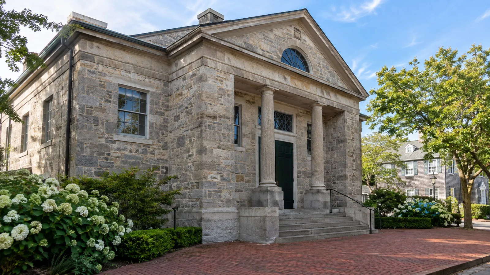
The Nantucket Historical Association’s Whaling Museum is the strongest indoor attraction near the harbor. Its galleries address whaling, island life, maritime trade, and the people whose labor and decisions shaped Nantucket.
A sperm whale skeleton and the restored candle factory help make the history tangible. The museum can fill more than an hour, so decide in advance whether it is the day’s main attraction.
Hours, admission, weather closures, and event access change. Check the official Nantucket Historical Association page shortly before the call rather than relying on a price copied months earlier.
Brant Point Lighthouse
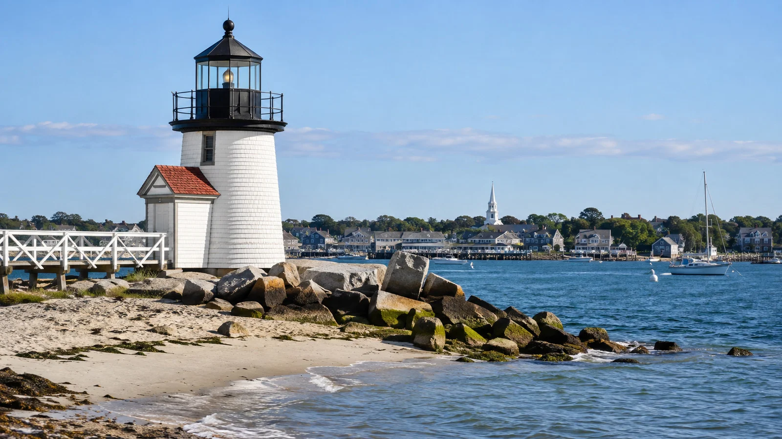
Brant Point Lighthouse marks the harbor entrance and is reachable from town on foot. The US Coast Guard says the station was established in 1746 and the current tower was first lit in 1901.
The present wooden tower stands only 26 feet above the water, making it the lowest lighthouse in New England according to Coast Guard history. It remains an operational aid to navigation.
The Coast Guard station and working waterfront require visitors to stay on public routes. Go early for a quieter view and turn back before the tender line builds.
Using the Wave bus
Nantucket Regional Transit Authority operates the Wave across the island. In 2026, the agency says all routes are free with support from the Massachusetts Department of Transportation.
Free service does not remove the need to check the timetable. Routes, frequency, crowding, and seasonal operation determine whether a trip fits the port call.
Siasconset, Madaket, Surfside, and other destinations can be reached on different routes. Choose one and begin the return earlier than the schedule seems to require.
A missed bus can become a missed tender. Save the current timetable offline and know which downtown stop is closest to the tender landing.
Cycling around Nantucket
Nantucket has an extensive network of bike paths, and a bicycle can reach farther than a town walk. It also adds wind, traffic crossings, equipment problems, and a fixed return requirement.
Rent only after confirming the weather and tender schedule. Check brakes, tires, seat height, lock, helmet, and the shop’s return policy before leaving.
A one-way bicycle plan that depends on a bus rack adds another failure point. Bike spaces can be limited, so be prepared to ride the full return distance.
Siasconset
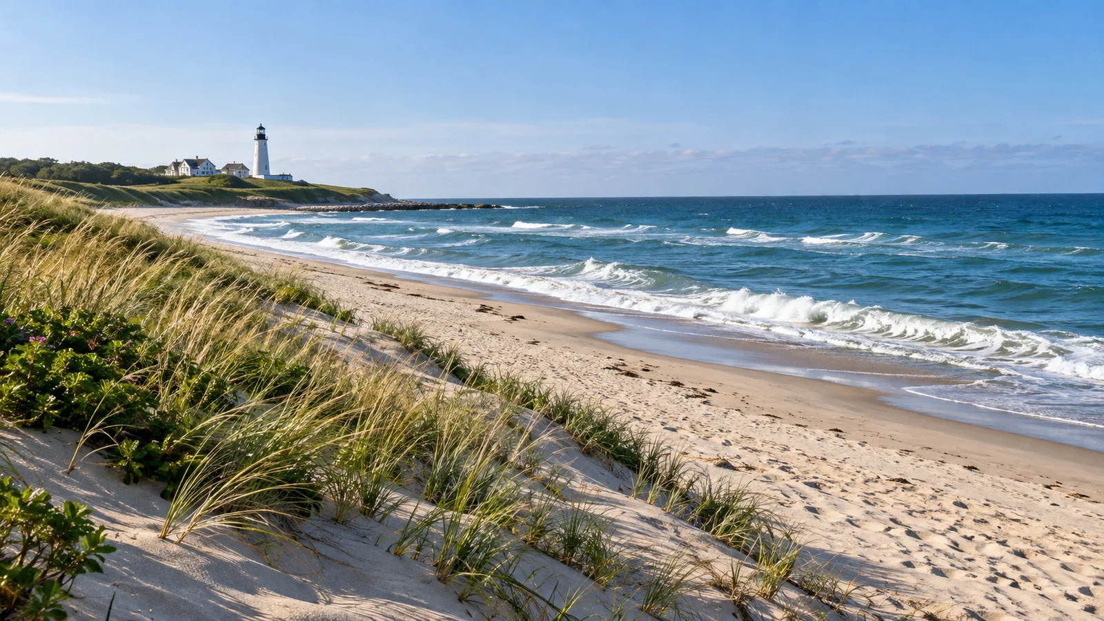
Siasconset, usually shortened to Sconset, sits at the eastern end of the island. Its compact village, cottages, and ocean setting make it an appealing bus or bike destination.
Do not combine Sconset with several other distant stops on a normal port day. The return ride, headwind, bus wait, and tender line all consume the same schedule margin.
Great Point is not a casual port-day outing
Great Point lies at the end of the Coskata-Coatue peninsula within a sensitive coastal landscape. Reaching it involves specialized access, sand driving, changing conditions, and wildlife restrictions.
A short cruise call is a poor match unless the ship offers a protected excursion. Independent visitors should not improvise a four-wheel-drive trip around the last tender.
Seasonal closures protect nesting birds and other wildlife. Check official refuge and conservation guidance before planning any longer island stay.
Cobblestones and accessibility
Nantucket’s central distances are short, but the surfaces are demanding. Main Street cobblestones, brick sidewalks, curb transitions, wharves, and old thresholds can challenge wheels and balance.
The tender transfer is the first and most important accessibility question. Ask whether the passenger must manage steps, whether the mobility device is accepted, and how crew handle movement between ship and boat.
The Wave provides accessible buses, but the route from the landing to the stop still matters. Confirm the nearest usable stop and whether the destination has a step-free entrance.
A traveler who cannot transfer safely to the tender may need to remain aboard even if town itself is manageable. Request a sailing-specific answer before paying for a shore excursion.
Weather and tender reliability
Nantucket weather can differ sharply from the mainland. Fog may settle over the harbor while conditions elsewhere in Massachusetts remain bright.
Wind and swell matter more than a simple rain forecast because tenders must move safely beside the ship. A pleasant afternoon in town does not prove that the offshore transfer is easy.
Dress in layers and carry a light waterproof shell. The open tender, harbor breeze, and shaded streets can feel cooler than the forecast temperature.
No public audited dataset provides a dependable missed-call percentage for Nantucket. It is accurate to describe the call as weather-sensitive without inventing a number.
Food, shopping, and timing
Downtown has many cafes, restaurants, and shops within walking distance of the wharves. Popular places can be crowded when ferries and cruise passengers arrive together.
Choose a meal that leaves a comfortable return margin. A reservation near the landing is safer than a lunch that depends on a long bus ride.
Nantucket purchases can be bulky or fragile, so remember the return tender. Keep both hands available and ask the store about shipping when an item is difficult to carry.
A two-hour plan
Stay entirely in town. Walk the harbor and historic streets, choose either the Whaling Museum or Brant Point, and return well before the final tender.
Do not board a bus simply because it is free. A short call rewards depth within the compact center.
A half-day plan
Begin with the Whaling Museum, walk the old town, and continue to Brant Point if weather and mobility allow. Use the remaining time for lunch near the wharves.
A Wave trip can replace one of those elements, but it should not be added on top. The island is larger than the historic center suggests.
A full-day plan
Choose either a town-focused day with extra museum time or one bus trip to Sconset followed by a shorter downtown walk. Keep the afternoon flexible in case the ship advances the last tender.
Great Point and multiple beaches belong on a land stay unless the cruise line has organized the transportation. Every mile away from the wharf must be traveled again before boarding.
Common planning mistakes
The first mistake is underestimating the tender queue. Returning at the final listed minute leaves no margin for a bus delay or paused boat operation.
The second mistake is treating town, Sconset, Madaket, and Great Point as one compact destination. They require separate travel and cannot all fit comfortably.
The third mistake is judging accessibility only by distance. Tender steps and cobblestones can make a short route more demanding than a longer paved one.
Another mistake is relying on last year’s bus fare or schedule. Check the Wave for the current season and exact date.
Quick answers
Do cruise ships dock at Nantucket?
Most visiting cruise ships anchor and tender passengers ashore. Very small coastal vessels may use a different arrangement.
How far is town from the tender landing?
Downtown begins beside the harbor wharves. The Whaling Museum and main historic streets are close once passengers are ashore.
Is the Wave free?
The Nantucket Regional Transit Authority says all routes are free throughout 2026. Future fares and seasonal schedules should be checked.
Is Brant Point walkable?
Yes, for many visitors from the downtown wharves. Use public routes around the working Coast Guard station and allow time to return.
Should cruise passengers rent a car?
Usually no. Walking, the Wave, a bicycle, or a ship excursion fits a port day better than parking and distant driving.
Final word
Nantucket’s best port day is deliberately smaller than the island. The tender is the bottleneck, while the historic town is the attraction already waiting at the wharf.
Stay close, choose one deeper experience, and return before the final rush. That approach leaves room for the island’s atmosphere without gambling the sailing on one more stop.
How this guide was researched: This guide was checked on September 12, 2026 against the US Army Corps of Engineers, Nantucket Regional Transit Authority, Nantucket Historical Association, US Coast Guard history, and official island transportation and conservation resources. Tender operations, bus schedules, museum access, weather, accessibility, and the last return time can change, so verify the live details for your sailing.