Camas-Washougal River Cruise Port Guide: Marina, Washougal, Downtown Camas, and Gorge Excursions
Camas-Washougal is a small Columbia River call where the first planning question is not which attraction to see, but exactly where your vessel will land. The port, Washougal waterfront, downtown Washougal, and downtown Camas are related communities, yet they are not one compact sightseeing center outside every gangway.
A relaxed local day can be genuinely enjoyable, while a guided Gorge excursion can deliver the big landscapes many travelers expect from the Columbia. Both work best when you use the ship’s current instructions and resist building a plan around an assumed dock.
My quick take
If the call is short, I would stay near the Port of Camas-Washougal and the adjacent waterfront, then add downtown Washougal or Camas only if transportation is clear. If the call is longer, a ship excursion into the Columbia River Gorge is the simplest way to see major viewpoints without managing parking, permits, and return timing.
Downtown Camas is charming, but it should not be described as an automatic stroll from every cruise landing. Treat it as a separate destination reached by a confirmed shuttle, taxi, ride service, or workable transit connection.
Quick Facts
- Port character: A small Columbia River landing serving the neighboring Washington communities of Camas and Washougal
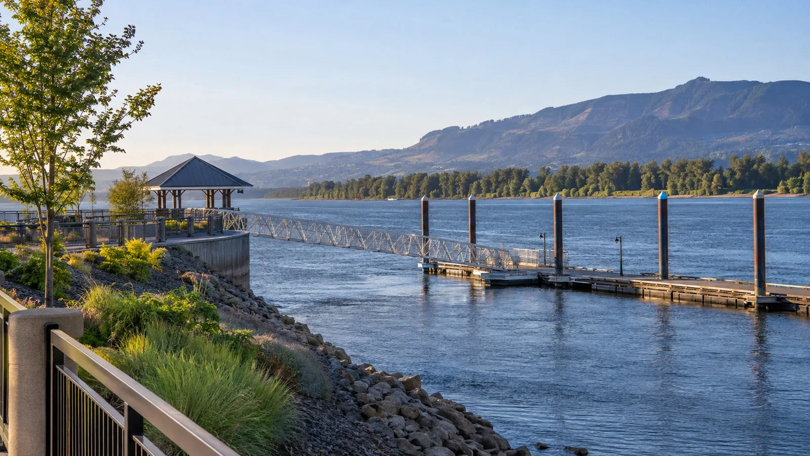
- Best local option: The marina, Parker’s Landing area, and Washougal waterfront when the ship’s landing is nearby
- Town option: Downtown Camas for independent shops, cafes, public art, and historic mill-town character
- Top excursion: A guided Columbia River Gorge drive with viewpoints, waterfalls, parks, or Bonneville-area stops
- Transit: C-TRAN serves Camas and Washougal, but routes and frequency must be checked for the exact berth and date
- Mobility: Waterfront paths can be easier than trails, while gangways, shuttles, and Gorge stops vary widely
- Best planning move: Confirm the landing first, then choose one local district or one protected Gorge excursion
Where river cruise ships land
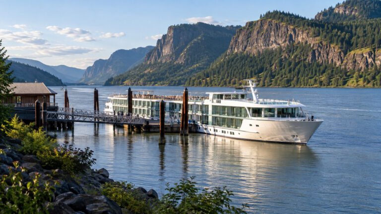
Cruise documents may use Camas-Washougal as a destination label even when the operational landing is described with a marina, port, or nearby waterfront name. The exact location can change by operator, river conditions, vessel needs, and local arrangements.
Check the daily program for the berth name, shuttle pickup point, and all aboard time before leaving the ship. Ask reception to mark the landing on a map if the label is unfamiliar.
The Port of Camas-Washougal manages marina, waterfront, airport, and business properties in East Clark County. Its current site is useful for port contacts, waterfront projects, and notices, but it is not a substitute for the cruise line’s passenger instructions.
Photograph the gangway, nearest sign, and access road before setting out. A driver may recognize the marina but still need the precise gate or meeting point to return you to the vessel.
The marina and Parker’s Landing area
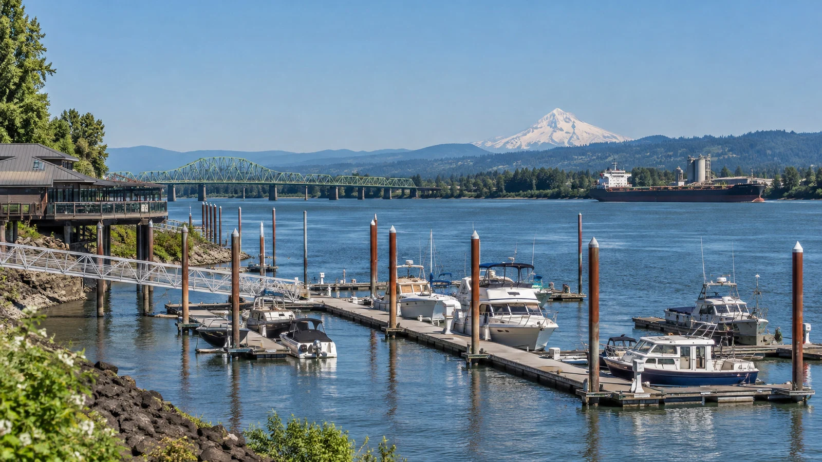
The marina area provides the most direct sense of place when your ship lands nearby. Boats, river traffic, Mount Hood views in clear weather, and the broad Columbia create an attractive setting without a long transfer.
Parker’s Landing Historical Park adds local context close to the waterfront. It is a modest stop rather than a major museum, so allow time to read the interpretation and then continue along the river.
Port development continues to shape this area, and a route that existed on an old map may meet construction or a changed access point. Follow signs and stay outside working marina areas.
A waterfront restaurant or cafe can fit a short call, but confirm current hours and service time. Do not begin a leisurely meal unless you know how long the walk and security process back to the ship will take.
Washougal waterfront
Washougal’s riverfront is the easiest extension of a marina-focused visit when the pedestrian connection is open and practical. It offers broad views, places to pause, and a calmer alternative to transferring into a town center.
The experience is more about landscape and local recreation than headline sightseeing. Watch barges, notice changing river levels, and enjoy the Gorge opening eastward.
Wind can be stronger beside the Columbia than in sheltered streets. Bring a light layer even on a warm day, and use sun protection because much of the waterfront is exposed.
Do not step onto rocks, boat ramps, or closed construction edges for a photograph. The river is powerful, surfaces can be slick, and working access points need to remain clear.
Downtown Washougal
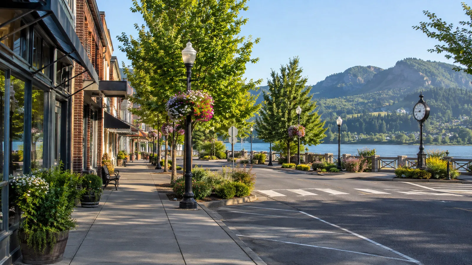
Downtown Washougal gives the stop a more everyday small-town feel, with local businesses, public spaces, and community history. It can pair with the waterfront when the ship or local transport makes the connection easy.
Opening days matter because small businesses may keep shorter hours than a major tourist district. Check the current city or business directory if a particular shop or meal is central to your plan.
A casual coffee or lunch often suits the call better than trying to force a long attraction list. The strength of Washougal is the contrast between river scenery and a working local community.
Keep your return route simple. If you use a taxi or ride service, set the exact pickup point and allow for a driver coming from elsewhere in Clark County.
Downtown Camas
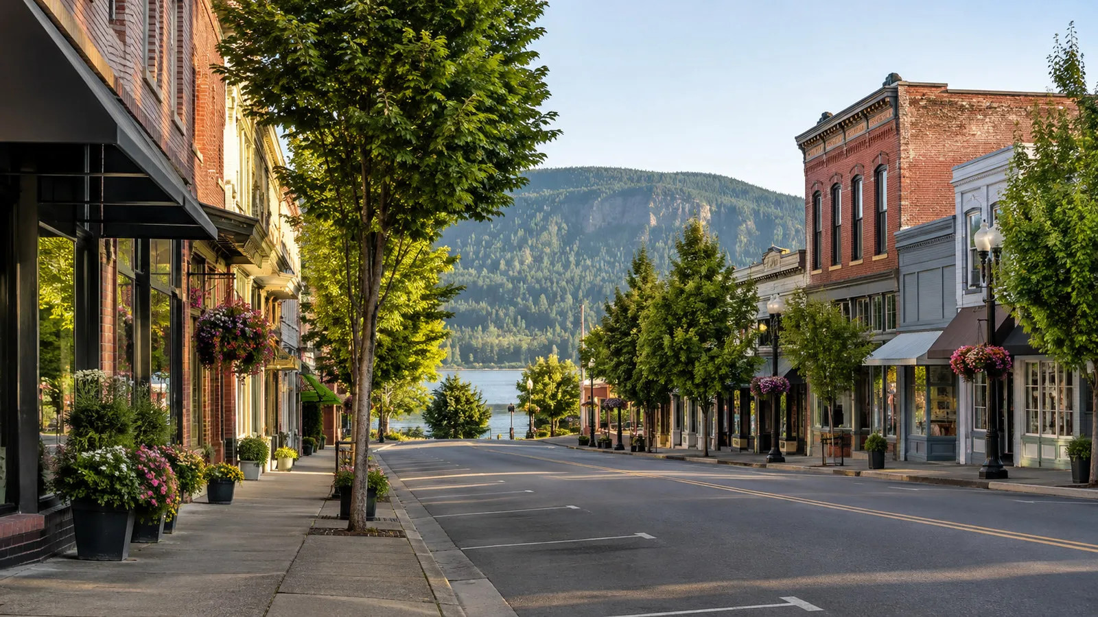
Downtown Camas is a revitalized historic district known for tree-lined streets, independent shops, galleries, cafes, and its mill-town roots. It is the best local choice for travelers who want browsing and food rather than a long nature excursion.
The Downtown Camas Association provides a current walking map, business directory, event calendar, dining information, and parking guidance. Use it to check what will actually be open during your call.
The compact core is pleasant on foot once you arrive, but transportation from the berth must be planned separately. Do not assume a cruise shuttle serves downtown unless the daily program says so.
Special events can make downtown lively, but they can also affect streets, parking, and pickup points. Confirm any First Friday or festival details before using an event listing to shape your return.
Camas retains a visible relationship with its industrial past, and the mill remains part of the city’s story. Respect operating property and view it only from public streets or designated spaces.
Getting between Camas and Washougal
C-TRAN currently lists Route 92 for Camas and Washougal and also provides a Camas-Washougal system map. Check the official Route 92 page for schedules, then review rider alerts and real-time planning on the day of your visit.
A published route does not guarantee a stop beside the gangway or convenient frequency for your ship’s hours. Walk time to the stop, waiting time, and the return schedule all need to fit inside your buffer.
C-TRAN also promotes The Current as an on-demand service in parts of its network, but eligibility, service zones, booking, and operating hours must be verified. Do not rely on it without confirming that a visitor can request the exact trip you need.
Taxis and ride services provide more flexibility, though vehicle supply may be limited when several groups leave at once. Arrange the return early and share the precise port location.
If the cruise line supplies a shuttle, note its final departure rather than only the ship’s all aboard time. A missed shuttle can turn a simple outing into an expensive or stressful return.
The Columbia River Gorge excursion
The Columbia River Gorge is the marquee regional experience, with forested cliffs, waterfalls, viewpoints, dams, and dramatic river scenery. A guided excursion is especially useful because the best stops are spread along Washington State Route 14 and Oregon roads across the river.
Read the excursion description for the actual stops rather than assuming every Gorge tour includes Multnomah Falls, Vista House, Beacon Rock, and Bonneville. Traffic, permits, weather, wildfire conditions, roadwork, and operator timing can all change the sequence.
The views are not limited to one side of the Columbia. Washington offers Cape Horn, Beacon Rock, and north-shore perspectives, while Oregon has the Historic Columbia River Highway and major waterfall corridors.
A cruise excursion protects the return and reduces parking uncertainty. It also lets everyone watch the landscape instead of asking one traveler to drive unfamiliar roads.
Beacon Rock and north-shore scenery
Beacon Rock State Park is a striking Washington-side destination east of Camas-Washougal. The rock, forest, river access, and surrounding trails make it useful for both scenic stops and more active outings.
The summit path is steep and exposed in places, with switchbacks, railings, and significant elevation gain. It is not an accessible stroll, and anyone uncomfortable with heights should choose a lower viewpoint.
Check the Washington State Parks page for Beacon Rock for current hours, trail closures, parking rules, and alerts. Storm damage, ice, wildlife protection, or maintenance can close a route even when the park remains open.
A short photo stop at river level can still be worthwhile if the summit trail does not fit your schedule or mobility. Ask the guide how long the group will remain before starting any climb.
Multnomah Falls and the Oregon side
Multnomah Falls is famous, but reaching it from Camas-Washougal requires crossing the Columbia and dealing with busy Oregon-side roads and parking. That makes it better suited to a coordinated excursion than an improvised ride.
Seasonal timed-use or parking requirements may apply, and rules can change from year to year. Check the United States Forest Service and Recreation.gov information for your date rather than relying on an old screenshot.
The lower viewpoint is much easier than hiking beyond the base, but crowds and wet pavement still affect movement. Wear shoes with grip and follow closure signs.
If a tour substitutes another waterfall or overlook, that can be a sensible response to congestion or access limits. The Gorge has many excellent stops, and the best day is not always the most famous itinerary.
Bonneville Dam and fish viewing
Bonneville offers a different way to understand the Columbia through navigation, hydropower, salmon passage, and regional history. Excursions may visit facilities on either the Washington or Oregon side, depending on current access.
Security rules, seasonal fish activity, and visitor-center hours can change. Check the United States Army Corps of Engineers before traveling independently.
The stop appeals to travelers who like engineering and environmental interpretation more than a pure scenic drive. It also provides an indoor or partly sheltered component when Gorge weather turns wet.
Do not assume the fish ladder will be equally active in every month. Migration patterns vary, and interpretation remains valuable even when fewer fish are visible.
Lacamas Lake and nearby nature
Lacamas Lake and surrounding parkland offer a closer nature option near Camas. Trails, lake views, seasonal wildflowers, and wooded sections can fit a longer local day without traveling deep into the Gorge.
Trail conditions vary with rain, maintenance, and season. Use official local park information and choose a route that matches your time and footwear.
The Camas Potholes area is not a safe place for casual cliff jumping or off-route scrambling. Stay on designated paths, respect barriers, and do not copy risky behavior you see online.
A taxi or ride service may be needed because trailheads are not necessarily convenient from the cruise landing. Confirm the return before starting a walk.
Should you take the ship excursion?
Choose the ship excursion when your priority is Gorge scenery, when the call is short, or when you do not want to coordinate several transportation steps. The protected return is particularly valuable where traffic and parking can be unpredictable.
Stay independent when your goal is the marina, waterfront, Washougal, or downtown Camas and you have a reliable local connection. A slower local day can feel more personal than a coach itinerary.
Compare the amount of walking, time on the bus, and actual viewpoints before booking. A panoramic tour may involve very little walking, while a waterfall tour can include wet steps and uneven paths.
Ask whether restrooms are available at each stop. Some Gorge pullouts have limited facilities, and seasonal closures can alter the plan.
Accessibility
Accessibility depends on the whole chain from gangway to destination. Ask about the berth surface, shuttle lift, curb cuts, restroom access, and the walking distance from coach parking.
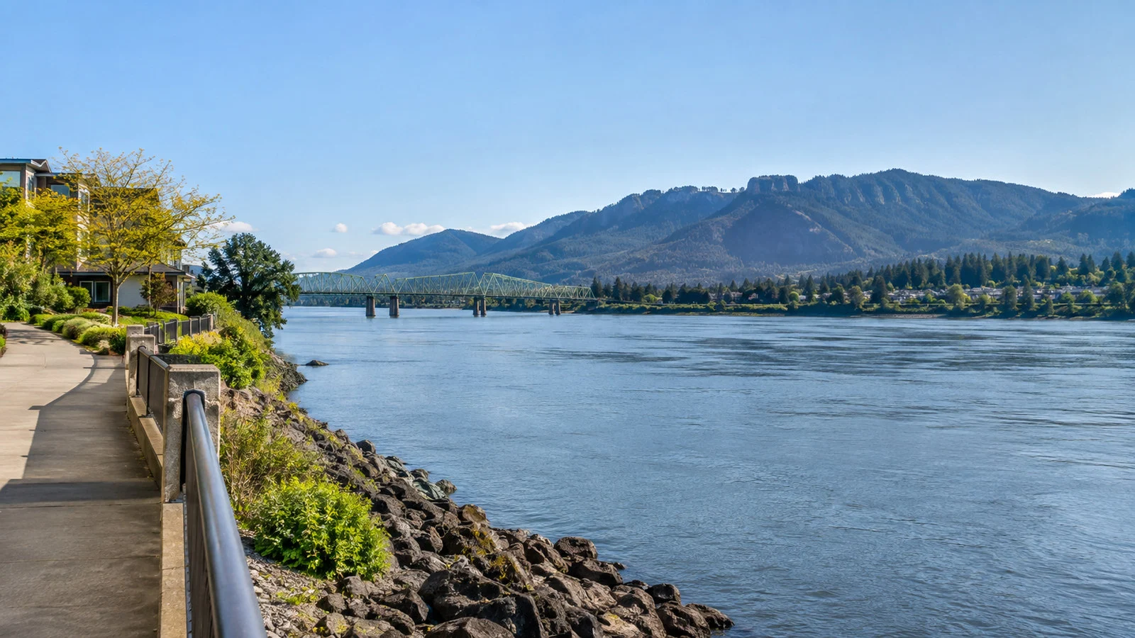
Waterfront paths are often the easiest local choice, but temporary construction or marina activity can create detours. A compact downtown route may be manageable once transportation delivers you to the core.
For Gorge excursions, distinguish a scenic overlook from a hiking trail. Beacon Rock’s summit route, waterfall paths, and uneven viewpoints are not equivalent to a paved coach stop.
Travelers using mobility devices should confirm that the specific vehicle can accommodate them. General statements about accessible transportation do not guarantee space on a particular shuttle.
Weather, river conditions, and seasonal risk
The Columbia Gorge funnels wind, and conditions can differ sharply from the sheltered town center. Bring a rain layer and a warm layer even when the forecast looks mild.
Summer can bring heat, smoke, wildfire closures, and crowded trailheads. Winter can bring ice, snow, fallen trees, and dangerous road conditions.
The Port of Camas-Washougal posts operational notices and local updates, while parks and transportation agencies publish their own alerts. Check each relevant official source on the morning of the call.
River levels and currents can also affect docking arrangements. Recheck the daily program after breakfast instead of assuming the original itinerary remains unchanged.
A simple short-call plan
Stay near the marina and waterfront first, then add downtown Washougal only if the connection is clear. Use a cafe or river-view stop as the flexible part that can be shortened.
If the ship provides a downtown Camas shuttle, explore the compact business district with the association’s walking map. Set a return alarm before you begin shopping or order lunch.
Do not spend the first half of a short call waiting for an uncertain ride. A modest waterfront day is better than reaching a farther destination with no margin.
If you have a longer day
Choose one organized Gorge route or pair the waterfront with downtown Camas. Both options create a coherent day without constant backtracking.
Independent drivers should select a few confirmed stops instead of collecting every waterfall and viewpoint. Cross-river traffic, parking, and seasonal permits can consume more time than expected.
Return toward the landing earlier than your navigation estimate suggests. Road incidents and Gorge congestion have limited alternate routes.
Quick answers
Can I walk from the ship?
Possibly, especially if the landing is beside the marina and waterfront. Follow the ship’s exact berth information because not every Camas-Washougal call uses the same access point.
Is downtown Camas walkable from the port?
Do not assume so for cruise planning. Downtown Camas is easy to explore on foot after arrival, but transportation from the berth should be confirmed.
Can I use public transit?
C-TRAN serves Camas and Washougal, including Route 92, but current schedules and stop locations determine whether it works for your call. Check both directions and preserve a return buffer.
What is the best Gorge excursion?
The best option is the one with confirmed access, enough time at a few strong stops, and a protected return. Choose viewpoints, waterfalls, a dam visit, or light hiking according to your interests and mobility.
Do I need a permit for Multnomah Falls?
Seasonal access or parking requirements can apply and change. Check official US Forest Service and Recreation.gov information for your exact date.
The last word
Camas-Washougal is a flexible Columbia River stop rather than a single obvious town-center port. The waterfront offers a calm local day, downtown Camas adds independent small-town character, and the Gorge supplies the grand scenery.
Confirm the landing, choose one focus, and leave real time for the return. That simple discipline makes the call feel spacious instead of uncertain.
Research note: Practical details were checked against official information from the Port of Camas-Washougal, Downtown Camas Association, C-TRAN, Washington State Parks, and public Gorge access agencies. Berths, trails, transit, permits, roads, park access, and cruise schedules can change, so verify them again for your sailing date.